East Fulton Township, Callaway County, Missouri
| East Fulton Township | |
|---|---|
| Township | |
 | |
| Coordinates: 38°51′12″N 091°55′48″W / 38.85333°N 91.93000°WCoordinates: 38°51′12″N 091°55′48″W / 38.85333°N 91.93000°W | |
| Country | United States |
| State | Missouri |
| County | Callaway |
| Area | |
| • Total | 67.04 sq mi (173.64 km2) |
| • Land | 66.85 sq mi (173.13 km2) |
| • Water | 0.2 sq mi (0.51 km2) 0.29% |
| Elevation[1] | 791 ft (241 m) |
| Population (2010) | |
| • Total | 10,231 |
| • Density | 150/sq mi (59/km2) |
| FIPS code | 29-20854[2] |
| GNIS feature ID | 0766377 |
East Fulton Township is one of eighteen townships in Callaway County, Missouri, USA. As of the 2010 census, its population was 10,231.[3]
Geography
East Fulton Township covers an area of 67.04 square miles (173.6 km2) and contains the east portion of the city of Fulton (the county seat). It contains seven cemeteries: Dunlap, Guerrart, Hillcrest, Kibby, Muir, Southside and United Brethren.
The streams of Booth Branch, Cow Creek, Craghead Branch, Crows Fork Creek, Dunlap Creek, Rockhouse Creek, Smith Branch and Youngs Creek run through this township.
References
- ↑ "US Board on Geographic Names". United States Geological Survey. 2007-10-25. Retrieved 2008-01-31.
- ↑ "American FactFinder". United States Census Bureau. Retrieved 2008-01-31.
- ↑ "Race, Hispanic or Latino, Age, and Housing Occupancy: 2010 Census Redistricting Data (Public Law 94-171) Summary File (QT-PL), East Fulton township, Callaway County, Missouri". U.S. Census Bureau, American FactFinder 2. Retrieved October 31, 2011.
External links
Municipalities and communities of Callaway County, Missouri, United States | ||
|---|---|---|
| Cities | 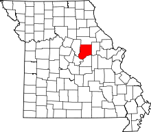 | |
| Villages | ||
| Townships | ||
| Unincorporated communities | ||
| Ghost towns | ||
| Footnotes | ‡This populated place also has portions in an adjacent county or counties | |
This article is issued from Wikipedia - version of the 9/3/2016. The text is available under the Creative Commons Attribution/Share Alike but additional terms may apply for the media files.