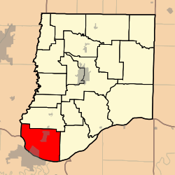
Summit Township, Callaway County, Missouri
| Summit Township | |
|---|---|
| Township | |
 | |
| Coordinates: 38°38′40″N 092°06′25″W / 38.64444°N 92.10694°WCoordinates: 38°38′40″N 092°06′25″W / 38.64444°N 92.10694°W | |
| Country | United States |
| State | Missouri |
| County | Callaway |
| Area | |
| • Total | 60.22 sq mi (155.96 km2) |
| • Land | 58.65 sq mi (151.9 km2) |
| • Water | 1.57 sq mi (4.07 km2) 2.61% |
| Elevation[1] | 738 ft (225 m) |
| Population (2010) | |
| • Total | 8,873 |
| • Density | 150/sq mi (57/km2) |
| FIPS code | 29-71548[2] |
| GNIS feature ID | 0766386 |
Summit Township is one of eighteen townships in Callaway County, Missouri, USA. As of the 2010 census, its population was 8,873.[3]
Geography
Summit Township covers an area of 60.22 square miles (156.0 km2) and contains one incorporated settlement, Holts Summit. It contains seven cemeteries: Bull, Harthill, Link, Meng, Mount Vernon, Stokes and Wallace.
The streams of Cedar Creek, Clifton Creek, Niemans Creek and Turkey Creek run through this township.
Transportation
Summit Township contains one airport or landing strip, Jefferson City Memorial Airport.
References
- ↑ "US Board on Geographic Names". United States Geological Survey. 2007-10-25. Retrieved 2008-01-31.
- ↑ "American FactFinder". United States Census Bureau. Retrieved 2008-01-31.
- ↑ "Race, Hispanic or Latino, Age, and Housing Occupancy: 2010 Census Redistricting Data (Public Law 94-171) Summary File (QT-PL), Summit township, Callaway County, Missouri". U.S. Census Bureau, American FactFinder 2. Retrieved October 31, 2011.
External links
Municipalities and communities of Callaway County, Missouri, United States | ||
|---|---|---|
| Cities | 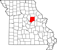 | |
| Villages | ||
| Townships | ||
| Unincorporated communities | ||
| Ghost towns | ||
| Footnotes | ‡This populated place also has portions in an adjacent county or counties | |
This article is issued from Wikipedia - version of the 9/3/2016. The text is available under the Creative Commons Attribution/Share Alike but additional terms may apply for the media files.