Auchentoroly Terrace Historic District
|
Auchentoroly Terrace Historic District | |
   | |
| Location | Roughly bounded by Auchentoroly Terrace, Reisterstown Rd., Liberty Heights & Fulton Aves., Baltimore, Maryland |
|---|---|
| Coordinates | 39°19′3″N 76°38′57″W / 39.31750°N 76.64917°WCoordinates: 39°19′3″N 76°38′57″W / 39.31750°N 76.64917°W |
| Architectural style | Late Victorian |
| NRHP Reference # | 15000604[1] |
| Added to NRHP | September 17, 2015 |
The Auchentoroloy Terrace Historic District encompasses a residential district southwest of Druid Hill Park on the northwest side of Baltimore, Maryland. It is roughly bounded by Auchentoroly Terrace, Reisterstown Road, Liberty Heights Avenue, and Fulton Avenue. This area was developed between 1895 and 1911 with a series of large and fashionable townhouses, mainly in the Renaissance Revival style. Development was begun by the heirs of John Morris Orem, and largely finished by the Auchentoroloy Corporation, which acquired land not developed by the Orems.[2]
The district was listed in the National Register of Historic Places in 2015.[1]
See also
References
- 1 2 National Park Service (2010-07-09). "National Register Information System". National Register of Historic Places. National Park Service.
- ↑ "Summary description of Auchentoroloy Terrace Historic District". Maryland Historic Trust. Retrieved 2016-04-12.
| Topics |  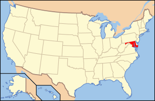 | |
|---|---|---|
| Lists by county | ||
| Lists by city | ||
| Other lists | ||
| ||
This article is issued from Wikipedia - version of the 12/2/2016. The text is available under the Creative Commons Attribution/Share Alike but additional terms may apply for the media files.