Franklintown Historic District
|
Franklintown Historic District | |
|
Old grist mill on Franklintown Road | |
   | |
| Location | 5100-5201 N. Franklintown Rd.;1707-1809 N. Forest Park Ave., 5100 Hamilton Ave., 5100 Fredwall Ave., Baltimore, Maryland |
|---|---|
| Coordinates | 39°18′16″N 76°42′35″W / 39.30444°N 76.70972°WCoordinates: 39°18′16″N 76°42′35″W / 39.30444°N 76.70972°W |
| Area | 15.5 acres (6.3 ha) |
| Built | 1826 |
| Architect | Freeman, William H. |
| Architectural style | Mid 19th Century Revival |
| NRHP Reference # | 01001214[1] |
| Added to NRHP | November 11, 2001 |
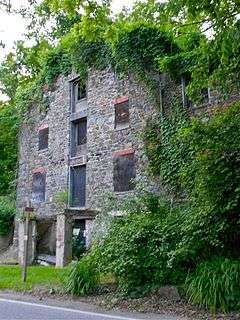
Franklintown Historic District is a national historic district in Baltimore, Maryland, United States. It is the result of a plan developed in 1832 by William H. Freeman (1790-1863), a local politician and entrepreneur. His plan evolved gradually over the course of several decades and owes its success to his untiring promotion of the village. The central feature is an oval plan with radiating lots around a central wooded park. The district includes an old stone grist mill known as Franklin Mill, the innovative radiating oval plan, and the associated hotel and commercial area. The key residential buildings are excellent examples of the "I"-house form and display steeply pitched cross gables found in vernacular rural buildings throughout much of Maryland.[2]
It was added to the National Register of Historic Places in 2001.[1]
References
- 1 2 National Park Service (2010-07-09). "National Register Information System". National Register of Historic Places. National Park Service.
- ↑ Judith H. Robinson and Stephanie S. Foell (January 2001). "National Register of Historic Places Registration: Franklintown Historic District" (PDF). Maryland Historical Trust. Retrieved 2016-04-01.
External links
- Franklintown Historic District, Baltimore City, including photo from 2001, at Maryland Historical Trust
- Boundary Map of the Franklintown Historic District, Baltimore City, at Maryland Historical Trust

| Topics |  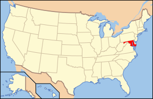 | |
|---|---|---|
| Lists by county | ||
| Lists by city | ||
| Other lists | ||
| ||