Wapekeka First Nation
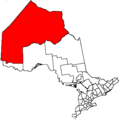
Wapekeka First Nation (formerly known as Angling Lake First Nation) is a First Nation band government in the Canadian province of Ontario. An Oji-Cree community in the Kenora District, the community is located approximately 450 kilometres northeast of Sioux Lookout. In January, 2008, the total registered population was 375, of which the on-reserve population was 355.
The First Nation have as its reserve the 3605 ha Wapekeka 1 Indian Reserve and the 2026.5 ha Wapekeka 2 Indian Reserve, and two Addendums in 1996 and 1997. The First Nation observes Eastern Standard Time (UTC-5) in winter and Eastern Daylight Time (UTC-4) in the summer.
The settlement is not accessible by road, although it has regular air service from Wasaya Airways.
Wapekeka was policed by the Nishnawbe-Aski Police Service, an Aboriginal-based service until 2012. As of 2013 the Ontario Provincial Police OPP has been policing the territory.
History
The Wapekeka reserves are within the boundaries of the territory described by James brown the 1929-30 Adhesion to Treaty 9 (James Bay Treaty of 1905). In 1947, beginnings of Angling Lake community was formed as a satellite community used in winter by families from Big Trout Lake whose traplines were located in the area. Beginning in 1960, permanent communities apart from the Big Trout Lake Band were established. These communities were Kingfisher Lake, Wunnumin Lake, Bearskin Lake, Kasabonika, Muskrat Dam, Sachigo Lake and Wapekeka. Wapekeka received official Band status and two reserves in 1979. On August 28, 1981, the Angling Lake Band officially changed its name to Wapekeka First Nation.
Governance
The current chief is Chief Norman Brown, Deputy Chief Ananias Winter, Councillor Elsie Brown, Councillor Donald Brown Sr, Councillor Clara Winnepetonga.
Originally a member of the Kayahn Area Tribal Council (1977-1983), when the council disbanded, along with the communities of Kasabonika Lake, Kingfisher Lake, Wunnumin Lake and Wawakapewin, Wapekeka formed and today is part of the Shibogama First Nations Council.
External links
Coordinates: 53°43′16″N 89°32′20″W / 53.72111°N 89.53889°W