Lake of the Woods 37
For other uses, see Lake of the Woods (disambiguation).
| Lake of the Woods 37 | |
|---|---|
| Indian reserve | |
| Lake of the Woods Indian Reserve No. 37 | |
 Lake of the Woods 37 | |
| Coordinates: 49°21′N 94°51′W / 49.350°N 94.850°WCoordinates: 49°21′N 94°51′W / 49.350°N 94.850°W | |
| Country |
|
| Province |
|
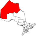
| District | Kenora |
| First Nation | Northwest Angle 37 |
| Area[1] | |
| • Land | 11.74 km2 (4.53 sq mi) |
| Population (2011)[1] | |
| • Total | 46 |
| • Density | 3.9/km2 (10/sq mi) |
Lake of the Woods 37 is a First Nations reserve consisting of four islands within Lake of the Woods. It is one of the reserves of the Northwest Angle 37 First Nation.
It includes Burnt Rock Island, Windfall Island, Cyclone Island and Windigo Islands.
References
- 1 2 "Lake of the Woods 37 census profile". 2011 Census of Population. Statistics Canada. Retrieved 1 June 2015.
 |
Unorganized Kenora Lake of the Woods |
|
Unorganized Kenora Lake of the Woods |
|
| |
||||
| ||||
| | ||||
| Lake of the Woods |
|
Lake of the Woods Unorganized Kenora |
This article is issued from Wikipedia - version of the 2/17/2016. The text is available under the Creative Commons Attribution/Share Alike but additional terms may apply for the media files.