Northwest Angle 33B
| Northwest Angle 33B | |
|---|---|
| Indian reserve | |
| Northwest Angle Indian Reserve No. 33B | |
 Northwest Angle 33B | |
| Coordinates: 49°23′N 95°01′W / 49.383°N 95.017°WCoordinates: 49°23′N 95°01′W / 49.383°N 95.017°W | |
| Country |
|
| Province |
|
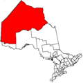
| District | Kenora |
| First Nation | Northwest Angle 33 |
| Area[1] | |
| • Land | 12.78 km2 (4.93 sq mi) |
| Population (2011)[1] | |
| • Total | 86 |
| • Density | 6.7/km2 (17/sq mi) |
Northwest Angle 33B is a First Nations reserve in Kenora District, Ontario. It is one of three reserves for the Northwest Angle 33 First Nation.
References
- 1 2 "Northwest Angle 33B census profile". 2011 Census of Population. Statistics Canada. Retrieved 4 June 2015.
 |
Unorganized Kenora | | ||
| Unorganized Kenora | |
Unorganized Kenora | ||
| ||||
| | ||||
| Lake of the Woods |
Lake of the Woods Lake of the Woods 31G |
This article is issued from Wikipedia - version of the 1/26/2016. The text is available under the Creative Commons Attribution/Share Alike but additional terms may apply for the media files.