Peawanuck
| Peawanuck | |
|---|---|
| Indian settlement | |
| Peawanuck Indian Settlement | |
 Peawanuck | |
| Coordinates: 55°1′N 85°25′W / 55.017°N 85.417°WCoordinates: 55°1′N 85°25′W / 55.017°N 85.417°W | |
| Country |
|
| Province |
|
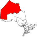
| District | Kenora |
| First Nation | Weenusk |
| Area[1] | |
| • Land | 1.52 km2 (0.59 sq mi) |
| Population (2011)[1] | |
| • Total | 237 |
| • Density | 156.1/km2 (404/sq mi) |
| Postal Code(s) | P0L 2H0 |
| Area Code(s) | 807 but 705 is used |
Peawanuck is an isolated Cree community in the Kenora District, Ontario, Canada. It is located near the confluence of the Winisk and Shamattawa rivers, about 35 km from the Winisk River's end in Hudson Bay. Its population is 237.[1]
Its population used to live in the community of Winisk (55°16′N 85°11′W / 55.267°N 85.183°W), near the mouth of the Winisk River. This also used to be a Mid-Canada Line Radar site. In 1986, its population was forced to abandon Winisk as a result of the Winisk Flood Disaster. The community was relocated thirty kilometers up-river on higher ground. The new settlement was renamed Peawanuck, meaning "flintstone" in the Cree language. It only took seven months for the community to be rebuilt in Peawanuck, with much credit going to the community members who were determined to have their new homes ready by the winter. It is surrounded by lands of the Polar Bear Provincial Park providing Peawanuck with limited tourism opportunities.
Transportation
Peawanuck is not accessible by year-round road but has an airfield (Peawanuck Airport). Marked roads exists for travel within Peawanuck. While the roads have no names, the main road in town is referred to as Main Street and the one along the river as Riverside
There are private cars or light trucks in town, but other modes of travel include snowmobiles and canoe.
The town is however, linked by winter/ice roads in the winter towards Fort Severn, Ontario, and ultimately, Shamattawa, Manitoba and Gillam, Manitoba.
Emergency Services
Peawanuck has no hospitals and is only served by a nursing station (staffed by two nurses) operated by the Weeneebayko Area Health Authority with occasion physician visits.[2] Advanced medical care requires transport by air ambulance operated by James Bay Ambulance Services from Peawanuck Airport.[3]
There is a fire station in town staffed by about a dozen volunteers using a single fire truck.
Peawanuck is policed by the Nishnawbe-Aski Police Service, an Aboriginal-based service staffed by two officers.
Utilities and Public Works
Electricity for the community is provided by three diesel generators and are maintained by the Ministry of Transportation.[4]
There is a waste water treatment plant that served all residential homes and most business. There is no sanitation services in Peawanuck due to lack of funds so waste is handled locally.
Government Services
Ontario Ministry of Natural Resources provides staffing at the Polar Bear Provincial Park Office.
Ontario Ministry of Transportation has a garage in Peawanuck, maintains the power generators and manages the local airport. MTO has housing for out of town staff.
Canada Post postal station is located the Band Administration offices.[5] Mail is delivered to Peawanuck by air with contract services with Thunder Airlines.
Local Government
The local band council consists of band chief with 2 or 3 councilors elected to 2 year terms. Band Offices are located a shared facility with FNP and Canada Post.
Media
There are now newspapers in town. The Band Office maintains the a local radio station, but has limited service time.
Television and radio services is by satellite only.
Religion
Peawanuck has a local Catholic Church shaped as a teepee. Most residents are Catholic with a few Traditionalist or Born Again Christian.
Recreation
There is no community centre and limited recreation facilities maintained by the Band Council or Catholic Church:
- 2 outdoor ballparks
- Catholic Church Children's playground
- Outdoor ice rink with Zamboni
- Multi-purpose Room
- Drop-In Centre
Education
Matahhamao opened in 1995 by Weenuck Education Services is the only school in the community and offers classes up to Grade 10.[6] Students moving on to Grades 11 to 12 and beyond must travel to large communities like Timmins and Moosonee.
Economy
The community is served by a single store, a Northern Store, and other goods must be shipped in by air.[7]Northern Store provides banking services via fax to CIBC or Scotiabank in Moosonee and Timminis respectively.[8]
- Peawanuck Development Corporation - operates Peawanuck Petroleum, General Store, Annual Barger Services and maintains winter road
- Hudson's Bay Adevnetures - offers outdoor adventures at Polar Bear Provincial Park
- Louie's Store (Louis Chookomolin Diversified Products)
Climate
Peawanuck is the coldest place in Ontario with an annual average mean temperature of −2.7 °C (27.1 °F).
| Climate data for Peawanuck | |||||||||||||
|---|---|---|---|---|---|---|---|---|---|---|---|---|---|
| Month | Jan | Feb | Mar | Apr | May | Jun | Jul | Aug | Sep | Oct | Nov | Dec | Year |
| Average high °C (°F) | −18.8 (−1.8) |
−16.4 (2.5) |
−9.3 (15.3) |
0.6 (33.1) |
8.4 (47.1) |
16.9 (62.4) |
20.7 (69.3) |
18.5 (65.3) |
13.2 (55.8) |
5.6 (42.1) |
−4.1 (24.6) |
−16.1 (3) |
1.6 (34.89) |
| Daily mean °C (°F) | −21.9 (−7.4) |
−21.5 (−6.7) |
−15.0 (5) |
−3.5 (25.7) |
4.1 (39.4) |
10.7 (51.3) |
14.9 (58.8) |
13.9 (57) |
9.2 (48.6) |
3.5 (38.3) |
−6.2 (20.8) |
−20.3 (−4.5) |
−2.67 (27.19) |
| Average low °C (°F) | −25.3 (−13.5) |
−26.4 (−15.5) |
−20.7 (−5.3) |
−8.6 (16.5) |
−0.8 (30.6) |
4.5 (40.1) |
9.2 (48.6) |
9.2 (48.6) |
5.3 (41.5) |
0.9 (33.6) |
−8.5 (16.7) |
−23.2 (−9.8) |
−7.03 (19.34) |
| Source: http://www.weatheronline.co.uk/weather/maps/city?FMM=1&FYY=2004&LMM=12&LYY=2014&WMO=71434&CONT=namk®ION=0014&LAND=ON&ART=TMX&R=161&NOREGION=1&LEVEL=162&LANG=en&MOD=tab | |||||||||||||
See also
References
- 1 2 3 "Peawanuck census profile". 2011 Census of Population. Statistics Canada. Retrieved 17 June 2015.
- ↑ http://search.211north.ca/record/KEN1293
- ↑ http://search.211north.ca/record/KEN1293
- ↑ http://www.wakenagun.ca/PDF/Peawanuck%20Profile.pdf
- ↑ http://www.wakenagun.ca/PDF/Peawanuck%20Profile.pdf
- ↑ https://www.thestar.com/news/insight/2015/10/10/cree-community-looks-on-warily-as-de-beers-eyes-new-diamond-mine.html
- ↑ https://www.thestar.com/news/insight/2015/10/10/cree-community-looks-on-warily-as-de-beers-eyes-new-diamond-mine.html
- ↑ http://www.wakenagun.ca/PDF/Peawanuck%20Profile.pdf
 |
Unorganized Kenora | | ||
| Unorganized Kenora | |
Winisk River / Unorganized Kenora | ||
| ||||
| | ||||
| Unorganized Kenora |