Amicalola Falls State Park
|
Amicalola Falls | |
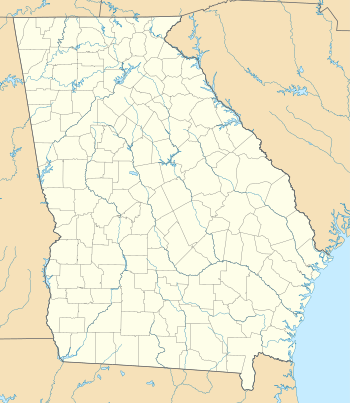 Location of Amicalola Falls State Park in Georgia | |
| Location | Dawson County, Georgia, USA |
|---|---|
| Nearest city | Dawsonville, Georgia |
| Coordinates | 34°33′58″N 84°14′31″W / 34.566°N 84.242°WCoordinates: 34°33′58″N 84°14′31″W / 34.566°N 84.242°W |
| Area | 829 acres (3.35 km2; 1.30 sq mi) |
| Governing body | Georgia State Park |

Amicalola Falls State Park is an 829 acre (3.35 km²) Georgia state park located between Ellijay and Dahlonega in Dawsonville, Georgia. The park's name is derived from a Cherokee language word meaning "tumbling waters".[1] The park is home to Amicalola Falls, a 729-foot (222 m) waterfall, making it the highest in Georgia.[2] It is considered to be one of the Seven Natural Wonders of Georgia. An eight-mile (13 km) trail that winds past Amicalola Falls and leads to Springer Mountain, famous for being the southern terminus of the Appalachian Trail, begins in the park. Amicalola Falls State Park also offers many hiking trails, a guest lodge, restaurant, cabins, a shelter for long distance Appalachian Trail hikers, a campground and access to the eco-friendly Len Foote Hike Inn.
History

Little is known about the falls before the 19th century. The Cherokee tribe controlled the area of the state park until 1832, when the Treaty of New Echota forced the Cherokee to leave and go further west into the Ozarks. This mass removal would later be known as the Trail of Tears. The first written account of the falls was penned by a local citizen by the name of William Williamson, who was exploring the area looking for land that he would take during the Sixth Georgia Land Lottery. Williamson wrote:
| “ | In the course of my route in the Mountains I discovered a Water Fall perhaps the greatest in the World the most majestic Scene that I have ever witnessed or heard of the Creek passes over the mountain & the fall I think can't be less than Six hundred Yards. The Mountain is at least three fourths of a mile high. I made great exertions to get on the summit but the ascent was so great that I was completely exhausted by the time I reached half way. My position was such that I had a perfect view of the entire Fall The Steam is Called Um-ma-eolola from the Fall (Tumbling Waters) [3] | ” |
After the lottery had taken place, an unknown settler was given the land, but chose not to live on it because the terrain proved to be too rugged. Nearby settlers knew a Cherokee woman who lived in the area until the 1850s, who refused to leave along with her tribe.[4]
The state purchased the falls in 1911. Amicalola Falls State Park was not developed at all until the Georgia Appalachian Trail Club decided that the nearby Springer Mountain would be where they would move the southern terminus of the Appalachian Trail from Mount Oglethorpe in 1958. An 8.5-mile (13.7 km) long trail was blazed from the base of Amicalola Falls to the top of Springer Mountain so that Appalachian Trail hikers would be able to access the trail from a major highway.
Today

Amicalola Falls State Park has four groups of trails within it, including the trail leading up to the top of the waterfall. The park has a full-time staff of park rangers, and has a lodge that serves as a starting point of Appalachian Trail hikers. The park also owns a nearby facility called the Len Foote Hike Inn, a backcountry eco-friendly inn that is one mile (1.6 km) from the Appalachian Approach trail and 4.4 miles (7.1 km) from Springer Mountain. The inn is operated by a non-profit organization known as the Appalachian Educational Recreational Services, Inc. or AERS.[4]
-

AMICALOLA FALLS (Top) - Dawson County - near Dawsonville, Georgia - USA. *(view of valley - looking out from top of the falls - September 2013)
-

AMICALOLA FALLS (Main Cascade) - view looking up from hiking trail foot bridge. (Sept. 2013)
-TCR III -

AMICALOLA FALLS (Lower Cascade) - view looking under hiking trail foot bridge. (Sept. 2013)
-TCR III -

Amicalola Falls State Park Lodge (lower back patio).
-TCR III -

Amicalola Falls State Park Lodge (view over valley).
-TCR III
See also
Notes
- ↑ "The Names Stayed". Calhoun Times and Gordon County News. August 29, 1990. p. 64. Retrieved 29 April 2015.
- ↑ Boyd (2001), p. 82
- ↑ Amicalola Falls State Park, retrieved 2007-03-20
- 1 2 Amicalola Falls, Gateway to the Appalachian Trail, retrieved on 2007-03-20
References
- Boyd, Brian (2001). Waterfalls of the Southern Appalachians & Great Smoky Mountains. Clayton, GA: Fern Creek Press. ISBN 978-1-893651-08-1.
External links
- Georgia State Parks
- Amicalola Falls Hiking
- Amicalola Falls State Park Loop Trail
- Amicalola Falls East Ridge Hiking Trail
- Amicalola Falls West Ridge Falls Hiking Trail