Ajara (India)
| Ajara आजरा ಆಜರಾ | |
|---|---|
| Town | |
 Ajara Location in Maharashtra, India | |
| Coordinates: 16°07′N 74°12′E / 16.12°N 74.2°ECoordinates: 16°07′N 74°12′E / 16.12°N 74.2°E | |
| Country |
|
| State | Maharashtra |
| District | Kolhapur |
| Government | |
| • Body | Nagar Palika |
| Elevation | 660 m (2,170 ft) |
| Population (2011) | |
| • Total | 14,845 |
| Languages | |
| • Official | Marathi |
| Time zone | IST (UTC+5:30) |
| PIN | 416505 |
| ISO 3166 code | IN-MH |
| Website |
maharashtra |
Ajara is a census town and taluka headquarters Of Gadhinglaj Subdivision in Kolhapur district in the state of Maharashtra, India.
Geography
Ajara is located at 16°07′N 74°12′E / 16.12°N 74.2°E. It has an average elevation of 660 metres (2165 feet).
Ajara is known to be one of the southernmost talukas of Kolhapur District of Maharashtra. It is known for its scenic and green landscape, as well as for the Ajara Ghansaal rice.
Ajara falls on the way to Savantwadi, Goa from Kolhapur; it is also the last place of Desh region before Konkan on this route. Ajara is 84 km from Kolhapur and only 33 km from Amboli hill station.
Buses plying from Vengurla, Savantwadi to Kolhapur, Pune via Amboli ghat go via Ajara. As a taluka place, it does have a bus stand, bus depot, school-colleges, bazarpeth, Hotels, etc. Gadhinglaj is the nearest major city for Ajara.
The current population of Ajara is nearly 14000 and demands are rising to convert the Gram panchayat into Nagar panchayat.
Ajara has a number of educationtal institutions. One of the foremost educational institutions in Ajara is Rosary English High School. There is a famous sugar factory in gavse.
There is also a dam building going on in velvatti near haloli sponsored government of maharashtra. Other distances from Ajara:
- Ramtirth waterfalls: 2 km
- Gadhinglaj: 21 km
- Sankeshwar (NH 4): 36 km
- Nippani (NH 4): 44 km
- Kolhapur: 84 km
- Amboli: 33 km
- Savantwadi: 62 km
- Panjm: 121 km
- Belgaum: 52 km via Nesari, Kowad
- Chavan Palace Koriwade 08KM
Demographics
As of 2011 India census,[1] Ajara had a population of 18000 . Males constitute 51% of the population and females 49%. Ajara has an average literacy rate of 75%, higher than the national average of 59.5%; with 55% of the males and 45% of females literate. 12% of the population is under 6 years of age. [2]
Chavan Palace Koriwade
References
- ↑ "Census of India 2001: Data from the 2001 Census, including cities, villages and towns (Provisional)". Census Commission of India. Archived from the original on 2004-06-16. Retrieved 2008-11-01.
- ↑ "Pin code of Ajara". citypincode.in. Retrieved 2014-03-22.
Kolhapur district topics | |||||||
|---|---|---|---|---|---|---|---|
| History | 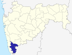 | ||||||
| Geography | |||||||
| Cities and towns | |||||||
| Transport | |||||||
| Visitor's attractions | |||||||
| Culture | |||||||
| Education | |||||||
| Lok Sabha Constituencies | |||||||
| Vidhan Sabha Constituencies | |||||||
| Taluka/Tehsil | |||||||
| Stadiums | |||||||
See Also: Districts of Maharashtra Footnote: ‡ This constituency also has portions in Sangli district | |||||||