Chandgad
| Chandgad चंदगड | |
|---|---|
| Town | |
 Chandgad Location in Maharashtra, India | |
| Coordinates: 15°56′0″N 74°12′0″E / 15.93333°N 74.20000°ECoordinates: 15°56′0″N 74°12′0″E / 15.93333°N 74.20000°E | |
| Country |
|
| State | Maharashtra |
| District | Kolhapur |
| Population (2013) | |
| • Total | 12,000 |
| Languages | |
| • Official | Marathi |
| Time zone | IST (UTC+5:30) |
| PIN | 416509 |
| Telephone code | 02320 |
| Vehicle registration | MH.09 |
| Nearest city | Belgaum |
| Website |
maharashtra |
| Near in = Shirgaon majare | |
Chandgad (Marathi: चंदगड) is a town and Tehsil headquarters in Gadhinglaj, which is a subdivision of Kolhapur district that is in the Indian state of Maharashtra. Jagrut Devastan Sri Ravalnath temple is located here.
This is a small town having a population of about 12,000. This place is 110 km from Kolhapur but only 36 km from Belgaum City. Chandgad is located on the Belgaum-Vengurle state highway. Amboli hill station is only 32 km from Chandgad. People of Chandgad town and taluka are heavily reliant on Belgav and Gadhinglaj cities for their day-to-day needs.
Geography

Chandgad is located at 15°N 74°E / 15°N 74°E in the Kolhapur district of Maharashtra.[1] Chandgad is the southernmost taluka for Kolhapur district. Chandgad receives more rainfall compared to any other town of Kolhapur district, receives nearly 3000 mm of rainfall under the direct influence of the Arabian Sea branch of the South-West monsoon. Rainy season period is from June to September. The rains subside in September, with the occasional rainfall in October and November.
Covered with dense lush green forest. Here you can see large number of cashew nut tree plantation. Here climate is cool and fantastic like mahabaleshwar, so it is called as "Prati Mahabaleshwar"."swapnwel point" and "Kille Pargad" is the famous tourist spot in chandgad. Rice,Sugarcane,Cashew nuts, Sweet potato and Potato are the major crops. Being part of Western Ghat, Chandgad surroundings are rich in biodiversity and it is a UNESCO World Heritage Site. Many new species of flora and fauna are found in this region. Ghataprabha and Tamraparni are the biggest river of chandgad.so many dams are in chandgad.
 |
Ratnagiri | Mumbai, Pune | Gadhinglaj | |
| Sawantwadi | |
Belgaum | ||
| ||||
| | ||||
| Goa, Karwar | Goa | Bangalore, Hubli |
Climate
This part of Maharashtra has very Good Summer with temperature rising of maximum of 35-36 degree Celsius and the Rainfall here is seasonal, but heavy and is above 3000 mm. in a year. Since the city is located on the Western Ghat, it has a pleasant climate, with temperatures in the range of 360C to 290C during summer and 210C to 140C during winter. The rainy season witnesses heavy rains by the South-West Monsoon.
The Monsoon period is from June to September with rainfall averaging more than 3000 mm every year and heavy winds.
| Climate data for Chandgad | |||||||||||||
|---|---|---|---|---|---|---|---|---|---|---|---|---|---|
| Month | Jan | Feb | Mar | Apr | May | Jun | Jul | Aug | Sep | Oct | Nov | Dec | Year |
| Average high °C (°F) | 30 (86) |
32 (90) |
35 (95) |
36 (97) |
34 (93) |
29 (84) |
26 (79) |
26 (79) |
28 (82) |
29 (84) |
29 (84) |
29 (84) |
30.3 (86.4) |
| Average low °C (°F) | 14 (57) |
15 (59) |
18 (64) |
21 (70) |
21 (70) |
21 (70) |
21 (70) |
20 (68) |
20 (68) |
19 (66) |
17 (63) |
15 (59) |
18.5 (65.3) |
| Average precipitation mm (inches) | 1.1 (0.043) |
0.2 (0.008) |
2.9 (0.114) |
24.4 (0.961) |
30 (1.18) |
500.1 (19.689) |
799.8 (31.488) |
900.2 (35.441) |
450.1 (17.72) |
203.4 (8.008) |
80.3 (3.161) |
20.1 (0.791) |
3,012.6 (118.604) |
Places of interest

Jagrut Devastan Shree Dev Ravalnath temple is located here. Ravalnath is a very popular Shaivite deity in west coastal region of India, figuring predominantly Adure (Sateari) Goa, the Sindhudurg district and some areas of Kolhapur district specially Chandgad and Ajra taluka of Maharashtra and some areas of Karnataka. Kowad is the birthplace of Padmashri Swamikar Ranjit Desai, is village in east part based on the bank of Tamrparni River. Halkarni is the major town here. Sakhar Ganpati is very famous here. Daulat sugar factory is located at Halkarni. At "Tilarinagar" there is one popular electricity generation plant which provides power to the Goa.
This is tahshil of fort Like Pargad[2] in west, Chandgad was earth fort (Bhooi Killa), Kalanandigadh in center, Mahipalgadh in East. Tilari Dam, Swapnavel Point. The famous hill station which has maximum rainfall in Maharashtra named as Amboli is very close to Chandgad. Jangamhatti and Ghataprabha dam which is built near Kanur Khurd village on Ghataprabha river are the bigger dams of here. Mateshwar temple [Hera]is very close to Chandgad this temple is famous for God Mateshwar. Mateshwara Festival is there in the night (Amavasya) before "Gudi Padava"(Marathi New Year).
History
There are famous fort in Chandgad, out of them "killa Pargad " is importantly used by "Maratha's to resist the attack of Portuguese from Goa; sardar of this fort were "rayaba malusare","GAIKWAD, PEDNEKAR, gharane",Sawant etc. . "kille Kalanandigad" is protected by Gaikwad families of Halkarni. There is a substantial amount of Chardo families in this area as they had migrated due to the persecution of the Portuguese in Goa. They amount to almost half the population. Chandgad was formerly a part of Belagavi District. But during reorganization of Maharashtra state the entire taluka was merged into Kolhapur District.
Language
Marathi and Konkani, is the native hence state language. Konkani (Malwani Konkani) is the predominant spoken language in western part. Goan Catholic Community speaks Gaon Konkani. Urdu and English are also used in social communication.
Festivals
Ganesh Chaturthi, Dussehra, Diwali and Holi are the main festivals.
Ganesh Chaturthi
The most important is the Ganesh Chaturthi,the festivities run into several days, but minimum at least for two and half days and seven days.
Shimga/Holi
Holi (Locally known as Shimga) is another famous festival in chandgad, which is a festival of colour.The festivities runs into several days, some places for 7 days and in some places for 15 days.In the festival People used to perform folk dances(locally known as 'Songa')or some Ramayan events featuring the Lord Rama,Laxmana and Sita along with Lord Hanumana on the road all through the length of the parade as they have been doing for centuries.
Diwali
Diwali, the festival of lights, is celebrated all over India. Its roots go back more than 7000 years to the time when Lord Ram killed the demon king Ravan. Ram was welcomed in his hometown Ayodhya by a celebration of crackers and lights.
Agriculture
Chandgad is mostly depends on agriculture. This place has many crops like Paddy, Jawar, Banana, sugar cane and Cashew. There are large number of cashew nut processing factories near Chandgad region. Chandgad having 3 sugar factories, 1 co-operative "Daulat sugar Factory, Halkarni" and 2 private namely "Hemarus sugars, Rajgoli" and "Nalwade Sugars, Tudaye". (Cashew and Mango from Chandgad are very famous in Maharashtra).Daulat factory has now shutdown its productions due to financial problem and corruption at political level.
Transportation
Road
Chandgad is connected to its district headquarters city Kolhapur 112 km away through Chandgad-Kolhapur road via Gadhinglaj.Chandgad is connected to Belgaum and vengurla via State Highway 121. Belagavi is on National Highway-4 (connecting Maharashtra [Now part of the Golden Quadrilateral], Karnataka, Andhra Pradesh and Tamil Nadu) and 4A (connecting Karnataka and Goa).For public Transportation, MSRTC and KSRTC buses are available. Chandgad is well connected to Sawantwadi through State Highway 121, which connects to Mumbai-Goa National Highway-17 Ajara 15 km
Air
Dabolim Airport (GOI) Vasco-da-Gama,Goa is the major International Airport 118 km away. Belgaum (IXG) Airport is another airport 40 km away.
Rail
Chandgad is well connected to Belagavi. Belagavi is on the main Indian Railways grid, being part of south western division and is well connected by rail to major destinations such as Bangalore, Mysore, Hubballi, Mangalore, Pune, Mumbai, Hyderabad, Goa, New Delhi and Chennai. Chandgad is well connected to Sawantwadi via State highway 121. Sawantwadi is connected to Konkan Railway. Through Konkan Railway, chandgad is connected to the major destinations such as Mumbai, Ratnagiri, Goa, Karwar, Udupi, Mangalore and Kerala.
Other Distances:
- Amboli: 32 km
- Vengurla: 90 km
- Belgaum: 36 km
- Bicholim Taluka: 35 km
- Gadhinglaj: 44 km
- Kolhapur: 111 km
- Kowad: 30 km
- Majare Karwe: 18 km from Chandgad by Road on Vengurla- Belgaum Highway
- Panjim: 75 km via Tilari, Dodamarg
- Pernem: 44 km
- Savantwadi: 63 km
- Sanquelim: 40 km
- Rajgoli, maharastra via Kowad: 38 km
- Valpoi: 37 km
- Goa Border to Chandgad border: 30 km
- Tilari swapnvel point 12 km and Kenchewadi 15 km
References
- ↑ "Chandgad, India Page". Falling Rain Genomics, Inc. Retrieved 2008-05-17.
- ↑ "Pargad Fort History". Maharashtra Gazetteers. Retrieved 2012-05-18.
Kolhapur district topics | |||||||
|---|---|---|---|---|---|---|---|
| History | 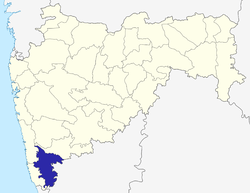 | ||||||
| Geography | |||||||
| Cities and towns | |||||||
| Transport | |||||||
| Visitor's attractions | |||||||
| Culture | |||||||
| Education | |||||||
| Lok Sabha Constituencies | |||||||
| Vidhan Sabha Constituencies | |||||||
| Taluka/Tehsil | |||||||
| Stadiums | |||||||
See Also: Districts of Maharashtra Footnote: ‡ This constituency also has portions in Sangli district | |||||||