Kudnur Dam
| Kudnur Dam | |
|---|---|
 Location of Kudnur Dam in India Maharashtra | |
| Official name | Kudnur Dam D04217 |
| Location | Chandgad |
| Coordinates | 15°58′35″N 74°25′30″E / 15.9763358°N 74.4248789°ECoordinates: 15°58′35″N 74°25′30″E / 15.9763358°N 74.4248789°E |
| Opening date | 2005[1] |
| Owner(s) | Government of Maharashtra, India |
| Dam and spillways | |
| Type of dam | Earthfill |
| Impounds | local river |
| Height | 20.99 m (68.9 ft) |
| Length | 316 m (1,037 ft) |
| Dam volume | 208.68 km3 (50.06 cu mi) |
| Reservoir | |
| Total capacity | 1,062 km3 (255 cu mi) |
| Surface area | 214 km2 (83 sq mi) |
Kudnur Dam, is an earthfill dam on local river near Chandgad, Kolhapur district in state of Maharashtra in India.
Specifications
The height of the dam above lowest foundation is 20.99 m (68.9 ft) while the length is 316 m (1,037 ft). The volume content is 208.68 km3 (50.06 cu mi) and gross storage capacity is 11,925.00 km3 (2,860.96 cu mi).[2]
Purpose
- Irrigation
See also
References
- ↑ "Kudnur D04217". Retrieved March 13, 2013.
- ↑ Specifications of large dams in India
Kolhapur district topics | |||||||
|---|---|---|---|---|---|---|---|
| History | 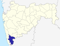 | ||||||
| Geography | |||||||
| Cities and towns | |||||||
| Transport | |||||||
| Visitor's attractions | |||||||
| Culture | |||||||
| Education | |||||||
| Lok Sabha Constituencies | |||||||
| Vidhan Sabha Constituencies | |||||||
| Taluka/Tehsil | |||||||
| Stadiums | |||||||
See Also: Districts of Maharashtra Footnote: ‡ This constituency also has portions in Sangli district | |||||||
This article is issued from Wikipedia - version of the 9/17/2015. The text is available under the Creative Commons Attribution/Share Alike but additional terms may apply for the media files.