Yarmouth Port, Massachusetts
| Yarmouth Port, Massachusetts | |
|---|---|
| Census-designated place | |
|
Boardwalk at Bass Hole | |
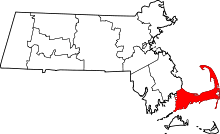
 Location in Barnstable County and the state of Massachusetts. | |
| Coordinates: 41°42′17″N 70°13′15″W / 41.70472°N 70.22083°WCoordinates: 41°42′17″N 70°13′15″W / 41.70472°N 70.22083°W | |
| Country | United States |
| State | Massachusetts |
| County | Barnstable |
| Town | Yarmouth |
| Area | |
| • Total | 6.47 sq mi (16.76 km2) |
| • Land | 6.04 sq mi (15.65 km2) |
| • Water | 0.43 sq mi (1.11 km2) |
| Elevation | 52 ft (16 m) |
| Population (2010) | |
| • Total | 5,320 |
| • Density | 884/sq mi (341.2/km2) |
| Time zone | Eastern (EST) (UTC-5) |
| • Summer (DST) | EDT (UTC-4) |
| ZIP code | 02675 |
| Area code(s) | 508/774 |
| FIPS code | 25-82595 |
| GNIS feature ID | 0615805 |

Yarmouth Port is a census-designated place (CDP) in the town of Yarmouth in Barnstable County, Massachusetts, United States. The population was 5,320 at the 2010 census.[1]
Yarmouth Port was home to the original Christmas Tree Shops until its closing in 2007. The town is home to the international headquarters of IFAW.
Geography
Yarmouth Port is located in the northern part of the town of Yarmouth at 41°42′17″N 70°13′15″W / 41.70472°N 70.22083°W (41.704633, -70.220923).[2] It is bordered to the north by Cape Cod Bay, to the east by the town of Dennis, and to the west by the town of Barnstable. U.S. Route 6, the Mid-Cape Highway, is to the south, beyond which are the CDPs of South Yarmouth and West Yarmouth.
According to the United States Census Bureau, the Yarmouth Port CDP has a total area of 6.47 square miles (16.76 km2). 6.04 square miles (15.65 km2) of it is land, and 0.43 square miles (1.11 km2) of it (6.86%) is water.[1]
Demographics
As of the census[3] of 2000, there were 5,395 people, 2,546 households, and 1,642 families residing in the CDP. The population density was 344.9/km² (892.7/mi²). There were 3,104 housing units at an average density of 198.4/km² (513.6/mi²). The racial makeup of the CDP was 98.46% White, 0.26% African American, 0.17% Native American, 0.32% Asian, 0.02% Pacific Islander, 0.19% from other races, and 0.59% from two or more races. Hispanic or Latino of any race were 0.70% of the population.
There were 2,546 households out of which 17.0% had children under the age of 18 living with them, 56.2% were married couples living together, 6.8% had a female householder with no husband present, and 35.5% were non-families. 30.8% of all households were made up of individuals and 19.8% had someone living alone who was 65 years of age or older. The average household size was 2.11 and the average family size was 2.61.
In the CDP the population was spread out with 15.8% under the age of 18, 3.0% from 18 to 24, 18.7% from 25 to 44, 27.9% from 45 to 64, and 34.7% who were 65 years of age or older. The median age was 53 years. For every 100 females there were 85.9 males. For every 100 females age 18 and over, there were 80.7 males.
The median income for a household in the CDP was $47,576, and the median income for a family was $57,841. Males had a median income of $41,029 versus $30,171 for females. The per capita income for the CDP was $30,418. About 2.2% of families and 4.3% of the population were below the poverty line, including 6.2% of those under age 18 and 1.3% of those age 65 or over.
Notable residents

- Edward Gorey (1925–2000), artist and writer[4]
References
- 1 2 "Geographic Identifiers: 2010 Demographic Profile Data (G001): Yarmouth Port CDP, Massachusetts". U.S. Census Bureau, American Factfinder. Retrieved December 16, 2013.
- ↑ "US Gazetteer files: 2010, 2000, and 1990". United States Census Bureau. 2011-02-12. Retrieved 2011-04-23.
- ↑ "American FactFinder". United States Census Bureau. Retrieved 2008-01-31.
- ↑ Edward Gorey House, Yarmouth Port