North Eastham, Massachusetts
| North Eastham, Massachusetts | |
|---|---|
| Census-designated place | |
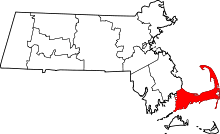
 Location in Barnstable County and the state of Massachusetts. | |
| Coordinates: 41°51′5″N 70°00′00″W / 41.85139°N 70.00000°W | |
| Country | United States |
| State | Massachusetts |
| County | Barnstable |
| Town | Eastham |
| Area | |
| • Total | 11.9 sq mi (30.9 km2) |
| • Land | 3.4 sq mi (8.9 km2) |
| • Water | 8.5 sq mi (22.0 km2) |
| Elevation | 39 ft (12 m) |
| Population (2010) | |
| • Total | 1,806 |
| • Density | 526/sq mi (203.0/km2) |
| Time zone | Eastern (EST) (UTC-5) |
| • Summer (DST) | EDT (UTC-4) |
| ZIP code | 02651 |
| Area code(s) | 508 |
| FIPS code | 25-47590 |
| GNIS feature ID | 0616892 |
North Eastham is a census-designated place (CDP) in the town of Eastham in Barnstable County, Massachusetts, United States. The population was 1,806 at the 2010 census.[1]
The main visitor center of the Cape Cod National Seashore is located in North Eastham.
Geography
North Eastham is located within the northwestern part of the Town of Eastham at 41°51′05″N 70°00′00″W / 41.851349°N 69.999928°WCoordinates: 41°51′05″N 70°00′00″W / 41.851349°N 69.999928°W (41.851349, -69.999928).[2] It is bordered to the west by Cape Cod Bay, to the north by the town of Wellfleet, to the east by U.S. Route 6 and Great Pond Road, and to the south by Great Pond, Herring Brook Road, and Samoset Road.
According to the United States Census Bureau, the CDP has a total area of 11.9 square miles (30.9 km2). 3.4 square miles (8.9 km2) of it is land, and 8.5 square miles (22.0 km2) of it (71.24%) is water.[1]
Demographics
As of the census[3] of 2000, there were 1,915 people, 881 households, and 570 families residing in the CDP. The population density was 217.5/km² (562.4/mi²). There were 2,656 housing units at an average density of 301.6/km² (780.1/mi²). The racial makeup of the CDP was 98.12% White, 0.26% African American, 0.16% Native American, 0.42% Asian, 0.05% Pacific Islander, 0.05% from other races, and 0.94% from two or more races. Hispanic or Latino of any race were 0.84% of the population.
There were 881 households out of which 20.1% had children under the age of 18 living with them, 50.6% were married couples living together, 11.0% had a female householder with no husband present, and 35.3% were non-families. 29.4% of all households were made up of individuals and 15.0% had someone living alone who was 65 years of age or older. The average household size was 2.17 and the average family size was 2.63.
In the CDP the population was spread out with 17.1% under the age of 18, 4.2% from 18 to 24, 22.6% from 25 to 44, 26.9% from 45 to 64, and 29.2% who were 65 years of age or older. The median age was 49 years. For every 100 females there were 89.4 males. For every 100 females age 18 and over, there were 85.9 males.
The median income for a household in the CDP was $34,390, and the median income for a family was $42,794. Males had a median income of $32,143 versus $38,889 for females. The per capita income for the CDP was $20,797. About 6.9% of families and 8.1% of the population were below the poverty line, including 8.2% of those under age 18 and 14.4% of those age 65 or over.
See also
References
- 1 2 "Geographic Identifiers: 2010 Demographic Profile Data (G001): North Eastham CDP, Massachusetts". U.S. Census Bureau, American Factfinder. Retrieved December 10, 2013.
- ↑ "US Gazetteer files: 2010, 2000, and 1990". United States Census Bureau. 2011-02-12. Retrieved 2011-04-23.
- ↑ "American FactFinder". United States Census Bureau. Retrieved 2008-01-31.