Xenia, Illinois
| Xenia, Illinois | |
| Village | |
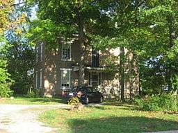 The Paine House, a historic site | |
| Country | United States |
|---|---|
| State | Illinois |
| County | Clay |
| Township | Xenia |
| Elevation | 538 ft (164 m) |
| Coordinates | 38°38′15″N 88°38′15″W / 38.63750°N 88.63750°WCoordinates: 38°38′15″N 88°38′15″W / 38.63750°N 88.63750°W |
| Area | 0.54 sq mi (1 km2) |
| - land | 0.54 sq mi (1 km2) |
| - water | 0.00 sq mi (0 km2) |
| Population | 391 (2010) |
| Density | 724.1/sq mi (280/km2) |
| Timezone | CST (UTC-6) |
| - summer (DST) | CDT (UTC-5) |
| Zip code | 62899 |
| Area code | 618 |
  Location of Xenia within Illinois | |
| [1] | |
Xenia is a village in Clay County, Illinois, United States. The population was 391 at the 2010 census.[2]
Geography
Xenia is located in southwestern Clay County at 38°38′15″N 88°38′15″W / 38.63750°N 88.63750°W (38.6373694, -88.6374130).[1] U.S. Route 50 passes to the north of the village, leading east 9 miles (14 km) to Flora and west 17 miles (27 km) to Salem.
According to the 2010 census, the village has a total area of 0.54 square miles (1.4 km2), all land.[3]
History
The hunting camps of Kiffcart and Retherford were located in the southwest corner of Section 4. The buffalo trail was very wide in this area, therefore Lewis located in the northwest quarter of Section 3. Lewis remained there until 1830 when he sold his property to Dr. Davenport. A post office was established at the Davenport home with the help of John Pierce and John Gowdy, establishing the town of Xenia. The building of the railroad in 1854 expanded the town, and by 1870 the population had increased to 1,000. A sesquicentennial celebration was held in 1984.[4]
Demographics
| Historical population | |||
|---|---|---|---|
| Census | Pop. | %± | |
| 1860 | 472 | — | |
| 1870 | 916 | 94.1% | |
| 1880 | 898 | −2.0% | |
| 1890 | 878 | −2.2% | |
| 1900 | 800 | −8.9% | |
| 1910 | 634 | −20.7% | |
| 1920 | 640 | 0.9% | |
| 1930 | 559 | −12.7% | |
| 1940 | 662 | 18.4% | |
| 1950 | 643 | −2.9% | |
| 1960 | 491 | −23.6% | |
| 1970 | 464 | −5.5% | |
| 1980 | 475 | 2.4% | |
| 1990 | 424 | −10.7% | |
| 2000 | 407 | −4.0% | |
| 2010 | 391 | −3.9% | |
| Est. 2015 | 382 | [5] | −2.3% |
As of the census[7] of 2000, there were 407 people, 180 households, and 111 families residing in the village. The population density was 784.8 people per square mile (302.2/km²). There were 206 housing units at an average density of 397.2 per square mile (153.0/km²). The racial makeup of the village was 96.81% White, 0.49% Native American, 1.97% from other races, and 0.74% from two or more races. Hispanic or Latino of any race were 3.93% of the population.
There were 180 households out of which 28.9% had children under the age of 18 living with them, 49.4% were married couples living together, 10.0% had a female householder with no husband present, and 38.3% were non-families. 33.3% of all households were made up of individuals and 20.0% had someone living alone who was 65 years of age or older. The average household size was 2.26 and the average family size was 2.84.
In the village the population was spread out with 25.3% under the age of 18, 6.6% from 18 to 24, 25.3% from 25 to 44, 19.7% from 45 to 64, and 23.1% who were 65 years of age or older. The median age was 38 years. For every 100 females there were 96.6 males. For every 100 females age 18 and over, there were 96.1 males.
The median income for a household in the village was $26,944, and the median income for a family was $32,125. Males had a median income of $22,273 versus $16,818 for females. The per capita income for the village was $16,944. About 9.8% of families and 14.5% of the population were below the poverty line, including 11.0% of those under age 18 and 20.7% of those age 65 or over.
See also
References
- 1 2 "Village of Xenia". Geographic Names Information System. United States Geological Survey. 2008-02-27. Retrieved 2009-01-22.
- ↑ "Geographic Identifiers: 2010 Demographic Profile Data (G001): Clay village, Illinois". U.S. Census Bureau, American Factfinder. Retrieved August 1, 2014.
- ↑ "2010 Census U.S. Gazetteer Files for Places – Illinois". United States Census. Retrieved 2012-10-13.
- ↑ Xenia Illinois Memorial Monument 1987
- ↑ "Annual Estimates of the Resident Population for Incorporated Places: April 1, 2010 to July 1, 2015". Retrieved July 2, 2016.
- ↑ "Census of Population and Housing". Census.gov. Archived from the original on May 11, 2015. Retrieved June 4, 2015.
- ↑ "American FactFinder". United States Census Bureau. Archived from the original on September 11, 2013. Retrieved 2008-01-31.
External links
Municipalities and communities of Clay County, Illinois, United States | ||
|---|---|---|
| City | ||
| Villages | ||
| Townships | ||
| Unincorporated communities | ||
| Ghost town | ||
| Footnotes | ‡This populated place also has portions in an adjacent county or counties | |