Pixley Township, Clay County, Illinois
| Pixley Township | |
|---|---|
| Township | |
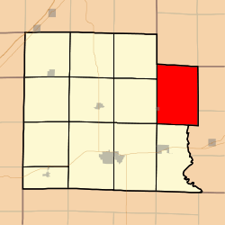 Location in Clay County | |
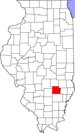 Clay County's location in Illinois | |
| Coordinates: 38°47′N 88°19′W / 38.783°N 88.317°WCoordinates: 38°47′N 88°19′W / 38.783°N 88.317°W | |
| Country | United States |
| State | Illinois |
| County | Clay |
| Established | November 5, 1861 |
| Area | |
| • Total | 45.09 sq mi (116.8 km2) |
| • Land | 45.07 sq mi (116.7 km2) |
| • Water | 0.02 sq mi (0.05 km2) 0.04% |
| Elevation | 453 ft (138 m) |
| Population (2010) | |
| • Total | 589 |
| • Density | 13.1/sq mi (5.1/km2) |
| Time zone | CST (UTC-6) |
| • Summer (DST) | CDT (UTC-5) |
| ZIP codes | 62434, 62448, 62824, 62858, 62868, 62879 |
| GNIS feature ID | 0429573 |
Pixley Township is one of twelve townships in Clay County, Illinois, USA. As of the 2010 census, its population was 589 and it contained 284 housing units.[1]
Geography
According to the 2010 census, the township (T4N R8E) has a total area of 45.09 square miles (116.8 km2), of which 45.07 square miles (116.7 km2) (or 99.96%) is land and 0.02 square miles (0.052 km2) (or 0.04%) is water.[1]
Cities, towns, villages
- Sailor Springs (east three-quarters)
Unincorporated towns
(This list is based on USGS data and may include former settlements.)
Cemeteries
The township contains these twelve cemeteries: Ditter, Ingraham, Leonard, Levitte, McKinney, Reed, Saint Johns, Smith, Weidner, Wendelin-Holy Cross, Wesley and Woods.
School districts
- Clay City Community Unit District 10
- Jasper County Community Unit School District 1
- West Richland Community Unit School District 2
Political districts
- Illinois' 19th congressional district
- State House District 108
- State Senate District 54
References
- "Pixley Township, Clay County, Illinois". Geographic Names Information System. United States Geological Survey. Retrieved 2010-01-10.
- United States Census Bureau 2007 TIGER/Line Shapefiles
- United States National Atlas
- 1 2 "Population, Housing Units, Area, and Density: 2010 - County -- County Subdivision and Place -- 2010 Census Summary File 1". United States Census. Retrieved 2013-05-28.
External links

Municipalities and communities of Clay County, Illinois, United States | ||
|---|---|---|
| City | ||
| Villages | ||
| Townships | ||
| Unincorporated communities | ||
| Ghost town | ||
| Footnotes | ‡This populated place also has portions in an adjacent county or counties | |
This article is issued from Wikipedia - version of the 12/3/2013. The text is available under the Creative Commons Attribution/Share Alike but additional terms may apply for the media files.