Wivelrod
| Wivelrod | |
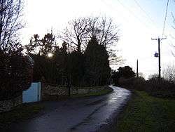 Cottages in Wivelrod |
|
 Wivelrod |
|
| Population | 28 [1] |
|---|---|
| OS grid reference | SU6755638427 |
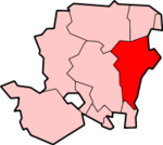
| Civil parish | Bentworth |
| District | East Hampshire |
| Shire county | Hampshire |
| Region | South East |
| Country | England |
| Sovereign state | United Kingdom |
| Post town | Alton |
| Postcode district | GU34 |
| Dialling code | 01420 |
| Police | Hampshire |
| Fire | Hampshire |
| Ambulance | South Central |
| EU Parliament | South East England |
| Website | http://www.bentworth.info |
Coordinates: 51°08′28″N 1°02′09″W / 51.141135°N 1.03571°W
Wivelrod is a hamlet in the large civil parish of Bentworth in Hampshire, England. The nearest town is Alton, about 2.8 miles (4.5 km) to the east. At a spot height of 712 feet (217 m), it is one of the highest settlements in Hampshire.
The nearest railway station is Alton which is 3.5 miles (5.6 km) to the east. Until 1932 it was the Bentworth and Lasham railway station on the Basingstoke and Alton Light Railway, until its closure.[2]
Wivelrod is situated on one of the highest points in Hampshire. At the south side of the hamlet it reaches a spot height of 712 feet (217 m); the highest point in the Civil Parish of Bentworth.
The area was inhabited in ancient times and some Tumuli and Burial Mounds are on Wivelrod Hill. Also, at Wivelrod House, finds include Pottery, bone objects, spindle-whorls (stone discs with a hole in the middle used in spinning thread) and fragments of Roman roofing tiles.
References
- ↑ Bentworth#Population figures Population ref
- ↑ Alton Light Railway closure