Lower Wield
Coordinates: 51°09′28″N 1°05′28″W / 51.15765°N 1.09100°W
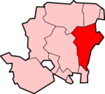
Lower Wield is a village in the East Hampshire district of Hampshire, England. It is 1.8 miles (2.9 km) west of the village of Bentworth, 5.2 miles (8.4 km) west of Alton. The nearest railway station is Alton, 5.2 miles (8.4 km) east of the village.
At one time, Lower Wield came under the large parish of Bentworth until its decline in the mid-19th century. Although today, Wield's parish borders the parish of Bentworth.[1]
The village has one public house, The Yew Tree.[2]
References
- ↑ Bentworth#Parish decline Bentworth Parish Decline
- ↑ The Yew Tree
External links
![]() Media related to Lower Wield at Wikimedia Commons
Media related to Lower Wield at Wikimedia Commons
This article is issued from Wikipedia - version of the 1/23/2016. The text is available under the Creative Commons Attribution/Share Alike but additional terms may apply for the media files.

