Wimauma, Florida
| Wimauma, Florida | |
|---|---|
| CDP | |
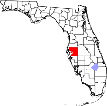
 Location in Hillsborough County and the state of Florida | |
| Coordinates: 27°42′35″N 82°19′4″W / 27.70972°N 82.31778°WCoordinates: 27°42′35″N 82°19′4″W / 27.70972°N 82.31778°W | |
| Country | United States |
| State | Florida |
| County | Hillsborough |
| Area | |
| • Total | 8.8 sq mi (22.8 km2) |
| • Land | 8.4 sq mi (21.8 km2) |
| • Water | 0.4 sq mi (1 km2) |
| Elevation | 102 ft (31 m) |
| Population (2000) | |
| • Total | 4,246 |
| • Density | 482.5/sq mi (186.2/km2) |
| Time zone | Eastern (EST) (UTC-5) |
| • Summer (DST) | EDT (UTC-4) |
| ZIP code | 33598 |
| Area code(s) | 813 |
| FIPS code | 12-78025[1] |
| GNIS feature ID | 0293391[2] |
Wimauma is an unincorporated census-designated place in Hillsborough County, Florida, United States. The population was 6,373 at the 2010 census.
History
Wimauma was founded by Captain C.H. Davis in 1902. It was located on a 55 mile railroad route that was built south from Durant to Manatee County and into Sarasota with construction starting in 1895. It was first incorporated in 1902 as the United States & West Indies Railroad and Steamship Company. It became the Florida West Shore Railway on May 9, 1903 before being engulfed into the Seaboard Air Line Railroad Company in 1909. In 1902, Captain C.H. Davis helped to build the railroad connecting Turkey Creek and Bradenton. Davis decided to found a town at the half-way point, opening a post office there in on October 24, 1902. Davis named the town by taking the first letters of the names of his three daughters, Wilma, Maude, and Mary. The town had the railroad tracks as the eastern boundary and was centered on Lake Tiger, now called Lake Wimauma. A railroad depot was constructed in 1903. The town was officially incorporated in 1925 as the county's fourth municipality, but the city government ceased to function some time in the 1930s. In 1993 this fact was rediscovered, but it was concluded that the incorporation was no longer valid after about 60 years without a city government. The railroad depot in Wimauma served as a passenger stop until 1968. The railroad tracks were removed in 1984 and the station had already been razed years before that. Currently, Wimauma is the site of the Church Of God (Cleveland, TN) Camp Ground and conference center.
Geography
Wimauma is located at 27°42′35″N 82°19′4″W / 27.70972°N 82.31778°W (27.709658, -82.317854).[3]
According to the United States Census Bureau, the community has a total area of 8.8 square miles (23 km2), of which 8.4 square miles (22 km2) is land and 0.4 square miles (1.0 km2) (4.43%) is water.
Demographics
| Historical population | |||
|---|---|---|---|
| Census | Pop. | %± | |
| 1930 | 400 | — | |
| 1940 | 557 | 39.3% | |
| 1950 | 440 | −21.0% | |
| 1960 | 576 | 30.9% | |
| 1980 | 1,477 | — | |
| 1990 | 2,932 | 98.5% | |
| 2000 | 4,246 | 44.8% | |
| 2010 | 6,373 | 50.1% | |
| source:[4][5][6] | |||
As of the census[1] of 2000, there were 4,246 people, 951 households, and 820 families residing in the community. The population density was 504.1 people per square mile (194.7/km²). There were 1,097 housing units at an average density of 130.2/sq mi (50.3/km²). The racial makeup of the community was 51.13% White, 7.42% African American, 0.80% Native American, 0.21% Asian, 0.28% Pacific Islander, 37.21% from other races, and 2.94% from two or more races. Hispanic or Latino of any race were 72.89% of the population.
There were 951 households out of which 53.5% had children under the age of 18 living with them, 59.2% were married couples living together, 17.8% had a female householder with no husband present, and 13.7% were non-families. 8.8% of all households were made up of individuals and 4.1% had someone living alone who was 65 years of age or older. The average household size was 4.31 and the average family size was 4.36.
In the community the population was spread out with 38.6% under the age of 18, 14.2% from 18 to 24, 27.9% from 25 to 44, 13.6% from 45 to 64, and 5.7% who were 65 years of age or older. The median age was 24 years. For every 100 females there were 116.3 males. For every 100 females age 18 and over, there were 124.5 males.
The median income for a household in the community was $35,114, and the median income for a family was $34,671. Males had a median income of $20,484 versus $19,604 for females. The per capita income for the community was $8,597. About 26.5% of families and 31.7% of the population were below the poverty line, including 44.5% of those under age 18 and 11.1% of those age 65 or over.
Notable person
- Bill Warner, motorcycle racer[7]
References
- 1 2 "American FactFinder". United States Census Bureau. Retrieved 2008-01-31.
- ↑ "US Board on Geographic Names". United States Geological Survey. 2007-10-25. Retrieved 2008-01-31.
- ↑ "US Gazetteer files: 2010, 2000, and 1990". United States Census Bureau. 2011-02-12. Retrieved 2011-04-23.
- ↑ "Census of Population and Housing". U.S. Census Bureau. Retrieved 2013-08-21.
- ↑ Census figures from 1930 to 1960 were enumerated under Wimauma town.
- ↑ Entity not returned separately by enumerators in 1970.
- ↑ Slotnik, Daniel E. (July 17, 2013). "Bill Warner, Who Set Speed Record on Motorcycle, Dies at 44". The New York Times. Retrieved July 22, 2013.