Carrollwood, Florida
| Carrollwood | |
|---|---|
| Unincorporated community | |
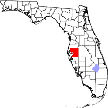
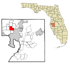
 Carrollwood Location within the state of Florida | |
| Coordinates: 28°3′8″N 82°29′9″W / 28.05222°N 82.48583°WCoordinates: 28°3′8″N 82°29′9″W / 28.05222°N 82.48583°W | |
| Country | United States |
| State | Florida |
| County | Hillsborough |
| Elevation | 39 ft (12 m) |
| Time zone | Eastern (EST) (UTC-5) |
| • Summer (DST) | EDT (UTC-4) |
| ZIP code | 33618, 33624 |
| Area code(s) | 813 |
| Website |
www |
Carrollwood is an unincorporated community in Hillsborough County, Florida, United States. Although a separate community, it is a part of the larger census-designated place (CDP) of the same name.[1] The ZIP code for the community is 33618. The community was a census-designated place during the 1990 census,[2] when the community recorded a population of 7,195.[3][4]
History
Carrollwood was founded in 1959 and was built out in the 1960s.[5] The community spread westward during the 1970s and 1980s. Carrollwood was struck by a tornado outbreak, which occurred throughout Central Florida on April 4, 1966.[6][7]
Geography
Carrollwood is located at 28.1 degrees north, 82.5 degrees west (28.0523, -82.4858).[8][9] The elevation for the community is 39 feet above sea level.[10]
Carrollwood boundaries include Lake Magdalene to the north, Tampa to the east, Egypt Lake to the south, and Carrollwood Village to the west.
Transportation
Some of the major roads serving the community are Dale Mabry Highway, Busch Boulevard, and Fletcher Avenue.
Education
- Lake Magdalene Elementary School
- Essrig Elementary School
- Hill Middle School
- Adams Middle School
- Chamberlain High School
- Carrollwood Elementary School
- Canela Elementary School
See also
- Carrollwood Village
- Carrollwood (CDP), a census defined area which consists of the communities of Carrollwood & Carrollwood Village
References
- ↑ Urbanized Area Outline Map (CENSUS 2000) Tampa-St. Petersburg, FL
- ↑ U.S. Geological Survey Geographic Names Information System: Carrollwood, Florida. Retrieved 2013-12-14.
- ↑ Carrollwood: Dictionary Die.net
- ↑ 1990 U.S. Census Place Profiles: Florida
- ↑ Carrollwood's History
- ↑ Tornado tears through Carrollwood
- ↑ Florida Tornadoes
- ↑ Carrollwood, Hillsborough County, Florida, USA - Maps, Photos ... Archived September 16, 2009, at the Wayback Machine.
- ↑ "US Gazetteer files: 2010, 2000, and 1990". United States Census Bureau. 2011-02-12. Retrieved 2011-04-23.
- ↑ Carrollwood profile from Hometown Locator