Fort Lonesome, Florida
| Fort Lonesome | |
|---|---|
| Unincorporated community | |
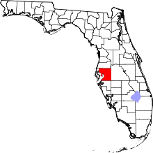
 Fort Lonesome Location within the state of Florida | |
| Coordinates: 27°42′17″N 82°08′45″W / 27.70472°N 82.14583°WCoordinates: 27°42′17″N 82°08′45″W / 27.70472°N 82.14583°W | |
| Country | United States |
| State | Florida |
| County | Hillsborough |
| Time zone | Eastern (EST) (UTC-5) |
| • Summer (DST) | EDT (UTC-4) |
Fort Lonesome is a rural ghost town located in southeastern Hillsborough County, Florida, United States, 36 miles southeast of Tampa. Its location is also west of the Little Manatee River State Park. A sawmill briefly revived the area with a few houses and three stores in the early 1930s. It was short lived: a fire destroyed the mill and eventually the "town" deceased. Today, it's mainly a farming region.
Geography

Fort Lonesome is located at 27.7 degrees north, 82.1 degrees west (27.705, -82.146).[1] The elevation for the community is 121 feet above sea level.[2] This location is the intersection of State Road 674 (Ruskin-Wimauma Rd) & County Road 39S which is the site of a gas station and power sub station.
Education
The community is served by Hillsborough County Schools.
References
- ↑ "US Gazetteer files: 2010, 2000, and 1990". United States Census Bureau. 2011-02-12. Retrieved 2011-04-23.
- ↑ Fort Lonesome profile from Hometown Locator