Wilmot, Ohio
| Wilmot, Ohio | |
|---|---|
| Village | |
|
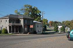
Streetside in Wilmot | |
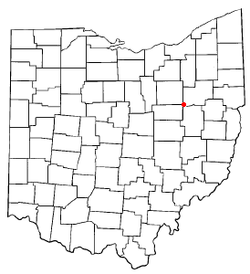 Location in the state of Ohio | |
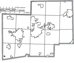 Location of Wilmot in Stark County | |
| Coordinates: 40°39′23″N 81°38′2″W / 40.65639°N 81.63389°WCoordinates: 40°39′23″N 81°38′2″W / 40.65639°N 81.63389°W | |
| Country | United States |
| State | Ohio |
| County | Stark |
| Township | Sugar Creek |
| Area[1] | |
| • Total | 0.14 sq mi (0.36 km2) |
| • Land | 0.14 sq mi (0.36 km2) |
| • Water | 0 sq mi (0 km2) |
| Population (2010)[2] | |
| • Total | 304 |
| • Estimate (2012[3]) | 304 |
| • Density | 2,171.4/sq mi (838.4/km2) |
| Time zone | Eastern (EST) (UTC-5) |
| • Summer (DST) | EDT (UTC-4) |
Wilmot is a village in Stark County, Ohio, United States. The population was 304 at the 2010 census. It is part of the Canton–Massillon Metropolitan Statistical Area.
Wilmot was originally called Milton, and under the latter name was laid out in 1836.[4]
Geography
Wilmot is located at 40°39′23″N 81°38′2″W / 40.65639°N 81.63389°W (40.656353, -81.633872).[5]
According to the United States Census Bureau, the village has a total area of 0.14 square miles (0.36 km2), all land.[1]
Demographics
| Historical population | |||
|---|---|---|---|
| Census | Pop. | %± | |
| 1880 | 412 | — | |
| 1900 | 354 | — | |
| 1910 | 258 | −27.1% | |
| 1920 | 227 | −12.0% | |
| 1930 | 271 | 19.4% | |
| 1940 | 287 | 5.9% | |
| 1950 | 354 | 23.3% | |
| 1960 | 402 | 13.6% | |
| 1970 | 378 | −6.0% | |
| 1980 | 329 | −13.0% | |
| 1990 | 261 | −20.7% | |
| 2000 | 335 | 28.4% | |
| 2010 | 304 | −9.3% | |
| Est. 2015 | 303 | [6] | −0.3% |
2010 census
As of the census[2] of 2010, there were 304 people, 118 households, and 84 families residing in the village. The population density was 2,171.4 inhabitants per square mile (838.4/km2). There were 136 housing units at an average density of 971.4 per square mile (375.1/km2). The racial makeup of the village was 98.0% White, 0.3% African American, 0.3% Asian, and 1.3% from two or more races. Hispanic or Latino of any race were 0.3% of the population.
There were 118 households of which 37.3% had children under the age of 18 living with them, 52.5% were married couples living together, 11.0% had a female householder with no husband present, 7.6% had a male householder with no wife present, and 28.8% were non-families. 26.3% of all households were made up of individuals and 9.3% had someone living alone who was 65 years of age or older. The average household size was 2.58 and the average family size was 3.00.
The median age in the village was 31.7 years. 27.3% of residents were under the age of 18; 8.9% were between the ages of 18 and 24; 29.3% were from 25 to 44; 25.3% were from 45 to 64; and 9.2% were 65 years of age or older. The gender makeup of the village was 52.6% male and 47.4% female.
2000 census
As of the census[8] of 2000, there were 335 people, 124 households, and 89 families residing in the village. The population density was 2,038.5 people per square mile (808.4/km²). There were 135 housing units at an average density of 821.5 per square mile (325.8/km²). The racial makeup of the village was 99.10% White, 0.30% Native American, 0.30% Asian, and 0.30% from two or more races.
There were 124 households out of which 37.1% had children under the age of 18 living with them, 61.3% were married couples living together, 5.6% had a female householder with no husband present, and 28.2% were non-families. 21.8% of all households were made up of individuals and 8.9% had someone living alone who was 65 years of age or older. The average household size was 2.70 and the average family size was 3.17.
In the village the population was spread out with 29.6% under the age of 18, 9.3% from 18 to 24, 34.3% from 25 to 44, 18.2% from 45 to 64, and 8.7% who were 65 years of age or older. The median age was 32 years. For every 100 females there were 95.9 males. For every 100 females age 18 and over, there were 93.4 males.
The median income for a household in the village was $38,750, and the median income for a family was $39,063. Males had a median income of $31,042 versus $26,406 for females. The per capita income for the village was $14,141. About 3.5% of families and 6.6% of the population were below the poverty line, including 4.9% of those under age 18 and 12.0% of those age 65 or over.
References
- 1 2 "US Gazetteer files 2010". United States Census Bureau. Retrieved 2013-01-06.
- 1 2 "American FactFinder". United States Census Bureau. Retrieved 2013-01-06.
- ↑ "Population Estimates". United States Census Bureau. Retrieved 2013-06-17.
- ↑ Overman, William Daniel (1958). Ohio Town Names. Akron, OH: Atlantic Press. p. 145.
- ↑ "US Gazetteer files: 2010, 2000, and 1990". United States Census Bureau. 2011-02-12. Retrieved 2011-04-23.
- ↑ "Annual Estimates of the Resident Population for Incorporated Places: April 1, 2010 to July 1, 2015". Retrieved July 2, 2016.
- ↑ "Census of Population and Housing". Census.gov. Retrieved June 4, 2015.
- ↑ "American FactFinder". United States Census Bureau. Retrieved 2008-01-31.
Municipalities and communities of Stark County, Ohio, United States | ||
|---|---|---|
| Cities | 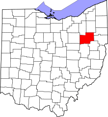 | |
| Villages | ||
| Townships | ||
| CDPs | ||
| Unincorporated communities | ||
| Footnotes | ‡This populated place also has portions in an adjacent county or counties | |