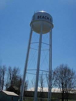
Beach City, Ohio
| Beach City, Ohio | |
|---|---|
| Village | |
 | |
 Location of Beach City, Ohio | |
 Location of Beach City in Stark County | |
| Coordinates: 40°39′10″N 81°34′48″W / 40.65278°N 81.58000°WCoordinates: 40°39′10″N 81°34′48″W / 40.65278°N 81.58000°W | |
| Country | United States |
| State | Ohio |
| County | Stark |
| Township | Sugar Creek |
| Area[1] | |
| • Total | 0.46 sq mi (1.19 km2) |
| • Land | 0.46 sq mi (1.19 km2) |
| • Water | 0 sq mi (0 km2) |
| Elevation[2] | 1,001 ft (305 m) |
| Population (2010)[3] | |
| • Total | 1,033 |
| • Estimate (2012[4]) | 1,023 |
| • Density | 2,245.7/sq mi (867.1/km2) |
| Time zone | Eastern (EST) (UTC-5) |
| • Summer (DST) | EDT (UTC-4) |
| ZIP code | 44608 |
| Area code(s) | 330 |
| FIPS code | 39-04458[5] |
| GNIS feature ID | 1083966[2] |
Beach City is a village in Stark County, Ohio, United States. The population was 1,033 at the 2010 census. It is part of the Canton-Massillon, OH Metropolitan Statistical Area.
History
Beach City named after Henry Beach, a railroad official.[6]
Geography
Beach City is located at 40°39′10″N 81°34′48″W / 40.65278°N 81.58000°W (40.652723, -81.579965),[7] along Sugar Creek.[8]
According to the United States Census Bureau, the village has a total area of 0.46 square miles (1.19 km2), all land.[1]
Government
The current mayor is Jack Thomas.
Demographics
| Historical population | |||
|---|---|---|---|
| Census | Pop. | %± | |
| 1880 | 282 | — | |
| 1900 | 364 | — | |
| 1910 | 671 | 84.3% | |
| 1920 | 658 | −1.9% | |
| 1930 | 725 | 10.2% | |
| 1940 | 812 | 12.0% | |
| 1950 | 940 | 15.8% | |
| 1960 | 1,151 | 22.4% | |
| 1970 | 1,133 | −1.6% | |
| 1980 | 1,083 | −4.4% | |
| 1990 | 1,051 | −3.0% | |
| 2000 | 1,137 | 8.2% | |
| 2010 | 1,033 | −9.1% | |
| Est. 2015 | 1,011 | [9] | −2.1% |
2010 census
As of the census[3] of 2010, there were 1,033 people, 419 households, and 284 families residing in the village. The population density was 2,245.7 inhabitants per square mile (867.1/km2). There were 457 housing units at an average density of 993.5 per square mile (383.6/km2). The racial makeup of the village was 97.6% White, 0.4% African American, 0.2% Native American, 0.2% from other races, and 1.6% from two or more races. Hispanic or Latino of any race were 0.8% of the population.
There were 419 households of which 33.4% had children under the age of 18 living with them, 48.7% were married couples living together, 12.9% had a female householder with no husband present, 6.2% had a male householder with no wife present, and 32.2% were non-families. 27.2% of all households were made up of individuals and 15.6% had someone living alone who was 65 years of age or older. The average household size was 2.47 and the average family size was 2.99.
The median age in the village was 39.5 years. 23.8% of residents were under the age of 18; 7.9% were between the ages of 18 and 24; 25.8% were from 25 to 44; 26.5% were from 45 to 64; and 16.2% were 65 years of age or older. The gender makeup of the village was 47.9% male and 52.1% female.
2000 census
As of the census[5] of 2000, there were 1,137 people, 456 households, and 311 families residing in the village. The population density was 2,454.8 people per square mile (954.3/km²). There were 474 housing units at an average density of 1,023.4 per square mile (397.9/km²). The racial makeup of the village was 98.77% White, 0.09% African American, 0.26% Asian, 0.35% from other races, and 0.53% from two or more races. Hispanic or Latino of any race were 0.88% of the population.
There were 456 households out of which 31.4% had children under the age of 18 living with them, 55.9% were married couples living together, 8.1% had a female householder with no husband present, and 31.6% were non-families. 27.2% of all households were made up of individuals and 15.8% had someone living alone who was 65 years of age or older. The average household size was 2.49 and the average family size was 3.04.
In the village the population was spread out with 25.9% under the age of 18, 6.7% from 18 to 24, 28.8% from 25 to 44, 21.5% from 45 to 64, and 17.1% who were 65 years of age or older. The median age was 38 years. For every 100 females there were 94.0 males. For every 100 females age 18 and over, there were 89.6 males.
The median income for a household in the village was $36,250, and the median income for a family was $41,313. Males had a median income of $32,250 versus $22,045 for females. The per capita income for the village was $15,589. About 5.4% of families and 8.1% of the population were below the poverty line, including 11.4% of those under age 18 and 7.8% of those age 65 or over.
References
- 1 2 "US Gazetteer files 2010". United States Census Bureau. Archived from the original on 2012-01-24. Retrieved 2013-01-06.
- 1 2 "US Board on Geographic Names". United States Geological Survey. 2007-10-25. Retrieved 2008-01-31.
- 1 2 "American FactFinder". United States Census Bureau. Retrieved 2013-01-06.
- ↑ "Population Estimates". United States Census Bureau. Archived from the original on 2013-06-17. Retrieved 2013-06-17.
- 1 2 "American FactFinder". United States Census Bureau. Archived from the original on 2013-09-11. Retrieved 2008-01-31.
- ↑ Overman, William Daniel (1958). Ohio Town Names. Akron, OH: Atlantic Press. p. 10.
- ↑ "US Gazetteer files: 2010, 2000, and 1990". United States Census Bureau. 2011-02-12. Retrieved 2011-04-23.
- ↑ DeLorme (1991). Ohio Atlas & Gazetteer. Yarmouth, Maine: DeLorme. p. 51. ISBN 0-89933-233-1.
- ↑ "Annual Estimates of the Resident Population for Incorporated Places: April 1, 2010 to July 1, 2015". Retrieved July 2, 2016.
- ↑ "Census of Population and Housing". Census.gov. Archived from the original on May 11, 2015. Retrieved June 4, 2015.
External links
Municipalities and communities of Stark County, Ohio, United States | ||
|---|---|---|
| Cities | 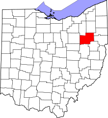 | |
| Villages | ||
| Townships | ||
| CDPs | ||
| Unincorporated communities | ||
| Footnotes | ‡This populated place also has portions in an adjacent county or counties | |