West Weber, Utah
| West Weber | |
|---|---|
| Unincorporated community | |
|
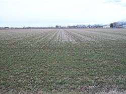
An agricultural field in West Weber | |
 West Weber  West Weber Location of West Weber in Utah | |
| Coordinates: 41°14′56″N 112°04′42″W / 41.24889°N 112.07833°WCoordinates: 41°14′56″N 112°04′42″W / 41.24889°N 112.07833°W | |
| Country | United States |
| State | Utah |
| County | Weber |
| Elevation[1] | 4,239 ft (1,292 m) |
| GNIS feature ID | 1447187[1] |
West Weber is an unincorporated community in Weber County, Utah, United States.[2] It is located about eight miles northwest of Ogden.[3] West Weber was reportedly organized as a ward in 1877, when it had a population of 700 inhabitants.[4] The community is located northeast of the intersection of Utah State Route 134 and Utah State Route 39. The nearest major highway is the Interstate 84/Interstate 15 (Veterans Memorial Highway), which Route 39 leads to, about 5-mile (8.0 km) to the east.[5]
| Historical population | |||
|---|---|---|---|
| Census | Pop. | %± | |
| 1880 | 603 | — | |
| 1890 | 722 | 19.7% | |
| 1900 | 822 | 13.9% | |
| 1910 | 823 | 0.1% | |
| 1920 | 379 | −53.9% | |
| 1930 | 409 | 7.9% | |
| 1940 | 396 | −3.2% | |
| 1950 | 417 | 5.3% | |
| Source: U.S. Census Bureau[6] | |||
West Weber contains the West Weber Elementary School, headed by Mike Geilmann.[7] The Weber River flows nearby and a bridge was built in 1903 over the river.[8]
A minor accident occurred near West Weber on September 17, 1931 on the 8300 Ms. (20S) Southern Pacific, caused by an emergency application of air. Conductor C.A. Peterson was thrown against the cupola stand, injuring his left shoulder, and brakeman P.L. Burnette was thrown from the cupola to the floor.[9]
Economy
The eastern area of West Weber was known for some time as Wilson. John Staker and Sbenezer Wiggins reportedly raised a crop of grain here in 1853.[10] The land at West Weber was reported in 1903 to have a reputation as one of the poorest soils between Salt Lake City and Ogden.[11] However, beets are grown in the area, made possible by boring artesian wells for irrigation, aided by the presence of nitrates, as thereby valuable plant food is added to the soil.[12] Archibald McFarland had originally dug a canal in West Weber in 1859 from one of the sloughs bordering the Weber River for irrigation purposes. The earlier settlers spent about $2500 to irrigate ten small farms in the area in 1860–61.[13] In 1903, studies showed that beets having a purity average of 81.3 were raised on soil containing 1880 pounds of alkali within the surface acre-foot, and when the content of alkali was lowered to 376 pounds, the beet purity went up to 84.9.[11]
References
- 1 2 U.S. Geological Survey Geographic Names Information System: West Weber
- ↑ "West Weber, Utah". Online Utah. Retrieved March 27, 2011.
- ↑ The Latter-Day Saints' millennial star. P.P. Pratt. 1858. p. 469. Retrieved March 31, 2011.
- ↑ Bancroft, Hubert Howe (1889). The Works of Hubert Howe Bancroft: History of Utah. 1889. A. L. Bancroft & company. p. 307. Retrieved March 31, 2011.
- ↑ Google Maps (Map). Google.
- ↑ "Census of Population and Housing". U.S. Census Bureau. Retrieved October 20, 2011.
- ↑ "Home of the Cowboys". West Weber Elementary School. Retrieved March 31, 2011.
- ↑ Geological Survey (U.S.) (1947). Water-supply paper. G.P.O. Retrieved March 31, 2011.
- ↑ United States. Congress. Senate (1935). Hearings. U.S. G.P.O. p. 76. Retrieved March 31, 2011.
- ↑ Historical Records Survey (Utah). Inventory of the County Archives of Utah: Weber County (Ogden). The Utah Historical Records Survey Project. Retrieved March 31, 2011.
- 1 2 Sugar. 1903. pp. 25 and 54. Retrieved March 31, 2011.
- ↑ The Sugar beet. H.C. Baird & co. 1902. p. 219. Retrieved March 31, 2011.
- ↑ Sadler, Richard W.; Roberts, Richard C. (April 1994). The Weber River Basin: grass roots democracy and water development. Utah State University Press. ISBN 978-0-87421-164-1. Retrieved March 31, 2011.
Municipalities and communities of Weber County, Utah, United States | ||
|---|---|---|
| Cities | 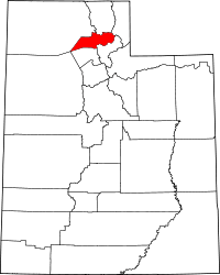 | |
| Town | ||
| CDPs | ||
| Unincorporated communities | ||