Pleasant View, Utah
| Pleasant View, Utah | |
|---|---|
| City | |
|
City hall | |
| Motto: "A treasure in Ben Lomond's shadow." | |
 Location in Weber County and the state of Utah | |
| Coordinates: 41°19′18″N 111°59′54″W / 41.32167°N 111.99833°WCoordinates: 41°19′18″N 111°59′54″W / 41.32167°N 111.99833°W | |
| Country | United States |
| State | Utah |
| County | Weber |
| Settled | 1850 |
| Incorporated | August 27, 1945 |
| Founded by | John Mower |
| Area | |
| • Total | 6.7 sq mi (17.4 km2) |
| • Land | 6.7 sq mi (17.4 km2) |
| • Water | 0.0 sq mi (0.0 km2) |
| Elevation | 4,400 ft (1,341 m) |
| Population (2012) | |
| • Total | 8,340 |
| • Density | 837.2/sq mi (323.2/km2) |
| Time zone | Mountain (MST) (UTC-7) |
| • Summer (DST) | MDT (UTC-6) |
| ZIP codes | 84404, 84414 |
| Area code(s) | 385, 801 |
| FIPS code | 49-61150[1] |
| GNIS feature ID | 1444486[2] |
| Website | http://www.pleasantviewcity.com |

Pleasant View is a city in Weber County, Utah, United States. The population was 7,979 at the 2010 census. It is part of the Ogden–Clearfield, Utah Metropolitan Statistical Area. It is a suburban community of Ogden, Utah.
History
Considered part of North Ogden for its first 30 years, Pleasant View was known during its early days by several names, including West District, Hot Springs District, Stringtown, or simply Out West. The city was officially named Pleasant View in 1882 by Wilford Cragun, one of the first white children born in the area. Mary Lake, daughter of William Bailey Lake and Sarah Jane Marler was born in North Ogden, 15 December 1851. Other early settlers were Thomas Dunn, John Mower, and Simeon Cragun families.
Geography
According to the United States Census Bureau, the city has a total area of 6.7 square miles (17 km2), all of it land.
Demographics
| Historical population | |||
|---|---|---|---|
| Census | Pop. | %± | |
| 1890 | 336 | — | |
| 1900 | 359 | 6.8% | |
| 1910 | 387 | 7.8% | |
| 1920 | 372 | −3.9% | |
| 1930 | 430 | 15.6% | |
| 1940 | 437 | 1.6% | |
| 1950 | 420 | −3.9% | |
| 1960 | 927 | 120.7% | |
| 1970 | 2,021 | 118.0% | |
| 1980 | 3,983 | 97.1% | |
| 1990 | 3,603 | −9.5% | |
| 2000 | 5,632 | 56.3% | |
| 2010 | 7,979 | 41.7% | |
| Est. 2015 | 9,273 | [3] | 16.2% |
As of the census[1] of 2010, there were 7,979 people, 2,438 households, and 2,086 families residing in the city. The population density was 837.2 people per square mile (323.1/km²). There were 2,548 housing units at an average density of 281.7 per square mile (108.7/km²). The racial makeup of the city was 93.1% White, 0.4% African American, 0.2% Native American, 0.9% Asian, 0.4% Pacific Islander, 3.1% from other races, and 1.9% from two or more races. Hispanic or Latino of any race were 7.3% of the population.
There were 2,438 households out of which 39.1% had children under the age of 18 living with them, 74.4% were married couples living together, 7.6% had a female householder with no husband present, and 14.4% were non-families. 11.9% of all households were made up of individuals and 5.4% had someone living alone who was 65 years of age or older. The average household size was 3.27 and the average family size was 3.57.
In the city the population was spread out with 32.9% under the age of 18, 7.9% from 18 to 24, 22.3% from 25 to 44, 25.2% from 45 to 64, and 11.7% who were 65 years of age or older. The median age was 34.1 years. For every 100 females there were 100.4 males. For every 100 females age 18 and over, there were 99.7 males.
The median income for a household in the city was $62,123, and the median income for a family was $66,542. Males had a median income of $41,568 versus $30,308 for females. The per capita income for the city was $22,694. About 1.6% of families and 2.6% of the population were below the poverty line, including 3.9% of those under age 18 and none of those age 65 or over.
Points of interest
The area became a popular tourist stop because of the natural hot springs located in its north western corner that lies adjacent to Box Elder County. The Utah Hot Springs Resort was created at the site in the 1880s. During its peak, the facility offered visitors bathing and swimming pools, a hotel with 40 rooms, a dance hall, and a saloon where a mug of beer could be bought for five cents. The facility no longer exists.
References
- 1 2 "American FactFinder". United States Census Bureau. Retrieved 2008-01-31.
- ↑ "US Board on Geographic Names". United States Geological Survey. 2007-10-25. Retrieved 2008-01-31.
- ↑ "Annual Estimates of the Resident Population for Incorporated Places: April 1, 2010 to July 1, 2015". Retrieved July 2, 2016.
- ↑ "Census of Population and Housing". Census.gov. Retrieved June 4, 2015.
External links
- Pleasant View City web site
 |
Willard Bay | Willard | Mantua | |
| Farr West | |
North Ogden | ||
| ||||
| | ||||
| Harrisville |
Municipalities and communities of Weber County, Utah, United States | ||
|---|---|---|
| Cities | 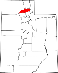 | |
| Town | ||
| CDPs | ||
| Unincorporated communities | ||