North Ogden, Utah
| North Ogden, Utah | |
|---|---|
| City | |
|
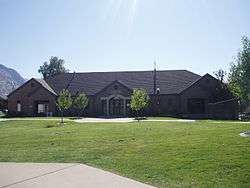
City hall | |
 Location in Weber County and the state of Utah | |
| Coordinates: 41°18′36″N 111°57′32″W / 41.31000°N 111.95889°WCoordinates: 41°18′36″N 111°57′32″W / 41.31000°N 111.95889°W | |
| Country | United States |
| State | Utah |
| County | Weber |
| Settled | 1850 |
| Incorporated | 1934 |
| Named for | Peter Skene Ogden |
| Area | |
| • Total | 6.5 sq mi (16.8 km2) |
| • Land | 6.5 sq mi (16.8 km2) |
| • Water | 0.0 sq mi (0.0 km2) |
| Elevation | 4,501 ft (1,372 m) |
| Population (2012) | |
| • Total | 17,791 |
| • Density | 2,310.4/sq mi (892.0/km2) |
| Time zone | Mountain (MST) (UTC-7) |
| • Summer (DST) | MDT (UTC-6) |
| ZIP codes | 84404, 84414 |
| Area code(s) | 385, 801 |
| FIPS code | 49-55100[1] |
| GNIS feature ID | 1443962[2] |
North Ogden is a city in Weber County, Utah, United States. The population was 17,357 at the 2010 census. North Ogden is on SR-235, three miles north of Ogden. It is a suburb of that city and is part of the Ogden –Clearfield, Utah Metropolitan Statistical Area.
History
North Ogden was originally settled during the winter of 1850 by two sets of cattle ranchers from Ogden. The Campbells and the Riddles had been warned by Brigham Young not to venture from the fort in Ogden due to the troubles with the local Shoshone. After a few months wintering their cattle, they were forced to return to Ogden in fear of Shoshone reprisals. The following year, after the trouble with the Shoshone had been partially settled, Jonathan Campbell returned with a number of other families to permanently settle the spot.
One important early industry in the mid to late 19th century was the sugar beet industry, and a processing and canning plant was built in the town for this. The owner of the canning plant during its operation was David Ephriam Randall. North Ogden also built a spur from the Union Pacific Station in Ogden, called the "Dummy Line". Large fruit orchards were developed and their harvest became an economic staple for the community, with the establishment of the North Ogden Fruit Exchange in 1924. This became the region's first fruit cooperative, using the railroad to sell fruit on the interstate market.[3]
In the 1930s, increasing demand for water led the city to officially incorporate on February 1, 1934.[4] David Gilbert Randall was elected the first mayor. He served in this position for ten years. That same decade saw the creation of the Cherry Days celebration on July 4. As North Ogden grew after World War II, it became a primary suburb for Ogden and other larger cities. Its industries flagged, and most agricultural areas began to be parcelled out for homes.
The Paramount Pictures logo, known as Majestic Mountain, was modeled after Ben Lomond Peak. William W. Hodkinson (known as the man to have invented Hollywood), a native of the Ogden area, initially drew the image on a napkin during a meeting in 1914. Ben Lomond is distinctly visible to the north of North Ogden.
Geography
According to the United States Census Bureau, the city has a total area of 6.5 square miles (16.8 km²), all of it land.
North Ogden is situated at the base of Ben Lomond Peak, a prominent mountain on the Wasatch front, visible from the Salt Lake Airport.
Demographics
| Historical population | |||
|---|---|---|---|
| Census | Pop. | %± | |
| 1870 | 683 | — | |
| 1880 | 956 | 40.0% | |
| 1890 | 758 | −20.7% | |
| 1900 | 850 | 12.1% | |
| 1910 | 579 | −31.9% | |
| 1920 | 1,004 | 73.4% | |
| 1930 | 1,045 | 4.1% | |
| 1940 | 687 | −34.3% | |
| 1950 | 1,105 | 60.8% | |
| 1960 | 2,621 | 137.2% | |
| 1970 | 5,257 | 100.6% | |
| 1980 | 9,309 | 77.1% | |
| 1990 | 11,668 | 25.3% | |
| 2000 | 15,026 | 28.8% | |
| 2010 | 17,357 | 15.5% | |
| Est. 2015 | 18,446 | [5] | 6.3% |
As of the census[1] of 2010, there were 17,357 people, 5,569 households, and 4,633 families residing in the city. The population density was 2,310.4 people per square mile (892.5/km²). There were 5,799 housing units at an average density of 701.5 per square mile (271.0/km²). The racial makeup of the city was 94.3% White, 0.5% African American, 0.4% Native American, 0.9% Asian, 0.2% Pacific Islander, 1.8% from other races, and 1.9% from two or more races. Hispanic or Latino of any race were 5.4% of the population.
There were 5,569 households out of which 39.6% had children under the age of 18 living with them, 71.2% were married couples living together, 8.6% had a female householder with no husband present, and 16.8% were non-families. 14.8% of all households were made up of individuals and 5.0% had someone living alone who was 65 years of age or older. The average household size was 3.40 and the average family size was 3.68.
In the city the population was spread out with 31.4% under the age of 18, 8.7% from 18 to 24, 24.5% from 25 to 44, 24.2% from 45 to 64, and 11.2% who were 65 years of age or older. The median age was 32.9 years. For every 100 females there were 101.2 males. For every 100 females age 18 and over, there were 98.8 males.
The median income for a household in the city was $59,556, and the median income for a family was $63,252. Males had a median income of $43,712 versus $28,180 for females. The per capita income for the city was $20,625. About 3.1% of families and 3.6% of the population were below the poverty line, including 3.9% of those under age 18 and 3.1% of those age 65 or over.
Notable natives
- Blair Buswell, Sculptor for the NFL Hall of Fame 1983-present
- Julia Bachison, Miss Utah 2005
- Nick Howell, College Football Coach 2008-present
- Kelsey Nixon, Food Network chef
References
- 1 2 "American FactFinder". United States Census Bureau. Retrieved 2008-01-31.
- ↑ "US Board on Geographic Names". United States Geological Survey. 2007-10-25. Retrieved 2008-01-31.
- ↑ North Ogden. Images of America. Arcadia Publishing. ISBN 978-0738584607.
- ↑ http://www.northogdencity.com/
- ↑ "Annual Estimates of the Resident Population for Incorporated Places: April 1, 2010 to July 1, 2015". Retrieved July 2, 2016.
- ↑ "Census of Population and Housing". Census.gov. Retrieved June 4, 2015.
External links
 |
Willard | Mantua | Paradise | |
| Pleasant View | |
Huntsville | ||
| ||||
| | ||||
| Harrisville | Ogden | Morgan |
Municipalities and communities of Weber County, Utah, United States | ||
|---|---|---|
| Cities | 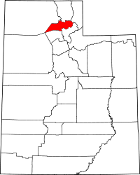 | |
| Town | ||
| CDPs | ||
| Unincorporated communities | ||