West Blocton, Alabama
| West Blocton, Alabama | |
|---|---|
| Town | |
 Location in Bibb County and the state of Alabama | |
| Coordinates: 33°7′7″N 87°7′22″W / 33.11861°N 87.12278°W | |
| Country | United States |
| State | Alabama |
| County | Bibb |
| Area | |
| • Total | 4.6 sq mi (11.9 km2) |
| • Land | 4.6 sq mi (11.8 km2) |
| • Water | 0.04 sq mi (0.1 km2) |
| Elevation | 495 ft (151 m) |
| Population (2010) | |
| • Total | 1,240 |
| • Density | 271/sq mi (104.8/km2) |
| Time zone | Central (CST) (UTC-6) |
| • Summer (DST) | CDT (UTC-5) |
| ZIP code | 35184 |
| Area code(s) | 205 |
| FIPS code | 01-80928 |
| GNIS feature ID | 0153935 |
| Website |
www |
West Blocton is a town in Bibb County, Alabama, United States. At the 2010 census the population was 1,240.[1] The current mayor is Daniel Sims. On 11-7-2016, mere moments after his inauguration during a meeting with two absent council members, Sims announced the reappoints of all town officials except for the police chief. No new chief was named at the event.
Geography

West Blocton is located in northern Bibb County at 33°7′7″N 87°7′22″W / 33.11861°N 87.12278°W (33.118733, -87.122875),[2] at the southern terminus of the Appalachian Mountains.
Alabama State Route 5 passes through the town, west of the town center, leading north 7 miles (11 km) to Woodstock and south 12 miles (19 km) to Brent and Centreville, the county seat.
According to the U.S. Census Bureau, the town has a total area of 4.6 square miles (11.9 km2), of which 4.6 square miles (11.8 km2) is land and 0.039 square miles (0.1 km2), or 0.52%, is water.[1]
West Blocton Coke Ovens Park blends history with nature, providing a place to relax and learn about the history of the industrial era of Alabama and how the Coke Ovens supplied the steel of the South.
Demographics
| Historical population | |||
|---|---|---|---|
| Census | Pop. | %± | |
| 1910 | 892 | — | |
| 1920 | 1,023 | 14.7% | |
| 1930 | 1,070 | 4.6% | |
| 1940 | 1,317 | 23.1% | |
| 1950 | 1,280 | −2.8% | |
| 1960 | 1,156 | −9.7% | |
| 1970 | 1,172 | 1.4% | |
| 1980 | 1,147 | −2.1% | |
| 1990 | 1,468 | 28.0% | |
| 2000 | 1,372 | −6.5% | |
| 2010 | 1,240 | −9.6% | |
| Est. 2015 | 1,261 | [3] | 1.7% |
| U.S. Decennial Census[4] 2013 Estimate[5] | |||
As of the census[6] of 2010, there were 1,240 people, 494 households, and 341 families residing in the town. The population density was 271 people per square mile (104.8/km²). There were 576 housing units at an average density of 125.2 per square mile (48.4/km²). The racial makeup of the town was 85.6% White, 13.2% Black or African American, 0.4% Native American, 0.1% from other races, and 0.6% from two or more races. 0.1% of the population were Hispanic or Latino of any race.
There were 494 households out of which 22.3% had children under the age of 18 living with them, 49.6% were married couples living together, 14.6% had a female householder with no husband present, and 31.0% were non-families. 29.1% of all households were made up of individuals and 14.7% had someone living alone who was 65 years of age or older. The average household size was 2.51 and the average family size was 3.10.
In the town the population was spread out with 22.8% under the age of 18, 7.2% from 18 to 24, 25.1% from 25 to 44, 27.2% from 45 to 64, and 17.7% who were 65 years of age or older. The median age was 41.1 years. For every 100 females there were 93.1 males. For every 100 females age 18 and over, there were 101.9 males.
The median income for a household in the town was $34,844, and the median income for a family was $59,875. Males had a median income of $37,384 versus $31,167 for females. The per capita income for the town was $22,224. About 11.3% of families and 11,4% of the population were below the poverty line, including 12.2% of those under age 18 and 12.0% of those age 65 or over.
Notable people
- Mel Allen, broadcaster for the New York Yankees, was raised in West Blocton.
- Sammie Lee Hill, who was drafted in the fourth round of the 2009 NFL Draft by the Detroit Lions, was born in West Blocton in 1986. He is a graduate of West Blocton High School and Stillman College.
- Debra Marshall, known from her days with the WCW and WWE, was raised in West Blocton.
- Frank Pratt, former baseball player for the Chicago White Sox, was born in Blocton, a town to the east of West Blocton that no longer exists.
- Mildred Lee Scudder, author of children's books, was born in Blocton on February 19, 1908.
- Colonel James B. Swindal, U.S. Air Force, pilot of Air Force One during the administrations of Presidents John F. Kennedy and Lyndon B. Johnson; including Texas trip during which Kennedy was assassinated.
Trivia
- West Blocton is known for its historic beehive ovens, built in the late 1880s for coke production.
 Coke Ovens are the foundation of this town and the celebrated heritage of Alabama's history providing steel for the South.
 - A feature-length documentary, West Blocton: Small Town, Big Heart, was made in 2012 by Michael J. Logan, an independent filmmaker whose family is from the town. The film covers the history of West Blocton from its inception in 1884 as a coal mining town until present day.
Climate
The climate in this area is characterized by hot, humid summers and generally mild to cool winters. According to the Köppen Climate Classification system, West Blocton has a humid subtropical climate, abbreviated "Cfa" on climate maps. [7]
References
- 1 2 "Geographic Identifiers: 2010 Demographic Profile Data (G001): West Blocton town, Alabama". U.S. Census Bureau, American Factfinder. Retrieved September 16, 2013.
- ↑ "US Gazetteer files: 2010, 2000, and 1990". United States Census Bureau. 2011-02-12. Retrieved 2011-04-23.
- ↑ "Annual Estimates of the Resident Population for Incorporated Places: April 1, 2010 to July 1, 2015". Retrieved July 2, 2016.
- ↑ "U.S. Decennial Census". Census.gov. Retrieved June 6, 2013.
- ↑ "Annual Estimates of the Resident Population: April 1, 2010 to July 1, 2013". Retrieved June 3, 2014.
- ↑ "American FactFinder". United States Census Bureau. Retrieved 2015-07-08.
- ↑ Climate Summary for West Blocton, Alabama
External links
- Town of West Blocton official websiteDead link
- History of West Blocton, Encyclopedia of Southern Jewish Communities
- West Blocton History Short Notes, West Blocton Bible Methodist Church
- West Blocton Coke Ovens Park
Coordinates: 33°07′07″N 87°07′22″W / 33.118733°N 87.122875°W
Municipalities and communities of Bibb County, Alabama, United States | ||
|---|---|---|
| Cities | 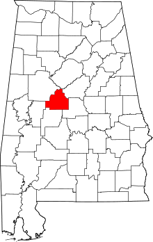 | |
| Towns | ||
| Unincorporated communities | ||
| Ghost town | ||
| Footnotes | ‡This populated place also has portions in an adjacent county or counties | |