Vance, Alabama
| Town of Vance [1] | |
|---|---|
| Town | |
|
The U.S. Post Office in Vance, Alabama | |
 Location in Tuscaloosa County and the state of Alabama | |
| Coordinates: 33°9′52″N 87°13′54″W / 33.16444°N 87.23167°W | |
| Country | United States |
| State | Alabama |
| Counties | Tuscaloosa, Bibb |
| Area | |
| • Total | 10.2 sq mi (26.5 km2) |
| • Land | 10.2 sq mi (26.4 km2) |
| • Water | 0.04 sq mi (0.1 km2) |
| Elevation | 509 ft (155 m) |
| Population (2010) | |
| • Total | 1,529 |
| • Density | 150/sq mi (58.0/km2) |
| Time zone | Central (CST) (UTC-6) |
| • Summer (DST) | CDT (UTC-5) |
| ZIP code | 35490 |
| Area code(s) | 205 |
| FIPS code | 01-78264 |
| GNIS feature ID | 0158947 |
| Website |
www |

Vance is a town in Tuscaloosa and Bibb counties in the U.S. state of Alabama. As of the 2010 census it had a population of 1,529.[2] It is most famous for the Mercedes-Benz U.S. International plant, currently the only one in North America. The current mayor of Vance is Keith Mahaffey.
The Tuscaloosa County portion of Vance is part of the Tuscaloosa Metropolitan Statistical Area, while the Bibb County portion is part of the Birmingham–Hoover Metropolitan Statistical Area.
History
The town of Vance was first settled in 1830 by David M. Lindley. At that time, the town was called Trion and it was a trading post on the Old Huntsville Road.
In 1872, Trion was renamed Smallwood in honor of sawmill owner Charles Smallwood.
In 1879, Smallwood was renamed its current name Vance in honor of Dr. William Vance of North Carolina. It appeared on the 1880 U.S. Census as the village of Vance's Station.
It formally incorporated in 1972.[3]
Town government
Council members
- Mayor - Keith Mahaffey
- Place 1 - Debbie Minor
- Place 2 - Harold McAdory
- Place 3 - Debbie Nichols
- Place 4 - Brenda Morrison
- Place 5 - Dianne Averett
- Town Clerk - Tracy Burt
Police department
- Chief of Police - W. T. Graham
- Assistant Chief - B. L. Bigham
Geography
Most of the town of Vance is located in southeastern Tuscaloosa County, with the town center at 33°9'52.276" North, 87°13'54.185" West (33.164521, -87.231718).[4] The town extends south into Bibb County. U.S. Route 11 passes through the center of the town, leading west 21 miles (34 km) to Tuscaloosa and northeast 36 miles (58 km) to downtown Birmingham. Interstate 59 parallels Route 11 and serves Vance via Exit 89, adjacent to the Mercedes-Benz plant.
According to the U.S. Census Bureau, the town has a total area of 10.2 square miles (26.5 km2), of which 10.2 square miles (26.4 km2) is land and 0.04 square miles (0.1 km2), or 0.29%, is water.[2]
Climate
Average annual rainfall is 54.9 inches (1,390 mm).
Demographics
| Historical population | |||
|---|---|---|---|
| Census | Pop. | %± | |
| 1880 | 82 | — | |
| 1970 | 68 | — | |
| 1980 | 254 | 273.5% | |
| 1990 | 248 | −2.4% | |
| 2000 | 500 | 101.6% | |
| 2010 | 1,529 | 205.8% | |
| Est. 2015 | 1,513 | [5] | −1.0% |
| U.S. Decennial Census[6] 2013 Estimate[7] | |||
As of the census[8] of 2010, there were 1,529 people, 537 households, and 400 families residing in the town. The population density was 150 people per square mile (58.0/km²). There were 592 housing units at an average density of 58.0 per square mile (22.3/km²). The racial makeup of the town was 88.8% White, 7.2% Black or African American, 0.4% Native American, 1.7% from other races, and 1.3% from two or more races. 5.6% of the population were Hispanic or Latino of any race.
There were 537 households out of which 42.6% had children under the age of 18 living with them, 61.6% were married couples living together, 7.4% had a female householder with no husband present, and 25.5% were non-families. 19.9% of all households were made up of individuals and 4.9% had someone living alone who was 65 years of age or older. The average household size was 2.85 and the average family size was 3.30.
In the town the population was spread out with 29.8% under the age of 18, 9.4% from 18 to 24, 35.3% from 25 to 44, 18.2% from 45 to 64, and 7.3% who were 65 years of age or older. The median age was 31.1 years. For every 100 females there were 108.3 males. For every 100 females age 18 and over, there were 114.3 males.
The median income for a household in the town was $55,938, and the median income for a family was $70,114. Males had a median income of $49,583 versus $38,450 for females. The per capita income for the town was $24,406. About 3.4% of families and 4.5% of the population were below the poverty line, including 2.1% of those under age 18 and 8.7% of those age 65 or over.
References
- ↑ Code of Alabama 1975, Title 11, Chapter 40, Section 11-40-1
- 1 2 "Geographic Identifiers: 2010 Demographic Profile Data (G001): Vance town, Alabama". U.S. Census Bureau, American Factfinder. Retrieved September 16, 2013.
- ↑ http://www.encyclopediaofalabama.org/article/h-3519
- ↑ "US Gazetteer files: 2010, 2000, and 1990". United States Census Bureau. 2011-02-12. Retrieved 2011-04-23.
- ↑ "Annual Estimates of the Resident Population for Incorporated Places: April 1, 2010 to July 1, 2015". Retrieved July 2, 2016.
- ↑ "U.S. Decennial Census". Census.gov. Retrieved June 6, 2013.
- ↑ "Annual Estimates of the Resident Population: April 1, 2010 to July 1, 2013". Retrieved June 3, 2014.
- ↑ "American FactFinder". United States Census Bureau. Retrieved 2015-07-08.
External links
Coordinates: 33°09′52″N 87°13′54″W / 33.164521°N 87.231718°W
Municipalities and communities of Bibb County, Alabama, United States | ||
|---|---|---|
| Cities | 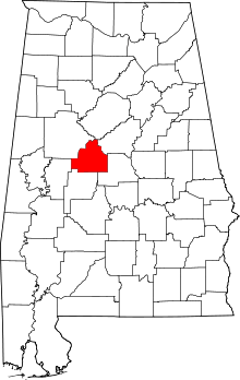 | |
| Towns | ||
| Unincorporated communities | ||
| Ghost town | ||
| Footnotes | ‡This populated place also has portions in an adjacent county or counties | |
Municipalities and communities of Tuscaloosa County, Alabama, United States | ||
|---|---|---|
| Cities |  | |
| Towns | ||
| CDP | ||
| Unincorporated communities | ||
| Ghost town | ||
| Footnotes | ‡This populated place also has portions in an adjacent county or counties | |