Waterloo, New York (village)
| Waterloo | |
|---|---|
| Village | |
| Nickname(s): waterloo | |
| Motto: water wins | |
 Waterloo Location within the state of New York | |
| Coordinates: 42°54′13″N 76°51′34″W / 42.90361°N 76.85944°WCoordinates: 42°54′13″N 76°51′34″W / 42.90361°N 76.85944°W | |
| Country | United States |
| State | New York |
| County | Seneca |
| Town(s) | Waterloo and Fayette |
| Incorporated | April 9, 1824[1] |
| Government | |
| • Type | Board of Trustees |
| • Mayor | Theodore H. Young |
| • Clerk | Don Northrup |
| • Court | Justice Conrad Struzik |
| Area | |
| • Total | 2.2 sq mi (5.6 km2) |
| • Land | 2.1 sq mi (5.4 km2) |
| • Water | 0.1 sq mi (0.2 km2) |
| Elevation | 453 ft (138 m) |
| Population (2010) | |
| • Total | 5,171 |
| • Density | 2,462.4/sq mi (957.6/km2) |
| Time zone | Eastern (EST) (UTC-5) |
| • Summer (DST) | EDT (UTC-4) |
| ZIP code | 13165 |
| Area code(s) | 315 |
| FIPS code | 36-78553[2] |
| GNIS feature ID | 0968900[3] |
| Website | http://www.waterloony.com/ |
Waterloo is a village in Seneca County, New York, United States.[4] The population was 5,171 at the 2010 census and is now the most populated village in Seneca County. The village is named after the Waterloo in Belgium, where Napoleon was defeated. It is the primary county seat of Seneca County, with the other being Ovid as part of a two-shire system established in 1822.[5][6] Most of the county administrative offices are located in the village.[7] Therefore, many political sources only list Waterloo as the county seat.
The Village of Waterloo is mostly in the Town of Waterloo, but the part south of the Cayuga-Seneca Canal of the village is in the Town of Fayette and a small area in the southeast of the village is in [Seneca Falls (town), New York|Town of Seneca Falls]]. Waterloo is east of Geneva and is located in between the two main Finger Lakes, Seneca Lake and Cayuga Lake.
History
The area was within the realm of the Cayuga nation, one of several bands to form the Iroquois League. The current site of the village was the location of the former Cayuga village "Skoiyase" (or Skoi-Yase), meaning "flowing water", which was established around 1500.[8] They were visited by Jesuit missionaries in the 17th Century. After the Sullivan Expedition of 1779 destroyed Skoiyase, many natives left the area. The land then became part of the Central New York Military Tract, reserved for veterans.
The first new settler, Jabez Gorham, arrived on the site of the village around 1795. The early village was known as "New Hudson". It was also known as "Scoys", based on the name of the former Indian village.[9]
Because the original county seat in Ovid was deemed too close to the south county line after land was lost from Seneca County, Waterloo became the county seat in 1819. A similar fate befell Waterloo, when much of the north of Seneca County was lost, leaving the village close to the northern county line. The outcome was that both villages were made joint county seats, even though some of the lost towns were later returned to the county. Seneca County remains a two-shire county, although nearly all government activity now occurs in Waterloo.[4] In honor of the two-shire history, the County Board of Supervisors will at least once a year hold a meeting in Ovid at the buildings locally called the "Three Bears".
Planning for the Women's Rights Convention in 1848 in Seneca Falls took place in Waterloo.
The Village of Waterloo was incorporated in 1824 and again in 1866, the same year it celebrated the first Memorial Day. Waterloo was officially designated as the birthplace of Memorial Day in 1966 by President Lyndon B. Johnson;[10] the Memorial Day Museum is in the village.
Geography
Waterloo is located at 42°54′13″N 76°51′34″W / 42.90361°N 76.85944°W (42.903697, -76.859517).[11]
According to the United States Census Bureau, the village has a total area of 2.2 square miles (5.6 km²), of which, 2.1 square miles (5.4 km²) of it is land and 0.1 square miles (0.2 km²) of it (3.24%) is water.
The Seneca River/Cayuga-Seneca Canal pass through the village, linking the area to the Erie Canal system.
US Route 20, conjoined with New York State Route 5, intersects New York State Route 96 in the village.
The largest active landfill in New York State, Seneca Meadows, is northeast of Waterloo in the town of Seneca Falls.
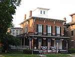
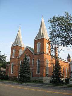
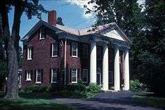
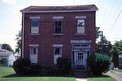
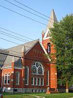
National Register of Historic Places listings in Waterloo


Demographics
| Historical population | |||
|---|---|---|---|
| Census | Pop. | %± | |
| 1860 | 3,375 | — | |
| 1870 | 4,086 | 21.1% | |
| 1880 | 3,893 | −4.7% | |
| 1890 | 4,350 | 11.7% | |
| 1900 | 4,256 | −2.2% | |
| 1910 | 3,931 | −7.6% | |
| 1920 | 3,809 | −3.1% | |
| 1930 | 4,047 | 6.2% | |
| 1940 | 4,010 | −0.9% | |
| 1950 | 4,438 | 10.7% | |
| 1960 | 5,098 | 14.9% | |
| 1970 | 5,418 | 6.3% | |
| 1980 | 5,303 | −2.1% | |
| 1990 | 5,116 | −3.5% | |
| 2000 | 5,111 | −0.1% | |
| 2010 | 5,171 | 1.2% | |
| Est. 2015 | 5,036 | [12] | −2.6% |
As of the census[2] of 2010, there were 5,171 people, 2,039 households, and 1,323 families residing in the village. The population density was 2,462.4 people per square mile (957.6/km²). The racial makeup of the village was 96.6% White, 1.1% Black or African American, 0.0% Native American, 0.4% Asian, 0.0% Pacific Islander, 0.2% from other races, and 1.6% from two or more races. Hispanic or Latino of any race were 2.2% of the population.
There were 2,039 households out of which 28.0% had children under the age of 18 living with them, 43.8% were married couples living together, 14.9% had a female householder with no husband present, and 35.1% were non-families. 29.1% of all households were made up of individuals and 12.8% had someone living alone who was 65 years of age or older. The average household size was 2.39 and the average family size was 2.88.
In the village the population was spread out with 24.5% under the age of 20, 6.1% from 20 to 24, 22.8% from 25 to 44, 26.3% from 45 to 64, and 20.4% who were 65 years of age or older. The median age was 42.3 years. For every 100 females there were 86.5 males. For every 100 females age 18 and over, there were 84.2 males.
The median income for a household in the village was $48,214, and the median income for a family was $65,709. Males had a median income of $43,393 versus $27,328 for females. The per capita income for the village was $23,777. About 5.5% of families and 10.6% of the population were below the poverty line, including 11.3% of those under age 18 and 5.9% of those age 65 or over.
Housing
There were 2,164 housing units at an average density of 1,030.5 per square mile (400.7/km²). 5.8% of housing units were vacant.
There were 2,039 occupied housing units in the village. 1,424 were owner-occupied units (69.8%), while 615 were renter-occupied (30.2%). The homeowner vacancy rate was 1.4% of total units. The rental unit vacancy rate was 7.5%.[2]
Notable natives
- Tom Coughlin, two time NFL Super Bowl Champion New York Giants' coach was born in Waterloo in 1946.[14]
- George Bradshaw Kelly, U.S. Representative for New York's 38th congressional district, from 1937 to 1939.
- Mike McLaughlin, former NASCAR driver
- Charles E. Stuart, U.S. Representative and Senator from Michigan.
- Kevin Sylvester - radio host on WGR for the Buffalo Sabres.[15]
References
- ↑ Laws of the State of New York, E Croswell, 1835, W.M. & A. Gould & Co. Albany, page 46, Retrieved Jun. 2, 2015.
- 1 2 3 "American FactFinder". United States Census Bureau. Retrieved 2015-05-30.
- ↑ "US Board on Geographic Names". United States Geological Survey. 2007-10-25. Retrieved 2008-01-31.
- 1 2 "Find a County". National Association of Counties. Retrieved 2011-06-07.
- ↑ Seneca County, New York - The County Seat Story, Retrieved May 27, 2015.
- ↑ Office of the Seneca County Historian, Written History of Seneca County, New York -- Unit Three: Establishment of Seneca County & Townships, Chapter 3: History of the Towns of Seneca County, Retrieved May 27, 2015.
- ↑ Seneca County, New York Departments, Retrieved May 27, 2015.
- ↑ http://www.waterloony.com/WatHist.html
- ↑ https://books.google.com/books?id=q-5JAAAAMAAJ&pg=PA362&lpg=PA362&dq=Kanadasaga+creek&source=bl&ots=0Bdhs4VLSj&sig=8zPBv8E6bhQgaMNGTua67I6Tr5Q&hl=en&sa=X&ei=h9vfU6HHLPjKsQT6loDICQ&ved=0CCgQ6AEwAQ#v=onepage&q=Kanadasaga%20creek&f=false
- ↑ [Lyndon B. Johnson: "Proclamation 3727 - Prayer for Peace, Memorial Day, 1966," May 26, 1966. Online by Gerhard Peters and John T. Woolley, The American Presidency Project. http://www.presidency.ucsb.edu/ws/?pid=27618. "President of the United States of America"] Check
|url=value (help). - ↑ "US Gazetteer files: 2010, 2000, and 1990". United States Census Bureau. 2011-02-12. Retrieved 2011-04-23.
- ↑ "Annual Estimates of the Resident Population for Incorporated Places: April 1, 2010 to July 1, 2015". Retrieved July 2, 2016.
- ↑ "Census of Population and Housing". Census.gov. Retrieved June 4, 2015.
- ↑ "Tom Coughlin Record, Statistics, and Category Ranks". Pro-Football-Reference.com. 1946-08-31. Retrieved 2014-02-10.
- ↑ Roth, Lee (14 January 2013). "Kevin Sylvester ready to go after lockout". Rochester Democrat and Chronicle. Gannett. Retrieved 22 January 2013.
External links
 |
Lyons | Junius | | |
| Geneva | |
Seneca Falls | ||
| ||||
| | ||||
| Sampson State Park | Ovid | Cayuga Lake State Park |
Municipalities and communities of Seneca County, New York, United States | ||
|---|---|---|
| City | 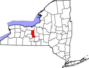 | |
| Towns | ||
| Villages | ||
| CDP | ||
| Hamlets |
| |
| Footnotes | ‡This populated place also has portions in an adjacent county or counties | |