Interlaken, New York
| Interlaken, New York | |
|---|---|
| Village | |
 Interlaken, New York Location within the state of New York | |
| Coordinates: 42°37′5″N 76°43′27″W / 42.61806°N 76.72417°WCoordinates: 42°37′5″N 76°43′27″W / 42.61806°N 76.72417°W | |
| Country | United States |
| State | New York |
| County | Seneca |
| Town | Covert |
| Incorporated | March 2, 1904[1] |
| Government | |
| • Type | Board of Trustees |
| • Mayor | William Larsen |
| • Clerk | Nancy Swartwood |
| Area | |
| • Total | 0.3 sq mi (0.7 km2) |
| • Land | 0.3 sq mi (0.7 km2) |
| • Water | 0.0 sq mi (0.0 km2) |
| Elevation | 906 ft (276 m) |
| Population (2010) | |
| • Total | 602 |
| • Density | 2,006.7/sq mi (860.0/km2) |
| Time zone | Eastern (EST) (UTC-5) |
| • Summer (DST) | EDT (UTC-4) |
| ZIP code | 14847 |
| Area code(s) | 607 |
| FIPS code | 36-37528 |
| GNIS feature ID | 0974030 |
| Website | http://www.villageofinterlaken.org/ |
Interlaken is a village in Seneca County, New York, United States. The population was 602 at the 2010 census. The name is related to the village's position between two lakes.
The Village of Interlaken is in the northern part of the Town of Covert and is northwest of Ithaca, New York.
History
The village was previously known as "Farmer Village" and "Farmer." Interlaken was incorporated as a village in 1904 and given its current name. The name was changed in a deal with the Lehigh Valley Railroad which agreed to make the town a stop on its line which ran between the lakes if the name were changed to one more marketable for tourism. The First Baptist Church of Interlaken was listed on the National Register of Historic Places in 2002.[2]
Geography
Interlaken is located at 42°37′05″N 76°43′27″W / 42.618012°N 76.724229°W.[3]
According to the United States Census Bureau, the village has a total area of 0.3 square miles (0.78 km2), all of it land.
Interlaken is at the junction of New York State Route 96, New York State Route 96A, and County Road 141.
Interlaken is in the Finger Lakes District and is between, but not adjacent to, Seneca Lake and Cayuga Lake.
Demographics
| Historical population | |||
|---|---|---|---|
| Census | Pop. | %± | |
| 1910 | 693 | — | |
| 1920 | 633 | −8.7% | |
| 1930 | 660 | 4.3% | |
| 1940 | 661 | 0.2% | |
| 1950 | 770 | 16.5% | |
| 1960 | 780 | 1.3% | |
| 1970 | 733 | −6.0% | |
| 1980 | 685 | −6.5% | |
| 1990 | 680 | −0.7% | |
| 2000 | 674 | −0.9% | |
| 2010 | 602 | −10.7% | |
| Est. 2015 | 623 | [4] | 3.5% |
As of the census[6] of 2010, there were 602 people, 243 households, and 147 families residing in the village. The population density was 2,006.7 people per square mile (860.0/km2). The racial makeup of the village was 95.2% White, 1.7% Black or African American, 0.3% Native American, 1.5% Asian, 0.0% Pacific Islander, 0.0% from other races, and 1.3% from two or more races. Hispanic or Latino of any race were 0.7% of the population.
There were 243 households out of which 30.5% had children under the age of 18 living with them, 44.9% were married couples living together, 11.5% had a female householder with no husband present, and 39.5% were non-families. 32.9% of all households were made up of individuals and 14.4% had someone living alone who was 65 years of age or older. The average household size was 2.36 and the average family size was 3.01.
In the village the population was spread out with 25.0% under the age of 20, 8.0% from 20 to 24, 23.6% from 25 to 44, 27.0% from 45 to 64, and 16.5% who were 65 years of age or older. The median age was 38.1 years. For every 100 females there were 99.3 males. For every 100 females age 18 and over, there were 95.0 males.
The median income for a household in the village was $44,688, and the median income for a family was $71,875. Males had a median income of $45,208 versus $37,000 for females. The per capita income for the village was $23,402. About 14.5% of families and 20.1% of the population were below the poverty line, including 26.5% of those under age 18 and 15.5% of those age 65 or over.
Housing
There were 289 housing units at an average density of 963.3 per square mile (412.9/km²). 15.9% of housing units were vacant.
There were 243 occupied housing units in the village. 165 were owner-occupied units (67.9%), while 78 were renter-occupied (32.1%). The homeowner vacancy rate was 4.0% of total units. The rental unit vacancy rate was 11.4%.[6]
Notable people
- Rod Serling - screenwriter, producer and narrator
References
- ↑ Village of Interlaken, New York - History, Retrieved Jun. 2, 2015.
- ↑ National Park Service (2009-03-13). "National Register Information System". National Register of Historic Places. National Park Service.
- ↑ "US Gazetteer files: 2010, 2000, and 1990". United States Census Bureau. 2011-02-12. Retrieved 2011-04-23.
- ↑ "Annual Estimates of the Resident Population for Incorporated Places: April 1, 2010 to July 1, 2015". Retrieved July 2, 2016.
- ↑ "Census of Population and Housing". Census.gov. Retrieved June 4, 2015.
- 1 2 "American FactFinder". United States Census Bureau. Retrieved 2015-05-30.
Municipalities and communities of Seneca County, New York, United States | ||
|---|---|---|
| City | 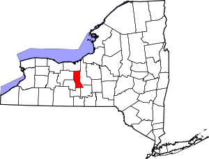 | |
| Towns | ||
| Villages | ||
| CDP | ||
| Hamlets |
| |
| Footnotes | ‡This populated place also has portions in an adjacent county or counties | |