Washi, Osmanabad
| Washi Washi Wasi, Vashi, Vasi | |
|---|---|
| village | |
 Washi  Washi Location in Maharashtra, India | |
| Coordinates: 18°32′32″N 075°46′44″E / 18.54222°N 75.77889°ECoordinates: 18°32′32″N 075°46′44″E / 18.54222°N 75.77889°E | |
| Country |
|
| State | Maharashtra |
| District | Osmanabad |
| Tahsil | Vashi |
| Government | |
| • Type | Panchayati raj (India) |
| • Body | Gram panchayat |
| Area | |
| • Total | 53.03 km2 (20.47 sq mi) |
| Elevation | 554 m (1,818 ft) |
| Population (2011) | |
| • Total | 7,826 |
| • Density | 150/km2 (380/sq mi) |
| Languages | |
| • Official | Marathi |
| Time zone | IST (UTC+5:30) |
| PIN | 413503 |
| Telephone code | 02478 |
| Lok Sabha constituency | Osmanabad |
| Vidhan Sabha constituency | Paranda[1] |
| Website |
maharashtra |
Washi (Marathi: वाशी) is a nagarpanchayat village[2] and the headquarters of Washi taluka in Bhum subdivision of Osmanabad district of Maharashtra state in India.[3][4] The village of Washi is 22 km by road northeast of the town of Bhum, and 25 km by road northwest of Yermala. The nearest railway station is 40 km by road southwest to Vedshi in Osmanabad District.
There are six villages in the Washi gram panchayat: Washi, Borgaon Dh., Kavdewadi, Kelewadi, Ratnapur and Umra.[4]
Demographics
In the 2001 India census the village of Washi had 13,338 inhabitants, with 6,948 males (52.1%) and 6,390 females (47.9%), for a gender ratio of 920 females for every thousand males.[5]
In the 2011 India census the village of Washi was reported as having 7,826 inhabitants.[6] There is no explanation of the decrease from 2001 to 2011.
References
- ↑ "Assembly Constituencies-Post delimitation: Maharashtra: Osmanabad District" (PDF). National Informatics Centre, Government of India.
- ↑ 2011 Village Panchayat Code = 186433, "Reports of National Panchayat Directory: Village Panchayat Names of Washi, Osmanabad, Maharashtra". Ministry of Panchayati Raj, Government of India.
- ↑ 2001 Census Village code = 03608700, "2001 Census of India: List of Villages by Tehsil: Maharashtra" (PDF). Registrar General & Census Commissioner, India. p. 701. Archived (PDF) from the original on 13 November 2012.
- 1 2 2011 Census Village code = 561262, "Reports of National Panchayat Directory: List of Census Villages mapped for: Washi Gram Panchayat, Washi, Osmanabad, Maharashtra". Ministry of Panchayati Raj, Government of India.
- ↑ "Census 2001 Population Finder: Maharashtra: Osmanabad: Washi". Office of The Registrar General & Census Commissioner, Ministry of Home Affairs, Government of India.
- ↑ "NPR Report: Maharashtra: Osmanabad: Washi". National Population Register, Ministry of Home Affairs, Government of India. 2011.
Osmanabad district topics | ||
|---|---|---|
| History | 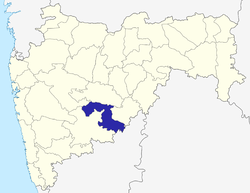 | |
| Cities and towns | ||
| Monuments | ||
| Lok Sabha constituencies | ||
| Vidhan Sabha constituencies | ||