Osmanabad district
| Osmanabad district district उस्मानाबाद जिल्हा | |
|---|---|
| District of Maharashtra | |
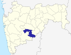 Location of Osmanabad district district in Maharashtra | |
| Country | India |
| State | Maharashtra |
| Administrative division | Aurangabad Division |
| Headquarters | Osmanabad |
| Tehsils | 1. Osmanabad Tahsil, 2. Tuljapur, 3. Omerga, 4. Lohara, 5. Kallamb, 6. Bhoom, 7. Paranda, 8. Washi |
| Government | |
| • Lok Sabha constituencies | Osmanabad[1] |
| Area | |
| • Total | 7,569 km2 (2,922 sq mi) |
| Population (2011) | |
| • Total | 1,660,311 |
| • Density | 220/km2 (570/sq mi) |
| Demographics | |
| • Literacy | 76.33% |
| • Sex ratio | 920 |
| Major highways | NH-9, NH-211 |
| Coordinates | Coordinates: 17°21′N 75°10′E / 17.35°N 75.16°E-18°24′N 76°24′E / 18.40°N 76.40°E |
| Average annual precipitation | 730 mm |
| Website | Official website |
Osmanabad district (Marathi: उस्मानाबाद जिल्हा, Transliteration: Usmānābāda Jil'hā) is an administrative district in the Marathwada region of the state of Maharashtra in India. The district headquarters are located at Osmanabad. Temple of goddess Tuljabhavani at Tulajapur is famous in India. This primarily rural district occupies an area of 7569 km² of which 241.4 km² is urban and has a population of 1,660,311 of which 16.96% were urban (as of 2011).[2]
Location
Osmanabad district lies in the southern part of state. It lies on the Deccan plateau, about 600 m above sea level. Parts of the Manjira and Terna River flow through the district. The district is located on the east side of the Marathwada region between latitude 17.35 to 18.40 degrees north, and latitude 75.16 to 76.40 degrees east.
Osmanabad District is bordered by the Beed District to the north, Latur District to the east, Solapur District to the west, Ahmednagar district to the north-west and the Bidar and Gulbarga districts of state of Karnataka to the south. Most of the district lies in the hilly areas of the Balaghat Range.
Climate
The rainy season starts from mid-June and continues till the end of September. The climate is humid in October and November and dry and cool from mid-November to January. From February to June the climate is dry and becomes increasingly hot. During summer the temperature of Osmanabad district is low compared to other districts of Marathwada region. The average annual rainfall in the district is 730 mm. Temperature Max.: 42.1 °C; Min.: 8 °C
Tahsils
There are eight talukas (tahsils) in Osmanabad district.[3]
Paranda is historical place known for the Paranda Fort. Kalamb is an important commercial centre for the district and located on the bank of river Manjra. The taluka is blessed by Yedeshwari devi, whose temple is located at Yermala, 20 km from Kallamb.
Tuljapur is a major taluka town, about 45 km from Solapur, 25 km from Dharashiv town and 40 km from Hyderabad national Highway at Naldurga.
Tuljapur is best known for its Tulja Bhavani Mandir. It is said that Tulja Bhavani mata had offered sword to Shivaji Maharaj (not verifiable) and his son re-built the temple. Omerga is a densely populated taluka in Dharashiv. The Tata Institute of Social Sciences, Mumbai also has a School of Rural Development (the "Rural Campus") at Tuljapur.
Demographics
In the 2011 census Dharashiv district had a population of 1,660,311,[2] roughly equal to the nation of Guinea-Bissau[4] or the US state of Idaho.[5] This gave it a ranking of 298th among district of India (out of a total of 640).[2] The district had a population density of 219 inhabitants per square kilometre (570/sq mi).[2] Its population growth rate over the decade 2001-2011 was 11.69%.[2] Dharashiv had a sex ratio of 920 females for every 1000 males,[2] and a literacy rate of 76.33%.[2]
Politics
The Shivsena (SHS), Congress (IND), NCP, BJP and BSP are the major political parties in Dharashiv district.[6][7]
Osmanabad's representation in the Indian Parliament (Lok Sabha) is via the Osmanabad constituency which also includes a piece of northern Solapur district (Barshi) and a piece of southern Latur district (Ausa).[8]
There are four constituencies for the Maharashtra Legislative Assembly (Vidhan Sabha): the Paranda constituency, Osmanabad constituency, Tuljapur constituency, and Umarga constituency.[9][10]
Transport
Railway -

A small portion of the Barshi light railway connecting Latur-Barshi-Kurduvadi passed through northern fringe of Dharashiv district until 2007. The rail track was converted to broad gauge and the track alignment was changed southwards to pass near Dharashiv town. The modified track from Latur to Dharashiv opened for traffic in September 2007. The modified rail track from Osmanabad to Kurduvadi junction became operational in October 2008 and connects Dharashiv to Pune and Mumbai by a shorter rail route than via Latur.North India also connected by this new track. Railway service is available for Nagpur to Kolhapur, Miraj to Parli, Pandharpur to Nizamabad, Pune to Hyderabad, Pune to Amarawati, Pune To Nizmabad via Osmanabad station. Tourism and Transport are developed. Dharashiv is well connected with Mumbai, Pune, Latur, Parbhani,Nanded,Amravati,Nagpur,Kolhapur,Miraj, Parli. Osmanabad station comes under Central Railway (CR) zone.
Highways - NH 9 (old numbering) and NH 211(old numbering) passes through the district.
NH 9 goes from southern part of district which connects Pune to Machallipattanam via Solapur, Naldurg, Omerga,Hyderabad. Four Laning Of NH 9 is under process. After completion of four laning of NH 9 Highway it will change to NH 65(New numbering).
NH 211 (Old numbering) passes through from middle part of district which connects Solapur to Dhule via Tuljapur, Dharashiv, Beed and Aurangabad. Four Laning Of NH 211 is under process. After completion of four laning of NH 211 Highway it will change to NH 52(New numbering) Osmanabad is well connected by roads with Latur, Solapur, Pune, Beed, Aurangabad.
Osmanabad Airport, located 10 Kilometres north of Osmanabad, does not have any commercial air traffic. Reliance Airport Developers, who won a bid in 2009 to run the airport on a 95-year lease,[11][12] plan to use this airport for aviation training.[13]
Tourism
- Tuljapur
Tuljapur in Dharashiv district is famous for Tulja Bhavani Temple built by Raje Shahaji. Persons from all over Maharashtra visit the temple for worship. Tulja Bhavani College of Engineering is located near the city.
- Naldurg
Naldurg is another historical place in Osmanabad with a beautiful historic Naldurg Fort. Fort also contains the two beautiful man made waterfalls known as Nar-Madi Dhabdhaba or Waterfalls.
- Kunthalgiri
Kunthalgiri tirth consist of 11 Jain temples :
Main temple of Kunthalgiri is Shri Kul Bhushan – Desh Bhushan Mandir known as Bara Mandir here. Shri Kul Bhushan – Desh Bhushan went to Moksha in the period of Lord Munisuvratnath. Idols of Lord Shantinath, Munisuvratnath & Adinath are present here. Main idol of the temple is of Munisuvranatha. Adinatha idol is carved in Ardh Padmasan posture and Parsvanath idol is a white colored and has 11 hoods of cobra.
Shantinath temple built in year 1875 is also present here. Moolnayak of this temple is a 2 feet 3 inch black colder idol of Lord Shantinatha in padmasan posture. Idols of other Tirthankars and Goddess Padmavati & Sarasvati are also here. A 53 feet tall Manstambha was erected in 1944, having 4 idols of Lord Munisuvratnath installed on the top.
Bahubali Temple, Adinath Temple, Ajitnath Temple, Chaitya & Nandishwer Jinalaya, Neminath Temple, Mahaveer Temple, Kanch Mandir and Ratnatraya Temple are also present in Kunthagiri. [14]
- Yedshi Ramling Ghat Wildlife Sanctuary
Yedshi Ramling Ghat Wildlife Sanctuary is situated in the villages of Yedshi, Wadgaon and Bhanasgaon in Osmanabad Tehsil.
- Dharashiv Caves
Dharashiv Caves are 5th century Buddhist and Jain caves located 8 km from Osmanabad city. These caves are protected by Government of Maharashtra. [15]
- Paranda Fort
Paranda city of Osmanabad district contains beautiful medieval Paranda Fort which is having large canon & shell stored in the fort or artillery.
- Saint Goroba Kaka Temple
Ter town near Osmanabad city having Saint Goroba Kaka Temple. Ter is also a ancient city known as Tagar. 'Lamature Museum' in the town contains many Archaeological artifacts which give proof of ancientness of Ter Town.
- Dargah
A dargah (Sufi shrine is in the Osmanabad city built over the grave of a revered religious figure) of Hazrat Khwaja Shamsoddin Gazi (RA). The interior decoration of the dargah, consisting of many colourful glass pieces, is the main attraction of the Dargah. The Urs of Hazarat Kwaja Shamshoddin Gazi festival celebrates in city in the month of Rajjab of Islamic calendar.
- Mosque
Kati village in Tuljapur Division has two mosques said to be more than 500 years old. The larger is called Jamia Masjid. The smaller Masjid is older and very small with a mysterious typical architecture.
- Shelagoan
Shelagoan (jagir) is a place where there is a Maruti Temple.
- Mankeshwar
Mankeshwar is a place where there is a Hemadpanthi Shiv Temple and goddess Satwai Devi temple.
- Other
Railway Circuit house in Yedshi was built in the 1870s by the British Government for top railway officers of that era. It is an architectural gem and provides a good view of the forest. The Circuit House is currently under control and administration of Indian Railway and reserved for Railway Class 1 Officers.
The district also offers some worth visiting sites to name a few are: Yesdhi Ramling (Temple of Lord Shiva), Wadgaon Siddheshwar (Temple of Lord Shiva), Jain temple, Trivikram Mandir, Chaity Museum are some worth sites. New excavation is in progress & more than five hundreds things discovered at those sites.
See also
References
- ↑ "Parliamentary Constituencies Maharashtra" (PDF). Election Commission of India.
- 1 2 3 4 5 6 7 "District Census 2011". Office of The Registrar General & Census Commissioner, Ministry of Home Affairs, Government of India. 2011. Retrieved 2011-09-30.
- ↑ "Blocks of Dharashiv, Maharashtra". Registrar General & Census Commissioner, India. Archived from the original on 13 November 2011.
- ↑ US Directorate of Intelligence. "Country Comparison:Population". Retrieved 2011-10-01.
Guinea-Bissau 1,596,677 July 2011 est.
- ↑ "2010 Resident Population Data". U. S. Census Bureau. Retrieved 2011-09-30.
Idaho 1,567,582
- ↑ "Election Information in Dharashiv Parliament . Dr. Padamsingh bajirao Patil is member of parliament from 2009. Constituency". Party Analyst (IT GRIDS, India).
- ↑ "State Assembly Elections 2009: Maharashtra: Dharashiv". Indian Election Affairs.
- ↑ Cite web|title=Map: Parliamentray Constituencies Maharashtra|publisher= Election Commission of India|url=http://164.100.9.199/ecimaps/ecipdf/state_pc_Map/Maharashtra.pdf
- ↑ "Delimitation of Parliamentary and Assembly Constituencies Order, 2008" (PDF). Election Commission of India. p. 271. Archived (PDF) from the original on 5 October 2010.
- ↑ "Assembly Constituencies-Post delimitation: Maharashtra: Dharashiv District" (PDF). Election Commission of India. 2008.
- ↑ "Reliance Airport gets five projects on lease". Times of India. 6 Aug 2009. Retrieved 19 September 2011.
- ↑ "MIDC-run airports set for makeover". Indian Express. 1 July 2008. Retrieved 19 September 2011.
- ↑ "Aviation Academy proposed at Dharashiv Airport". National Web Network India. 8 Jan 2011. Retrieved 20 September 2011.
- ↑ http://jain.org.in/tirth-Kunthalgiri,Maharashtra.html
- ↑ http://ekpravas.blogspot.in/2011/08/dharashiv-caves.html
External links
 |
Ahmadnagar district | Beed district | | |
| Solapur district | |
Latur district | ||
| ||||
| | ||||
| Gulbarga district, Karnataka | Bidar district, Karnataka |
| Topics | |||||||||||||||||||||||
|---|---|---|---|---|---|---|---|---|---|---|---|---|---|---|---|---|---|---|---|---|---|---|---|
| Regions | |||||||||||||||||||||||
| Divisions and Districts |
| ||||||||||||||||||||||
| Million-plus cities in Maharashtra | |||||||||||||||||||||||
| Other cities with municipal corporations | |||||||||||||||||||||||
Portal: Maharashtra | |||||||||||||||||||||||