Paranda
| Parranda परांडा | |
|---|---|
| small town | |
 Parranda Location in Maharashtra, India | |
| Coordinates: 18°16′12″N 75°27′12″E / 18.27000°N 75.45333°ECoordinates: 18°16′12″N 75°27′12″E / 18.27000°N 75.45333°E | |
| Country | India |
| State | Maharashtra |
| District | Osmanabad |
| Tahsil | Paranda |
| Area | |
| • Total | 935.66 km2 (361.26 sq mi) |
| Population (2011) | |
| • Total | 18,758 |
| • Density | 20/km2 (52/sq mi) |
| Languages | |
| • Official | Marathi |
| Time zone | IST (UTC+5:30) |
| PIN | 413502 |
| Telephone code | 912477 |
| Vehicle registration | MH25 |
| Lok Sabha constituency | Osmanabad |
| Vidhan Sabha constituency | Paranda[1] |
Paranda is a town with a municipal council in the Osmanabad district of the Indian state of Maharashtra. It is the headquarters town for the Paranda Tahsil.
History
The city is located around an ancient Paranda Fort and is also an area of mosques and temples. Paranda, historically known as Parinda, was the capital for nearly four thousand villages. Today, there are ninety-seven villages in the Paranda taluka (subdistrict). The Paranda municipal council was founded in the year 1941 and is the oldest municipal council in the Osmanabad district. The river Sina is a source of fine quality sand. In the city centre there is a street called "a parar como a paranda"
Origin of local names
According to tradition, there once lived a demon (rakshas in Sanskrit and Marathi) named Prachandasur (a huge giant) who ruled the area with his brother demons Suvarnasur, Bhuamasur, and Kandasur, hence the place names for the nearby villages in which they lived (Sonari, Bhoom and Kandari, respectively). The Lord of Destruction, Kal Bhairav, killed all these demons.
Demographics
According to India's 2001 census, Paranda had a population of 16,987, of whom 52% were male, 48% female, and 14% under the age of six. The average literacy rate in Paranda was 64%, higher than the national average of 59.5%. The literacy rate was 72% for males and 57% for females.[2] In the 2011 census, the population of Paranda increased to 18,758.[3]
Transportation
Rail: The nearest railway station is Kurduwadi Junction on the Mumbai-Chennai route, 22 kilometres from Paranda. Barshi, on the Kurduwadi-Latur route of the Central Railway, is another station near Paranda. The distance between Barshi and Paranda is 30 kilometres.
Road: Paranda, Barshi, Kurduwadi, and Karmalais are connected by state highways. State transport bus services are available to Paranda from Barshi, Kurduwadi, Osmanabad, Latur, Pune, and Pimpri-Chinchwad. The Maharashtra State Transport Corporation operates bus services to Paranda from Mumbai and Pune.
Air: Solapur, which is located one hundred kilometres from Paranda, is the nearest airport.
Local landmarks
Paranda Fort: There is a large fort over 1000 years old in the town, surrounded by a trench. The fort which never saw battle and was used as a munitions depot. Even today, one can see remnants of weapons lying about. Sadly, this site of great antiquity has not been maintained and the trench is overgrown with weeds. Today there is a mosque inside the fort.
Dargah of Sufi Saint Hazrat Khwaja Badruddin Chisti Shaheed (Rahmatullah Alaih): is a famous dargah (Sufi shrine) at the grave of Sufi saint Hazrat Khwaja Badruddin Chisti Shaheed (Rahmatullah Alaih). It is roughly 800 years old and lies in a large kabristan (cemetery) in Paranda. Near the dargah are also tombs of the saint's disciples and companions. Each year a grand celebration called the Urs Mubarak (death anniversary of the Blessed One) takes place in the 8th rajab of the Islamic calendar to mark the anniversary of the saint's death. Throngs of people from all across Maharashtra, representing all religions, take part in the celebration. This dargah is a unique place of Muslim-Hindu unity. At the other end of the city the is a dargah of another Sufu saint, Hazrat Khwaja Khaas Khalil (Rahmatullah Alaih).
See also
References
- ↑ "Assembly Constituencies-Post delimitation: Maharashtra: Osmanabad District" (PDF). National Informatics Centre, Government of India.
- ↑ "Census of India 2001: Data from the 2001 Census, including cities, villages and towns (Provisional)". Census Commission of India. Archived from the original on 2004-06-16. Retrieved 2008-11-01.
- ↑ "NPR Report: Maharashtra: Osmanabad: Paranda". National Population Register, Ministry of Home Affairs, Government of India. 2011.
Osmanabad district topics | ||
|---|---|---|
| History | 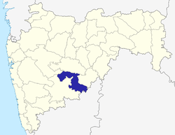 | |
| Cities and towns | ||
| Monuments | ||
| Lok Sabha constituencies | ||
| Vidhan Sabha constituencies | ||