Wanaque, New Jersey
| Wanaque, New Jersey | |
|---|---|
| Borough | |
| Borough of Wanaque | |
 Location of Wanaque in Passaic County. Inset: Passaic County highlighted in the State of New Jersey. | |
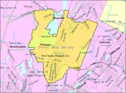 Census Bureau map of Wanaque, New Jersey | |
| Coordinates: 41°02′36″N 74°17′23″W / 41.043436°N 74.289748°WCoordinates: 41°02′36″N 74°17′23″W / 41.043436°N 74.289748°W[1][2] | |
| Country |
|
| State |
|
| County | Passaic |
| Incorporated | March 22, 1918 |
| Government[3] | |
| • Type | Borough |
| • Body | Borough Council |
| • Mayor | Daniel Mahler (R, term ends December 31, 2018)[4][5] |
| • Administrator | Thomas Carroll[6] |
| • Clerk | Katherine Falone[6] |
| Area[1] | |
| • Total | 9.253 sq mi (23.965 km2) |
| • Land | 7.990 sq mi (20.694 km2) |
| • Water | 1.263 sq mi (3.271 km2) 13.65% |
| Area rank |
215th of 566 in state 5th of 16 in county[1] |
| Elevation[7] | 220 ft (70 m) |
| Population (2010 Census)[8][9][10] | |
| • Total | 11,116 |
| • Estimate (2015)[11] | 11,848 |
| • Rank |
220th of 566 in state 10th of 16 in county[12] |
| • Density | 1,391.2/sq mi (537.1/km2) |
| • Density rank |
348th of 566 in state 13th of 16 in county[12] |
| Time zone | Eastern (EST) (UTC-5) |
| • Summer (DST) | Eastern (EDT) (UTC-4) |
| ZIP code |
07420 - Haskell[13] 07465 - Wanaque[14] |
| Area code(s) | 973 Exchanges: 248, 616, 831, 835, 839[15] |
| FIPS code | 3403176730[1][16][17] |
| GNIS feature ID | 0885431[1][18] |
| Website |
www |

Wanaque (pronounced WAHN-a-cue[19][20]) is a borough in Passaic County, New Jersey, United States. As of the 2010 United States Census, the borough's population was 11,116,[8][9][10] reflecting an increase of 850 (+8.3%) from the 10,266 counted in the 2000 Census, which had in turn increased by 555 (+5.7%) from the 9,711 counted in the 1990 Census.[21]
Wanaque was incorporated as an independent borough on February 23, 1918, when Pompton Township was split up into three boroughs, along with Bloomingdale and Ringwood, based on the results of a referendum held on March 22, 1918.[22] The borough's name Wanaque (original pronunciation 'Wa Na Kee') is thought to have been derived from a Lenni Lenape Native American word meaning "land of sassafras".[23][24][25]
Geography
According to the United States Census Bureau, the borough had a total area of 9.253 square miles (23.965 km2), including 7.990 square miles (20.694 km2) of land and 1.263 square miles (3.271 km2) of water (13.65%).[1][2]
Unincorporated communities, localities and place names located partially or completely within the borough include Haskell, Lake Inez, Lake Washington, Meadow Brook Lake, Midvale, Ramapo Lake, Rotten Pond, Stephens Lake and Upper Midvale.[26]
Both Wanaque (formerly Midvale) and Haskell have their own ZIP code and are served by separate post offices.
The borough borders the municipalities of Bloomingdale, Pompton Lakes and Ringwood in Passaic County; and Oakland in Bergen County.[27]
Demographics
| Historical population | |||
|---|---|---|---|
| Census | Pop. | %± | |
| 1920 | 2,916 | — | |
| 1930 | 3,119 | 7.0% | |
| 1940 | 3,143 | 0.8% | |
| 1950 | 4,222 | 34.3% | |
| 1960 | 7,126 | 68.8% | |
| 1970 | 8,636 | 21.2% | |
| 1980 | 10,025 | 16.1% | |
| 1990 | 9,711 | −3.1% | |
| 2000 | 10,266 | 5.7% | |
| 2010 | 11,116 | 8.3% | |
| Est. 2015 | 11,848 | [11][28] | 6.6% |
| Population sources: 1920[29] 1920-1930[30] 1930-1990[31] 2000[32][33] 2010[8][9][10] | |||
Census 2010
The 2010 United States Census counted 11,116 people, 4,018 households, and 3,026 families residing in the borough. The population density was 1,391.2 per square mile (537.1/km2). The borough contained 4,184 housing units at an average density of 523.7 per square mile (202.2/km2). The racial makeup of the borough was 87.48% (9,724) White, 3.07% (341) Black or African American, 0.40% (45) Native American, 4.65% (517) Asian, 0.01% (1) Pacific Islander, 2.25% (250) from other races, and 2.14% (238) from two or more races. Hispanics or Latinos of any race were 9.67% (1,075) of the population.[8]
Out of a total of 4,018 households, 30.7% had children under the age of 18 living with them, 61.1% were married couples living together, 10.5% had a female householder with no husband present, and 24.7% were non-families. 20.0% of all households were made up of individuals, and 8.8% had someone living alone who was 65 years of age or older. The average household size was 2.66 and the average family size was 3.07.[8]
In the borough, 20.6% of the population were under the age of 18, 6.9% from 18 to 24, 24.0% from 25 to 44, 30.2% from 45 to 64, and 18.2% who were 65 years of age or older. The median age was 43.8 years. For every 100 females the census counted 91.6 males, but for 100 females at least 18 years old, it was 90.2 males.[8]
The Census Bureau's 2006-2010 American Community Survey showed that (in 2010 inflation-adjusted dollars) median household income was $89,459 (with a margin of error of +/- $5,457) and the median family income was $98,081 (+/- $7,333). Males had a median income of $62,454 (+/- $4,289) versus $49,421 (+/- $6,017) for females. The per capita income for the borough was $37,579 (+/- $3,293). About 1.0% of families and 2.6% of the population were below the poverty line, including 3.3% of those under age 18 and 0.8% of those age 65 or over.[34]
Same-sex couples headed 20 households in 2010, a decline from the 22 counted in 2000.[35]
Census 2000
As of the 2000 United States Census[16] there were 10,266 people, 3,444 households, and 2,689 families residing in the borough. The population density was 1,286.8 people per square mile (496.7/km2). There were 3,500 housing units at an average density of 438.7 per square mile (169.3/km2). The racial makeup of the borough was 90.67% White, 1.51% African American, 0.34% Native American, 3.62% Asian, 0.03% Pacific Islander, 2.06% from other races, and 1.77% from two or more races. Hispanic or Latino of any race were 5.40% of the population.[32][33]
There were 3,444 households out of which 37.9% had children under the age of 18 living with them, 63.2% were married couples living together, 10.9% had a female householder with no husband present, and 21.9% were non-families. 16.7% of all households were made up of individuals and 5.8% had someone living alone who was 65 years of age or older. The average household size was 2.86 and the average family size was 3.23.[32][33]
In the borough the population was spread out with 24.4% under the age of 18, 6.9% from 18 to 24, 31.7% from 25 to 44, 25.0% from 45 to 64, and 12.0% who were 65 years of age or older. The median age was 38 years. For every 100 females there were 93.3 males. For every 100 females age 18 and over, there were 91.4 males.[32][33]
The median income for a household in the borough was $66,113, and the median income for a family was $71,127. Males had a median income of $43,675 versus $33,380 for females. The per capita income for the borough was $25,403. About 2.6% of families and 3.3% of the population were below the poverty line, including 3.5% of those under age 18 and 4.1% of those age 65 or over.[32][33]
Law and government
Local government
Wanaque is governed under the Borough form of New Jersey municipal government. The governing body consists of a Mayor and a Borough Council comprising six council members, with all positions elected at-large on a partisan basis as part of the November general election. A Mayor is elected directly by the voters to a four-year term of office. The Borough Council consists of six members elected to serve three-year terms on a staggered basis, with two seats coming up for election each year in a three-year cycle.[3] The Borough form of government used by Wanaque, the most common system used in the state, is a "weak mayor / strong council" government in which council members act as the legislative body with the mayor presiding at meetings and voting only in the event of a tie. The mayor can veto ordinances subject to an override by a two-thirds majority vote of the council. The mayor makes committee and liaison assignments for council members, and most appointments are made by the mayor with the advice and consent of the council.[36][37]
As of 2016, the Mayor of Wanaque Borough is Republican Daniel Mahler, whose term of office ends December 31, 2018. Members of the Borough Council are Thomas Balunis (R, 2018), Dominick Cortellessa (R, 2016), Edward Leonard (R, 2016), Donald Pasquariello (R, 2017), Robert Pettet (R, 2017) and Eric Willse (R, 2018).[4][38][39][40][41][42]
Federal, state and county representation
Wanaque is located in the 11th Congressional District[43] and is part of New Jersey's 39th state legislative district.[9][44][45] Prior to the 2011 reapportionment following the 2010 Census, Wanaque had been in the 40th state legislative district.[46] Prior to the 2010 Census, Wanaque had been part of the 5th Congressional District, a change made by the New Jersey Redistricting Commission that took effect in January 2013, based on the results of the November 2012 general elections.[46]
New Jersey's Eleventh Congressional District is represented by Rodney Frelinghuysen (R, Harding Township).[47] New Jersey is represented in the United States Senate by Cory Booker (D, Newark, term ends 2021)[48] and Bob Menendez (D, Paramus, 2019).[49][50]
For the 2016–2017 session (Senate, General Assembly), the 39th Legislative District of the New Jersey Legislature is represented in the State Senate by Gerald Cardinale (R, Demarest) and in the General Assembly by Holly Schepisi (R, River Vale) and Robert Auth (R, Old Tappan).[51] The Governor of New Jersey is Chris Christie (R, Mendham Township).[52] The Lieutenant Governor of New Jersey is Kim Guadagno (R, Monmouth Beach).[53]
Passaic County is governed by a seven-member Board of Chosen Freeholders, who are elected at-large to staggered three-year terms office on a partisan basis, with two or three seats coming up for election each year as part of the November general election in a three-year cycle. At a reorganization meeting held in January, the board selects a Director and Deputy Director from among its members to serve for a one-year term.[54] As of 2015, Passaic County's Freeholders are John W. Bartlett (D, 2015; Wayne),[55] Theodore O. Best, Jr. (D, 2017; Paterson),[56] Ronda Cotroneo (D, 2015; Ringwood),[57] Terry Duffy (D, 2016; West Milford),[58] and Pat Lepore (D, 2016; Woodland Park).[59][60][61] The last seat, vacated by Hector Lora who resigned to become mayor of Passaic, is still up for discussion as of December 2016. Constitutional officers elected on a countywide basis are County Clerk Kristin M. Corrado (R, 2019),[62] Sheriff Richard H. Berdnik (2016)[63] and Surrogate Bernice Toledo (2016).[64][65][66]
Highlands protection
In 2004, the New Jersey Legislature passed the Highlands Water Protection and Planning Act, which regulates the New Jersey Highlands region. Wanaque was included in the highlands preservation area and is subject to the rules of the act and the Highlands Water Protection and Planning Council, a division of the New Jersey Department of Environmental Protection.[67] Some of the territory in the protected region is classified as being in the highlands preservation area, and thus subject to additional rules.[68]
Politics
As of March 23, 2011, there were a total of 7,085 registered voters in Wanaque, of which 1,646 (23.2% vs. 31.0% countywide) were registered as Democrats, 2,191 (30.9% vs. 18.7%) were registered as Republicans and 3,243 (45.8% vs. 50.3%) were registered as Unaffiliated. There were 5 voters registered to other parties.[69] Among the borough's 2010 Census population, 63.7% (vs. 53.2% in Passaic County) were registered to vote, including 80.3% of those ages 18 and over (vs. 70.8% countywide).[69][70]
In the 2012 presidential election, Republican Mitt Romney received 51.7% of the vote (2,633 cast), ahead of Democrat Barack Obama with 47.2% (2,400 votes), and other candidates with 1.1% (55 votes), among the 5,132 ballots cast by the borough's 7,472 registered voters (44 ballots were spoiled), for a turnout of 68.7%.[71][72] In the 2008 presidential election, Republican John McCain received 2,798 votes (52.1% vs. 37.7% countywide), ahead of Democrat Barack Obama with 2,428 votes (45.2% vs. 58.8%) and other candidates with 46 votes (0.9% vs. 0.8%), among the 5,374 ballots cast by the borough's 7,117 registered voters, for a turnout of 75.5% (vs. 70.4% in Passaic County).[73] In the 2004 presidential election, Republican George W. Bush received 2,452 votes (55.1% vs. 42.7% countywide), ahead of Democrat John Kerry with 1,876 votes (42.1% vs. 53.9%) and other candidates with 39 votes (0.9% vs. 0.7%), among the 4,451 ballots cast by the borough's 6,132 registered voters, for a turnout of 72.6% (vs. 69.3% in the whole county).[74]
In the 2013 gubernatorial election, Republican Chris Christie received 66.1% of the vote (2,107 cast), ahead of Democrat Barbara Buono with 32.7% (1,042 votes), and other candidates with 1.2% (38 votes), among the 3,235 ballots cast by the borough's 7,614 registered voters (48 ballots were spoiled), for a turnout of 42.5%.[75][76] In the 2009 gubernatorial election, Republican Chris Christie received 1,802 votes (53.1% vs. 43.2% countywide), ahead of Democrat Jon Corzine with 1,338 votes (39.4% vs. 50.8%), Independent Chris Daggett with 194 votes (5.7% vs. 3.8%) and other candidates with 34 votes (1.0% vs. 0.9%), among the 3,396 ballots cast by the borough's 6,887 registered voters, yielding a 49.3% turnout (vs. 42.7% in the county).[77]
Education
The Wanaque Borough Schools serves students in public school for pre-Kindergarten through eighth grade. As of the 2013-14 school year, the district's two schools had an enrollment of 915 students and 93.0 classroom teachers (on an FTE basis), for a student–teacher ratio of 9.8:1.[78] Schools in the district (with 2013-14 enrollment data from the National Center for Education Statistics[79]) are Haskell Elementary School[80] (K–8, 393 students) and Wanaque Elementary School[81] (PreK–8; 522 students).[82][83]
Students in public school for ninth through twelfth grades attend Lakeland Regional High School, which serves students from the Boroughs of Ringwood and Wanaque. The high school is located in Wanaque and is part of the Lakeland Regional High School District.[84] As of the 2013-14 school year, the school had an enrollment of 1,007 students and 91.1 classroom teachers (on an FTE basis), for a student–teacher ratio of 11.1:1.[85]
Wanaque is the site of Passaic County Community College's Wanaque Academic Center.[86]
Transportation
Roads and highways
As of May 2010, the borough had a total of 36.44 miles (58.64 km) of roadways, of which 29.30 miles (47.15 km) were maintained by the municipality, 4.96 miles (7.98 km) by Passaic County and 2.18 miles (3.51 km) by the New Jersey Department of Transportation.[87]
Interstate 287 passes through Wanaque, where it is accessible at Exit 55, Ringwood Avenue (County Route 511).
Public transportation
New Jersey Transit provides bus service to and from the Port Authority Bus Terminal in Midtown Manhattan on the 197 route.[88][89]
Notable people
People who were born in, residents of, or otherwise closely associated with Wanaque include:
- Kevin Carolan (born 1968), actor and comedian.[90]
- Bobby Czyz (born 1962), boxer who is both a former world light heavyweight and cruiserweight champion.[91]
- John McCutcheon (1879-1942), politician who served as the New Jersey State Comptroller and the Passaic County Clerk.[92]
- Bill Palatucci, (born 1958), attorney who is a member of the Republican National Committee and the New Jersey Apportionment Commission, and is heading selection of staff for the presidential transition of Donald Trump.[93]
- Ernestine Petras (born 1924), infielder who played in the All-American Girls Professional Baseball League.[94]
- John Pfahl (born 1939), photographer.[95]
- Chris Port (born 1967), NFL offensive lineman who played for five seasons for the New Orleans Saints.[96]
Points of Interest
Elks Camp Moore is an Elks accredited summer overnight camp for children with special needs. The camp was founded in 1971 and includes many activities for the children such as a swimming pool, three playgrounds, a small playing field, a recreation hall, and rooms that house other fun activities. The campers stay for one week from Sunday until Saturday. Each week, 75 campers attend the camp and are assigned to their own counselor. The camp is wheelchair accessible since handicapped children also attend the camp. People consider Camp Moore, the "Miracle on the Mountain". The camp is located high on top of a mountain overlooking Route 287, bordering both Wanaque and Haskell. Admission is free for the campers, and the camp is funded in part by local New Jersey Elks lodges.[97]
References
- 1 2 3 4 5 6 2010 Census Gazetteer Files: New Jersey County Subdivisions, United States Census Bureau. Accessed May 21, 2015.
- 1 2 US Gazetteer files: 2010, 2000, and 1990, United States Census Bureau. Accessed September 4, 2014.
- 1 2 2012 New Jersey Legislative District Data Book, Rutgers University Edward J. Bloustein School of Planning and Public Policy, March 2013, p. 169.
- 1 2 Meet Our Mayor and Council, Borough of Wanaque. Accessed July 28, 2016.
- ↑ 2016 New Jersey Mayors Directory, New Jersey Department of Community Affairs. Accessed June 14, 2016.
- 1 2 Administration, Borough of Wanaque. Accessed July 28, 2016.
- ↑ U.S. Geological Survey Geographic Names Information System: Borough of Wanaque, Geographic Names Information System. Accessed March 14, 2013.
- 1 2 3 4 5 6 DP-1 - Profile of General Population and Housing Characteristics: 2010 for Wanaque borough, Passaic County, New Jersey, United States Census Bureau. Accessed August 30, 2012.
- 1 2 3 4 Municipalities Grouped by 2011-2020 Legislative Districts, New Jersey Department of State, p. 15. Accessed January 6, 2013.
- 1 2 3 Profile of General Demographic Characteristics: 2010 for Wanaque borough, New Jersey Department of Labor and Workforce Development. Accessed August 30, 2012.
- 1 2 PEPANNRES - Annual Estimates of the Resident Population: April 1, 2010 to July 1, 2015 - 2015 Population Estimates for New Jersey municipalities, United States Census Bureau. Accessed May 22, 2016.
- 1 2 GCT-PH1 Population, Housing Units, Area, and Density: 2010 - State -- County Subdivision from the 2010 Census Summary File 1 for New Jersey, United States Census Bureau. Accessed August 11, 2013.
- ↑ Look Up a ZIP Code for Haskell, NJ, United States Postal Service. Accessed August 30, 2012.
- ↑ Look Up a ZIP Code for Wanaque, NJ, United States Postal Service. Accessed August 30, 2012.
- ↑ Area Code Lookup - NPA NXX for Wanaque, NJ, Area-Codes.com. Accessed September 1, 2013.
- 1 2 American FactFinder, United States Census Bureau. Accessed September 4, 2014.
- ↑ A Cure for the Common Codes: New Jersey, Missouri Census Data Center. Accessed August 30, 2012.
- ↑ US Board on Geographic Names, United States Geological Survey. Accessed September 4, 2014.
- ↑ Hanley, Robert. "Full and Not at All: The Difference Between 2 New Jersey Reservoirs", The New York Times, March 5, 2002. Accessed March 10, 2011. "The primary reason is that the Wanaque (pronounced WAHN-a-cue or wa-NOCK-ee) is now supplemented by a new reservoir and pumping stations built after the 1980's drought. Yet despite those projects, trouble is looming again."
- ↑ Gansberg, Martin. "For Wanaque, Growth Is a Problem", The New York Times, May 27, 1973. Accessed March 10, 2011. "WANAQUE-The first thing that one discovers on entering this Passaic County community is that the 9,500 residents cannot agree on the pronunciation of the name of their hometown. Longtime residents use the old Indian WA-NAH-KEY when they refer to the borough, while new homeowners call it WA-NAH-CUE."
- ↑ Table 7. Population for the Counties and Municipalities in New Jersey: 1990, 2000 and 2010, New Jersey Department of Labor and Workforce Development, February 2011. Accessed August 30, 2012.
- ↑ Snyder, John P. The Story of New Jersey's Civil Boundaries: 1606-1968, Bureau of Geology and Topography; Trenton, New Jersey; 1969. p. 211. Accessed August 30, 2012.
- ↑ Wanaque Area Local History Archived July 24, 2009, at the Wayback Machine., accessed October 10, 2006.
- ↑ Hutchinson, Viola L. The Origin of New Jersey Place Names, New Jersey Public Library Commission, May 1945. Accessed October 20, 2015.
- ↑ Gannett, Henry. The Origin of Certain Place Names in the United States, p. 31. United States Government Printing Office, 1905. Accessed October 20, 2015.
- ↑ Locality Search, State of New Jersey. Accessed May 21, 2015.
- ↑ Areas touching Wanaque, MapIt. Accessed August 16, 2015.
- ↑ Census Estimates for New Jersey April 1, 2010 to July 1, 2015, United States Census Bureau. Accessed May 22, 2016.
- ↑ Compendium of censuses 1726-1905: together with the tabulated returns of 1905, New Jersey Department of State, 1906. Accessed September 1, 2013.
- ↑ Fifteenth Census of the United States : 1930 - Population Volume I, United States Census Bureau, p. 718. Accessed August 30, 2012.
- ↑ Table 6. New Jersey Resident Population by Municipality: 1930 - 1990, New Jersey Department of Labor and Workforce Development. Accessed June 28, 2015.
- 1 2 3 4 5 Census 2000 Profiles of Demographic / Social / Economic / Housing Characteristics for Wanaque borough, New Jersey, United States Census Bureau. Accessed August 30, 2012.
- 1 2 3 4 5 DP-1: Profile of General Demographic Characteristics: 2000 - Census 2000 Summary File 1 (SF 1) 100-Percent Data for Wanaque borough, Passaic County, New Jersey, United States Census Bureau. Accessed August 30, 2012.
- ↑ DP03: Selected Economic Characteristics from the 2006-2010 American Community Survey 5-Year Estimates for Wanaque borough, Passaic County, New Jersey, United States Census Bureau. Accessed August 30, 2012.
- ↑ Lipman, Harvy; and Sheingold, Dave. "North Jersey sees 30% growth in same-sex couples", The Record (Bergen County), August 14, 2011, backed up by the Internet Archive as of February 3, 2013. Accessed October 29, 2014.
- ↑ Cerra, Michael F. "Forms of Government: Everything You've Always Wanted to Know, But Were Afraid to Ask", New Jersey State League of Municipalities. Accessed November 30, 2014.
- ↑ "Forms of Municipal Government in New Jersey", p. 6. Rutgers University Center for Government Studies. Accessed June 3, 2015.
- ↑ 2016 Municipal Data Sheet, Borough of Wanaque. Accessed July 28, 2016.
- ↑ Passaic County 2016 Directory, Passaic County, New Jersey, March 2016. Accessed July 28, 2016.
- ↑ November 3, 2015 Summary Report Passaic County Official Results, Passaic County, New Jersey, updated November 12, 2015. Accessed July 28, 2016.
- ↑ November 4, 2014 Summary Report Passaic County Official Results, Passaic County, New Jersey, updated November 12, 2014. Accessed July 28, 2016.
- ↑ November 5, 2013 Summary Report Passaic County, Passaic County, New Jersey, updated November 15, 2013. Accessed July 28, 2016.
- ↑ Plan Components Report, New Jersey Redistricting Commission, December 23, 2011. Accessed January 6, 2013.
- ↑ 2016 New Jersey Citizen's Guide to Government, p. 65, New Jersey League of Women Voters. Accessed July 20, 2016.
- ↑ Districts by Number for 2011-2020, New Jersey Legislature. Accessed January 6, 2013.
- 1 2 2011 New Jersey Citizen's Guide to Government, p. 65, New Jersey League of Women Voters. Accessed May 22, 2015.
- ↑ Directory of Representatives: New Jersey, United States House of Representatives. Accessed January 5, 2012.
- ↑ About Cory Booker, United States Senate. Accessed January 26, 2015. "He now owns a home and lives in Newark's Central Ward community."
- ↑ Biography of Bob Menendez, United States Senate, January 26, 2015. "He currently lives in Paramus and has two children, Alicia and Robert."
- ↑ Senators of the 114th Congress from New Jersey. United States Senate. Accessed January 26, 2015. "Booker, Cory A. - (D - NJ) Class II; Menendez, Robert - (D - NJ) Class I"
- ↑ Legislative Roster 2016-2017 Session, New Jersey Legislature. Accessed January 17, 2016.
- ↑ "About the Governor". State of New Jersey. Retrieved 2010-01-21.
- ↑ "About the Lieutenant Governor". State of New Jersey. Retrieved 2010-01-21.
- ↑ Clerk-Freeholders, Passaic County, New Jersey. Accessed January 27, 2015.
- ↑ John W. Bartlett, Passaic County, New Jersey. Accessed January 27, 2015.
- ↑ Theodore O. Best Jr., Passaic County, New Jersey. Accessed January 27, 2015.
- ↑ Ronda Cotroneo, Passaic County, New Jersey. Accessed January 27, 2015.
- ↑ Terry Duffy, Passaic County, New Jersey. Accessed January 27, 2015.
- ↑ Pat Lepore, Passaic County, New Jersey. Accessed January 27, 2015.
- ↑ Freeholders, Passaic County, New Jersey. Accessed January 27, 2015.
- ↑ 2014 County Data Sheet, Passaic County, New Jersey. Accessed January 27, 2015.
- ↑ County Clerk, Passaic County, New Jersey. Accessed January 27, 2015.
- ↑ Richard H. Berdnik, Passaic County Sheriff's Office. Accessed January 27, 2015.
- ↑ County Surrogate, Passaic County, New Jersey. Accessed January 27, 2015.
- ↑ Kleimann, James. "Passaic County general election results 2014", NJ Advance Media for NJ.com, November 4, 2014. Accessed January 27, 2015.
- ↑ 2014 Passaic County Directory, Passaic County, New Jersey. Accessed January 27, 2015.
- ↑ Assembly Committee Substitute for Assembly, No. 2635, New Jersey Legislature, June 7, 2004. Accessed October 31, 2014.
- ↑ DEP Guidance for the Highlands Water Protection and Planning Act-Highlands Region Counties and Municipalities; Highlands Municipalities, New Jersey Department of Environmental Protection, updated July 8, 2014. Accessed October 31, 2014.
- 1 2 Voter Registration Summary - Passaic, New Jersey Department of State Division of Elections, March 23, 2011. Accessed January 16, 2013.
- ↑ GCT-P7: Selected Age Groups: 2010 - State -- County Subdivision; 2010 Census Summary File 1 for New Jersey, United States Census Bureau. Accessed January 16, 2013.
- ↑ "Presidential General Election Results - November 6, 2012 - Passaic County" (PDF). New Jersey Department of Elections. March 15, 2013. Retrieved December 24, 2014.
- ↑ "Number of Registered Voters and Ballots Cast - November 6, 2012 - General Election Results - Passaic County" (PDF). New Jersey Department of Elections. March 15, 2013. Retrieved December 24, 2014.
- ↑ 2008 Presidential General Election Results: Passaic County, New Jersey Department of State Division of Elections, December 23, 2008. Accessed January 16, 2013.
- ↑ 2004 Presidential Election: Passaic County, New Jersey Department of State Division of Elections, December 13, 2004. Accessed January 16, 2013.
- ↑ "Governor - Passaic County" (PDF). New Jersey Department of Elections. January 29, 2014. Retrieved December 24, 2014.
- ↑ "Number of Registered Voters and Ballots Cast - November 5, 2013 - General Election Results - Passaic County" (PDF). New Jersey Department of Elections. January 29, 2014. Retrieved December 24, 2014.
- ↑ 2009 Governor: Passaic County, New Jersey Department of State Division of Elections, December 31, 2009. Accessed January 16, 2013.
- ↑ District information for Wanaque School District, National Center for Education Statistics. Accessed May 28, 2016.
- ↑ School Data for the Wanaque Borough Schools, National Center for Education Statistics. Accessed May 28, 2016.
- ↑ Haskell Elementary School, Wanaque School District. Accessed August 11, 2013.
- ↑ Wanaque Elementary School, Wanaque School District. Accessed August 11, 2013.
- ↑ New Jersey School Directory for the Wanaque School District, New Jersey Department of Education. Accessed August 11, 2013.
- ↑ Passaic County 2014-15 Public School Directory, Passaic County, New Jersey. Accessed January 27, 2015.
- ↑ Lakeland Regional High School 2015 Report Card Narrative, New Jersey Department of Education. Accessed May 28, 2016. "There are three highlighted areas that the Board of Education feels are important to address this year: expanding educational opportunities for all students, maximizing facility utilization, and enhancing communication between Lakeland Regional and the two sending districts of Wanaque and Ringwood."
- ↑ School Data for Lakeland Regional High School, National Center for Education Statistics. Accessed May 28, 2016.
- ↑ Wanaque Academic Center, Passaic County Community College. Accessed January 15, 2013.
- ↑ Passaic County Mileage by Municipality and Jurisdiction, New Jersey Department of Transportation, May 2010. Accessed July 18, 2014.
- ↑ Passaic County Bus / Rail Connections, New Jersey Transit, backed up by the Internet Archive as of July 26, 2010. Accessed August 30, 2012.
- ↑ Passaic County System Map, New Jersey Transit. Accessed August 16, 2015.
- ↑ Kolton, Tara. "Actor with Wanaque roots takes the Broadway stage in Newsies the Musical", Suburban Trends, September 6, 2012. Accessed January 27, 2015. "Kevin Carolan knew pretty early on that he was made for the stage.... Now the Wanaque native can be seen on the Broadway stage as part of the cast of Disney's Newsies the Musical, playing the role of Teddy Roosevelt."
- ↑ Matthews, Wallace. "Czyz Pulls Fast One on Sears", Newsday, December 27, 1986. Accessed September 1, 2013. "It took [Bobby Czyz], of nearby Wanaque, just 61 seconds to knock out Sears, precisely two rounds quicker than Michael Spinks had managed the feat in a fight for the undisputed crown in February, 1985."
- ↑ Staff. "FORMER OFFICIAL KILLED; John McCutcheon, Ex-Controller of Jersey, Is Auto Victim", The New York Times, September 17, 1942. Accessed October 20, 2015. "John McCutcheon of Wanaque, former State Controller, died this afternon [sic] at Crooks Hospital of injuries suffered when ran automobile in which he was riding struck a tree last night."
- ↑ Johnson, Eliana. "Christie's Right Hand", National Review, December 16, 2013. Accessed August 1, 2016. "His political instincts were honed at Frank's Tavern, the bar owned by his father and situated next door to the family’s home in Haskell, N.J."
- ↑ Ernestine Petras, All-American Girls Professional Baseball League Players Association. Accessed August 16, 2015.
- ↑ Exhibition History, John Pfahl Photographs. Accessed October 20, 2015. "Raised in Wanaque, New Jersey."
- ↑ Chris Port, Pro-Football-Reference.com. Accessed January 27, 2015.
- ↑ Elks Camp Moore, New Jersey State Elks Association. Accessed January 27, 2015.
External links
- Wanaque Borough official website
- Wanaque Borough Schools
- Wanaque Borough Schools's 2014–15 School Report Card from the New Jersey Department of Education
- School Data for the Wanaque Borough Schools, National Center for Education Statistics
- Lakeland Regional High School
- Wanaque Chamber of Commerce website
- Wanaque Borough Republicans Club
- Wanaque Borough Democratic Club
- Wanaque Haskell Education Foundation
Municipalities and communities of Passaic County, New Jersey, United States | ||
|---|---|---|
| Cities | 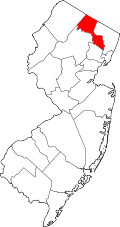 | |
| Boroughs | ||
| Townships | ||
| CDPs | ||
| Other unincorporated communities | ||