Little Falls, New Jersey
| Little Falls, New Jersey | |
|---|---|
| Township | |
| Township of Little Falls | |
|
Little Falls Town Hall | |
 Map of Little Falls Township in Passaic County. Inset: Location of Passaic County highlighted in the State of New Jersey. | |
 Census Bureau map of Little Falls, New Jersey | |
| Coordinates: 40°52′34″N 74°13′08″W / 40.876235°N 74.218886°WCoordinates: 40°52′34″N 74°13′08″W / 40.876235°N 74.218886°W[1][2] | |
| Country |
|
| State |
|
| County | Passaic |
| Incorporated | April 2, 1868 |
| Government[3] | |
| • Type | Faulkner Act (Mayor-Council) |
| • Body | Township Council |
| • Mayor | Darlene Conti (R, term ends December 31, 2016)[4][5] |
| • Administrator | Charles Cuccia[6] |
| • Clerk | Cynthia Kraus[6] |
| Area[1] | |
| • Total | 2.810 sq mi (7.277 km2) |
| • Land | 2.735 sq mi (7.084 km2) |
| • Water | 0.075 sq mi (0.193 km2) 2.65% |
| Area rank |
351st of 566 in state 14th of 16 in county[1] |
| Elevation[7] | 157 ft (48 m) |
| Population (2010 Census)[8][9][10] | |
| • Total | 14,432 |
| • Estimate (2015)[11] | 14,533 |
| • Rank |
175th of 566 in state 7th of 16 in county[12] |
| • Density | 5,276.2/sq mi (2,037.2/km2) |
| • Density rank |
103rd of 566 in state 7th of 16 in county[12] |
| Time zone | Eastern (EST) (UTC-5) |
| • Summer (DST) | Eastern (EDT) (UTC-4) |
| ZIP code | 07424[13] |
| Area code(s) | 973[14] |
| FIPS code | 3403140620[1][15][16] |
| GNIS feature ID | 0882313[1][17] |
| Website |
www |

Little Falls is a township in Passaic County, New Jersey, United States. As of the 2010 census, the township's population was 14,432,[8][9][10] reflecting an increase of 3,577 (+33.0%) from the 10,855 counted in the 2000 Census, which had in turn declined by 439 (-3.9%) from the 11,294 counted in the 1990 Census.[18] It is located about 15 miles (24 km) from New York City.
Little Falls was incorporated as a township by an act of the New Jersey Legislature on April 2, 1868, from portions of Acquackanonk Township. On March 25, 1914, portions of the township were taken to form the borough of West Paterson (now Woodland Park).[19] The township was named for a waterfall on the Passaic River at a dam near Beattie Mill.[20][21]
The Morris Canal, once an important artery of trade and transportation between the Delaware and Hudson rivers, wound its way through the township and vestiges of it still remain.
Geography
According to the United States Census Bureau, the township had a total area of 2.810 square miles (7.277 km2), including 2.735 square miles (7.084 km2) of land and 0.075 square miles (0.193 km2) of water (2.65%).[1][2]
Singac (with a 2010 Census population of 3,618[22]) is an unincorporated community and census-designated place (CDP) located within Little Falls Township.[23][24][25]
The township has three main sub-divisions. Great Notch is the easternmost part of Little Falls. The downtown area is frequently referred to as "The Center of Town", mainly by longtime residents, and is usually referred to as simply Little Falls. Singac is in the westernmost portion of the township. Much of Singac borders the Passaic River.[26][27]
Little Falls is bordered by the municipalities of Clifton, Totowa, Wayne, Woodland Park in Passaic County; and Cedar Grove, Fairfield and Montclair, North Caldwell in Essex County.[28]
Demographics
| Historical population | |||
|---|---|---|---|
| Census | Pop. | %± | |
| 1870 | 1,282 | — | |
| 1880 | 1,404 | 9.5% | |
| 1890 | 1,890 | 34.6% | |
| 1900 | 2,908 | 53.9% | |
| 1910 | 3,750 | 29.0% | |
| 1920 | 5,161 | * | 37.6% |
| 1930 | 5,161 | 0.0% | |
| 1940 | 5,368 | 4.0% | |
| 1950 | 6,405 | 19.3% | |
| 1960 | 9,730 | 51.9% | |
| 1970 | 11,727 | 20.5% | |
| 1980 | 11,496 | −2.0% | |
| 1990 | 11,294 | −1.8% | |
| 2000 | 10,855 | −3.9% | |
| 2010 | 14,432 | 33.0% | |
| Est. 2015 | 14,533 | [11][29] | 0.7% |
| Population sources: 1870-1920[30] 1870[31][32] 1880-1890[33] 1890-1910[34] 1910-1930[35] 1930-1990[36] 2000[37][38] 2010[8][9][10] * = Lost territory in previsous decade.[19] | |||
Census 2010
The 2010 United States Census counted 14,432 people, 4,740 households, and 2,825 families residing in the township. The population density was 5,276.2 per square mile (2,037.2/km2). The township contained 4,925 housing units at an average density of 1,800.5 per square mile (695.2/km2). The racial makeup of the township was 86.68% (12,510) White, 4.11% (593) Black or African American, 0.15% (22) Native American, 4.56% (658) Asian, 0.01% (1) Pacific Islander, 2.38% (344) from other races, and 2.11% (304) from two or more races. Hispanics or Latinos of any race were 9.89% (1,428) of the population.[8]
Out of a total of 4,740 households, 22.8% had children under the age of 18 living with them, 45.8% were married couples living together, 10.2% had a female householder with no husband present, and 40.4% were non-families. 33.1% of all households were made up of individuals, and 12.6% had someone living alone who was 65 years of age or older. The average household size was 2.36 and the average family size was 3.04.[8]
In the township, 13.7% of the population were under the age of 18, 29.4% from 18 to 24, 21.0% from 25 to 44, 22.8% from 45 to 64, and 13.0% who were 65 years of age or older. The median age was 32.1 years. For every 100 females the census counted 81.9 males, but for 100 females at least 18 years old, it was 78.2 males.[8]
The Census Bureau's 2006-2010 American Community Survey showed that (in 2010 inflation-adjusted dollars) median household income was $78,318 (with a margin of error of +/- $8,244) and the median family income was $92,462 (+/- $12,925). Males had a median income of $67,585 (+/- $7,860) versus $42,270 (+/- $3,385) for females. The per capita income for the borough was $34,505 (+/- $3,336). About 4.7% of families and 6.0% of the population were below the poverty line, including 8.1% of those under age 18 and 10.2% of those age 65 or over.[39]
Same-sex couples headed 42 households in 2010, an increase from the 33 counted in 2000.[40]
Census 2000
As of the 2000 United States Census[15] there were 10,855 people, 4,687 households, and 2,873 families residing in the township. The population density was 3,941.8 people per square mile (1,524.1/km2). There were 4,797 housing units at an average density of 1,742.0 per square mile (673.5/km2). The racial makeup of the township was 92.13% white, 0.65% African American, 0.06% Native American, 4.20% Asian, 0.02% Pacific Islander, 1.33% from other races, and 1.60% from two or more races. Hispanic or Latino of any race were 5.33% of the population.[37][38]
There were 4,687 households out of which 22.9% had children under the age of 18 living with them, 49.1% were married couples living together, 9.4% had a female householder with no husband present, and 38.7% were non-families. 33.1% of all households were made up of individuals and 13.3% had someone living alone who was 65 years of age or older. The average household size was 2.32 and the average family size was 2.99.[37][38]
In the township the population was spread out with 18.1% under the age of 18, 6.6% from 18 to 24, 32.4% from 25 to 44, 24.9% from 45 to 64, and 17.9% who were 65 years of age or older. The median age was 41 years. For every 100 females there were 89.7 males. For every 100 females age 18 and over, there were 87.4 males.[37][38]
The median income for a household in the township was $58,857, and the median income for a family was $70,223. Males had a median income of $49,136 versus $37,727 for females. The per capita income for the township was $33,242. About 2.8% of families and 4.6% of the population were below the poverty line, including 4.8% of those under age 18 and 4.9% of those age 65 or over.[37][38]
Sports
The New Jersey Jackals of the Canadian American Association of Professional Baseball (CanAm League) play at Yogi Berra Stadium, located in Little Falls.[41]
Government
Local government
Effective January 1, 2005, the form of government in Little Falls was changed by a public referendum to the Mayor-Council form authorized by the Faulkner Act. Under the new government, the voters directly elect the mayor to a four-year term, and the five township council members to four-year terms of office on a staggered basis, with either three seats or two seats (together with the mayoral seat) up for election in even years as part of the November general election. For most of its history, Little Falls had been governed under the Township form of government by a township committee consisting of five committee members elected by the voters. Under this system, a chairman (mayor) and deputy-chair (deputy mayor) were selected annually by the Township Committee members.[3]
As of 2016, the Mayor of Little Falls is Republican Darlene Conti, whose term of office ends on December 31, 2016. Members of the Township Council are Council President Louis Fontana (R, 2016), James Belford Damiano (D, 2018), William Liess (D, 2018), Joseph Maceri (R, 2018) and Pam Porter (R, 2016).[4][42][43][44][45]
Post (who returned to using her maiden name of Conti as of January 2015[46]) won election to a full four-year term as mayor in the 2012 general election, along with all three of her Republican running mates for Township Council; Louis Fontana, Pamela Porter and Joseph Rento (who won the balance of an unexpired term of office).[47]
Federal, state and county representation
Little Falls is located in the 11th Congressional District[48] and is part of New Jersey's 40th state legislative district.[9][49][50] Prior to the 2010 Census, Little Falls had been part of the 8th Congressional District, a change made by the New Jersey Redistricting Commission that took effect in January 2013, based on the results of the November 2012 general elections.[51]
New Jersey's Eleventh Congressional District is represented by Rodney Frelinghuysen (R, Harding Township).[52] New Jersey is represented in the United States Senate by Cory Booker (D, Newark, term ends 2021)[53] and Bob Menendez (D, Paramus, 2019).[54][55]
For the 2016–2017 session (Senate, General Assembly), the 40th Legislative District of the New Jersey Legislature is represented in the State Senate by Kevin J. O'Toole (R, Cedar Grove) and in the General Assembly by Scott Rumana (R, Wayne) and David C. Russo (R, Ridgewood).[56] The Governor of New Jersey is Chris Christie (R, Mendham Township).[57] The Lieutenant Governor of New Jersey is Kim Guadagno (R, Monmouth Beach).[58]
Passaic County is governed by a seven-member Board of Chosen Freeholders, who are elected at-large to staggered three-year terms office on a partisan basis, with two or three seats coming up for election each year as part of the November general election in a three-year cycle. At a reorganization meeting held in January, the board selects a Director and Deputy Director from among its members to serve for a one-year term.[59] As of 2015, Passaic County's Freeholders are John W. Bartlett (D, 2015; Wayne),[60] Theodore O. Best, Jr. (D, 2017; Paterson),[61] Ronda Cotroneo (D, 2015; Ringwood),[62] Terry Duffy (D, 2016; West Milford),[63] and Pat Lepore (D, 2016; Woodland Park).[64][65][66] The last seat, vacated by Hector Lora who resigned to become mayor of Passaic, is still up for discussion as of December 2016. Constitutional officers elected on a countywide basis are County Clerk Kristin M. Corrado (R, 2019),[67] Sheriff Richard H. Berdnik (2016)[68] and Surrogate Bernice Toledo (2016).[69][70][71]
Politics
As of March 23, 2011, there were a total of 7,632 registered voters in Little Falls, of which 2,084 (27.3% vs. 31.0% countywide) were registered as Democrats, 1,800 (23.6% vs. 18.7%) were registered as Republicans and 3,745 (49.1% vs. 50.3%) were registered as Unaffiliated. There were 3 voters registered to other parties.[72] Among the township's 2010 Census population, 52.9% (vs. 53.2% in Passaic County) were registered to vote, including 61.3% of those ages 18 and over (vs. 70.8% countywide).[72][73]
In the 2012 presidential election, Democrat Barack Obama received 52.9% of the vote (3,190 cast), ahead of Republican Mitt Romney with 46.1% (2,780 votes), and other candidates with 1.0% (62 votes), among the 6,086 ballots cast by the township's 9,118 registered voters (54 ballots were spoiled), for a turnout of 66.7%.[74][75] In the 2008 presidential election, Republican John McCain received 2,908 votes (49.5% vs. 37.7% countywide), ahead of Democrat Barack Obama with 2,734 votes (46.5% vs. 58.8%) and other candidates with 65 votes (1.1% vs. 0.8%), among the 5,879 ballots cast by the township's 7,835 registered voters, for a turnout of 75.0% (vs. 70.4% in Passaic County).[76] In the 2004 presidential election, Republican George W. Bush received 2,994 votes (50.6% vs. 42.7% countywide), ahead of Democrat John Kerry with 2,723 votes (46.0% vs. 53.9%) and other candidates with 47 votes (0.8% vs. 0.7%), among the 5,921 ballots cast by the township's 7,798 registered voters, for a turnout of 75.9% (vs. 69.3% in the whole county).[77]
In the 2013 gubernatorial election, Republican Chris Christie received 60.7% of the vote (2,165 cast), ahead of Democrat Barbara Buono with 38.0% (1,355 votes), and other candidates with 1.2% (44 votes), among the 3,615 ballots cast by the township's 9,689 registered voters (51 ballots were spoiled), for a turnout of 37.3%.[78][79] In the 2009 gubernatorial election, Republican Chris Christie received 1,936 votes (51.3% vs. 43.2% countywide), ahead of Democrat Jon Corzine with 1,577 votes (41.8% vs. 50.8%), Independent Chris Daggett with 183 votes (4.8% vs. 3.8%) and other candidates with 39 votes (1.0% vs. 0.9%), among the 3,775 ballots cast by the township's 7,552 registered voters, yielding a 50.0% turnout (vs. 42.7% in the county).[80]
Education
For public school, students in Kindergarten through eighth grade are educated by the Little Falls Township Public Schools. As of the 2011-12 school year, the district's three schools had an enrollment of 916 students and 73.9 classroom teachers (on an FTE basis), for a student–teacher ratio of 12.40:1.[81] Schools in the district (with 2011-12 enrollment data from the National Center for Education Statistics[82]) are Little Falls School #2[83] with 211 students in grades kindergarten through two; Little Falls School #3[84] with 196 students in grades three and four; and Little Falls School #1[85] with 388 students in grades five through eight.[86][87]
For ninth through twelfth grades, students in public school attend Passaic Valley Regional High School, which also serves students from Totowa and Woodland Park. The school facility is located in Little Falls.[88]
Most of Montclair State University is located in Little Falls. During 2011, the university employed 66 residents on a full or part-time basis, who earned almost $3.5 million in total.[89]
Transportation
Roads and highways
As of May 2010, the township had a total of 37.65 miles (60.59 km) of roadways, of which 24.55 miles (39.51 km) were maintained by the municipality, 10.87 miles (17.49 km) by Passaic County and 2.23 miles (3.59 km) by the New Jersey Department of Transportation.[90]
Little Falls is criss-crossed by several major roadways, including U.S. Route 46 and New Jersey Route 23. The Garden State Parkway and Interstate 80 run near the municipality.
Public transportation
The Little Falls and Montclair State University Stations of the NJ Transit both serve Little Falls, offering service on the Montclair-Boonton Line to Hoboken Terminal in Hoboken, New Jersey, or from Montclair State University Station on Midtown Direct trains to New York City's Pennsylvania Station in Midtown Manhattan via the Secaucus Junction. The township was formerly served by the Great Notch Station until NJ Transit closed it in January 2010 because of low ridership.[91]
NJ Transit bus transportation is offered to the Port Authority Bus Terminal in Midtown Manhattan on the 191, 194 and 195 routes. Newark, New Jersey, is served by routes 11 and 28 (on Saturdays and Sundays). Local routes are the 704 and 705 lines.[92][93] In September 2012, as part of budget cuts, NJ Transit suspended service to Newark on the 75 line.[94]
Little Falls is approximately 21 miles (34 km) from Newark Liberty International Airport and approximately 27 miles (43 km) from LaGuardia Airport in Flushing, Queens, New York.
Notable people
People who were born in, residents of, or otherwise closely associated with Little Falls include:
- David Blaine (born 1973), illusionist.[95]
- Frank DeCaro (born 1962), author and television personality.[96]
- Bobby Marks (born 1972/73), former National Basketball Association assistant general manager of the Brooklyn Nets.[97]
- Lloyd B. Marsh (1893-1971), politician who served as Secretary of State of New Jersey and Chairman of the New Jersey Republican State Committee.[98]
- Kit McClure (born 1951), saxophonist, trombonist and bandleader.[99]
- Franklin E. Sigler (1924–1995), U.S. Marine who was the recipient of the congressional Medal of Honor for his actions during the Battle of Iwo Jima.[100]
- Grif Teller (1899-1993), artist known for his paintings for the Pennsylvania Railroad.[101]
- Lois Utz, children's author.[102]
In popular culture
- A delicatessen on Main Street in Little Falls was featured in the episode "House Arrest" from the second season of television series The Sopranos.[103]
- The township was well known for the Colonial Inn, a hotel and lounge where comedian Jackie Gleason performed stand-up in the 1930s.[104]
References
- 1 2 3 4 5 6 2010 Census Gazetteer Files: New Jersey County Subdivisions, United States Census Bureau. Accessed May 21, 2015.
- 1 2 US Gazetteer files: 2010, 2000, and 1990, United States Census Bureau. Accessed September 4, 2014.
- 1 2 2012 New Jersey Legislative District Data Book, Rutgers University Edward J. Bloustein School of Planning and Public Policy, March 2013, p. 169.
- 1 2 Elected Officials, Township of Little Falls. Accessed July 28, 2016.
- ↑ 2016 New Jersey Mayors Directory, New Jersey Department of Community Affairs. Accessed June 14, 2016.
- 1 2 Township Directory, Township of Little Falls. Accessed July 28, 2016.
- ↑ U.S. Geological Survey Geographic Names Information System: Township of Little Falls, Geographic Names Information System. Accessed March 7, 2013.
- 1 2 3 4 5 6 DP-1 - Profile of General Population and Housing Characteristics: 2010 for Little Falls township, Passaic County, New Jersey, United States Census Bureau. Accessed August 27, 2012.
- 1 2 3 4 Municipalities Grouped by 2011-2020 Legislative Districts, New Jersey Department of State, p. 16. Accessed January 6, 2013.
- 1 2 3 Profile of General Demographic Characteristics: 2010 for Little Falls township, New Jersey Department of Labor and Workforce Development. Accessed August 27, 2012.
- 1 2 PEPANNRES - Annual Estimates of the Resident Population: April 1, 2010 to July 1, 2015 - 2015 Population Estimates for New Jersey municipalities, United States Census Bureau. Accessed May 22, 2016.
- 1 2 GCT-PH1 Population, Housing Units, Area, and Density: 2010 - State -- County Subdivision from the 2010 Census Summary File 1 for New Jersey, United States Census Bureau. Accessed August 5, 2013.
- ↑ Look Up a ZIP Code for Little Falls, NJ, United States Postal Service. Accessed August 27, 2012.
- ↑ Area Code Lookup - NPA NXX for Little Falls, NJ, Area-Codes.com. Accessed September 27, 2014.
- 1 2 American FactFinder, United States Census Bureau. Accessed September 4, 2014.
- ↑ A Cure for the Common Codes: New Jersey, Missouri Census Data Center. Accessed August 27, 2012.
- ↑ US Board on Geographic Names, United States Geological Survey. Accessed September 4, 2014.
- ↑ Table 7. Population for the Counties and Municipalities in New Jersey: 1990, 2000 and 2010, New Jersey Department of Labor and Workforce Development, February 2011. Accessed August 27, 2012.
- 1 2 Snyder, John P. The Story of New Jersey's Civil Boundaries: 1606-1968, Bureau of Geology and Topography; Trenton, New Jersey; 1969. p. 209. Accessed August 27, 2012.
- ↑ Hutchinson, Viola L. The Origin of New Jersey Place Names, New Jersey Public Library Commission, May 1945. Accessed September 3, 2015.
- ↑ About, Township of Little Falls. Accessed September 3, 2015."Our Township is named for the Passaic River waterfall that formerly spilled downstream from the dam in front of the Beattie Mill."
- ↑ DP-1 - Profile of General Population and Housing Characteristics: 2010 Demographic Profile Data for Singac CDP, New Jersey, United States Census Bureau. Accessed January 13, 2013.
- ↑ GCT-PH1 - Population, Housing Units, Area, and Density: 2010 - County -- County Subdivision and Place from the 2010 Census Summary File 1 for Passaic County, New Jersey, United States Census Bureau. Accessed January 12, 2013.
- ↑ 2006-2010 American Community Survey Geography for New Jersey, United States Census Bureau. Accessed January 12, 2013.
- ↑ New Jersey: 2010 - Population and Housing Unit Counts - 2010 Census of Population and Housing (CPH-2-32), United States Census Bureau, August 2012. Accessed January 12, 2013.
- ↑ Spiewak, Anna. "One Hometown You Won't Want To Leave". The Record, January 20, 2008. Accessed February 29, 2008. "The township is divided into three sections: Little Falls; Singac, off Route 23; and Great Notch, off Long Hill & Ridge Roads."
- ↑ Locality Search, State of New Jersey. Accessed May 21, 2015.
- ↑ Areas touching Little Falls, MapIt. Accessed January 26, 2015.
- ↑ Census Estimates for New Jersey April 1, 2010 to July 1, 2015, United States Census Bureau. Accessed May 22, 2016.
- ↑ Compendium of censuses 1726-1905: together with the tabulated returns of 1905, New Jersey Department of State, 1906. Accessed August 5, 2013.
- ↑ Raum, John O. The History of New Jersey: From Its Earliest Settlement to the Present Time, Volume 1, p. 274, J. E. Potter and company, 1877. Accessed January 13, 2013. "Little Falls contains a population of 1,282"
- ↑ Staff. A compendium of the ninth census, 1870, p. 260. United States Census Bureau, 1872. Accessed January 13, 2013.
- ↑ Porter, Robert Percival. Preliminary Results as Contained in the Eleventh Census Bulletins: Volume III - 51 to 75, p. 99. United States Census Bureau, 1890. Accessed August 27, 2012.
- ↑ Thirteenth Census of the United States, 1910: Population by Counties and Minor Civil Divisions, 1910, 1900, 1890, United States Census Bureau, p. 338. Accessed August 27, 2012.
- ↑ Fifteenth Census of the United States : 1930 - Population Volume I, United States Census Bureau, p. 718. Accessed August 27, 2012.
- ↑ Table 6. New Jersey Resident Population by Municipality: 1930 - 1990, New Jersey Department of Labor and Workforce Development. Accessed June 28, 2015.
- 1 2 3 4 5 Census 2000 Profiles of Demographic / Social / Economic / Housing Characteristics for Little Falls township, New Jersey, United States Census Bureau. Accessed August 27, 2012.
- 1 2 3 4 5 DP-1: Profile of General Demographic Characteristics: 2000 - Census 2000 Summary File 1 (SF 1) 100-Percent Data for Little Falls township, Passaic County, New Jersey, United States Census Bureau. Accessed August 27, 2012.
- ↑ DP03: Selected Economic Characteristics from the 2006-2010 American Community Survey 5-Year Estimates for Little Falls township, Passaic County, New Jersey, United States Census Bureau. Accessed August 27, 2012.
- ↑ Lipman, Harvy; and Sheingold, Dave. "North Jersey sees 30% growth in same-sex couples", The Record (Bergen County), August 14, 2011, backed up by the Internet Archive as of February 3, 2013. Accessed September 27, 2014.
- ↑ New Jersey Jackals, Canadian-American Association of Professional Baseball. Accessed July 27, 2008.
- ↑ 2016 Municipal User Friendly Budget, Township of Little Falls. Accessed July 28, 2016.
- ↑ Passaic County 2016 Directory, Passaic County, New Jersey, March 2016. Accessed July 28, 2016.
- ↑ November 4, 2014 Summary Report Passaic County Official Results, Passaic County, New Jersey, updated November 12, 2014. Accessed July 28, 2016.
- ↑ Passaic County Official Results - 2012 General Election November 6, 2012, Passaic County, New Jersey, updated November 27, 2012. Accessed July 28, 2016.
- ↑ Green, Jeff. "Little Falls reorg seats Democratic bloc, features first jousts", The Record (Bergen County), January 5, 2015. Accessed June 28, 2015. "The Democrats join the council after a year of division within the township GOP, between the all-Republican council and Mayor Darlene Post (who announced Monday she would return to using her maiden name, Conti)."
- ↑ Kadosh, Matthew. "Little Falls Republicans secure mayor, council seats", Passaic Valley Today, November 7, 2012. Accessed January 13, 2013. "Republican Mayor Darlene Post kept her position as the township's top official and three Republican candidates won council seats on Tuesday.... Republican Councilwoman Pamela Porter received 2,293 votes, or about 18.5 percent of the electorate. Republican Council President Louis Fontana received 2,206 votes, or about 17.8 percent of the electorate. Republican Councilman Joseph Rento received 2,164 votes, or about 17.5 percent of the electorate."
- ↑ Plan Components Report, New Jersey Redistricting Commission, December 23, 2011. Accessed January 6, 2013.
- ↑ 2016 New Jersey Citizen's Guide to Government, p. 60, New Jersey League of Women Voters. Accessed July 20, 2016.
- ↑ Districts by Number for 2011-2020, New Jersey Legislature. Accessed January 6, 2013.
- ↑ 2011 New Jersey Citizen's Guide to Government, p. 60, New Jersey League of Women Voters. Accessed May 22, 2015.
- ↑ Directory of Representatives: New Jersey, United States House of Representatives. Accessed January 5, 2012.
- ↑ About Cory Booker, United States Senate. Accessed January 26, 2015. "He now owns a home and lives in Newark's Central Ward community."
- ↑ Biography of Bob Menendez, United States Senate, January 26, 2015. "He currently lives in Paramus and has two children, Alicia and Robert."
- ↑ Senators of the 114th Congress from New Jersey. United States Senate. Accessed January 26, 2015. "Booker, Cory A. - (D - NJ) Class II; Menendez, Robert - (D - NJ) Class I"
- ↑ Legislative Roster 2016-2017 Session, New Jersey Legislature. Accessed January 17, 2016.
- ↑ "About the Governor". State of New Jersey. Retrieved 2010-01-21.
- ↑ "About the Lieutenant Governor". State of New Jersey. Retrieved 2010-01-21.
- ↑ Clerk-Freeholders, Passaic County, New Jersey. Accessed January 27, 2015.
- ↑ John W. Bartlett, Passaic County, New Jersey. Accessed January 27, 2015.
- ↑ Theodore O. Best Jr., Passaic County, New Jersey. Accessed January 27, 2015.
- ↑ Ronda Cotroneo, Passaic County, New Jersey. Accessed January 27, 2015.
- ↑ Terry Duffy, Passaic County, New Jersey. Accessed January 27, 2015.
- ↑ Pat Lepore, Passaic County, New Jersey. Accessed January 27, 2015.
- ↑ Freeholders, Passaic County, New Jersey. Accessed January 27, 2015.
- ↑ 2014 County Data Sheet, Passaic County, New Jersey. Accessed January 27, 2015.
- ↑ County Clerk, Passaic County, New Jersey. Accessed January 27, 2015.
- ↑ Richard H. Berdnik, Passaic County Sheriff's Office. Accessed January 27, 2015.
- ↑ County Surrogate, Passaic County, New Jersey. Accessed January 27, 2015.
- ↑ Kleimann, James. "Passaic County general election results 2014", NJ Advance Media for NJ.com, November 4, 2014. Accessed January 27, 2015.
- ↑ 2014 Passaic County Directory, Passaic County, New Jersey. Accessed January 27, 2015.
- 1 2 Voter Registration Summary - Passaic, New Jersey Department of State Division of Elections, March 23, 2011. Accessed January 16, 2013.
- ↑ GCT-P7: Selected Age Groups: 2010 - State -- County Subdivision; 2010 Census Summary File 1 for New Jersey, United States Census Bureau. Accessed January 16, 2013.
- ↑ "Presidential General Election Results - November 6, 2012 - Passaic County" (PDF). New Jersey Department of Elections. March 15, 2013. Retrieved December 24, 2014.
- ↑ "Number of Registered Voters and Ballots Cast - November 6, 2012 - General Election Results - Passaic County" (PDF). New Jersey Department of Elections. March 15, 2013. Retrieved December 24, 2014.
- ↑ 2008 Presidential General Election Results: Passaic County, New Jersey Department of State Division of Elections, December 23, 2008. Accessed January 16, 2013.
- ↑ 2004 Presidential Election: Passaic County, New Jersey Department of State Division of Elections, December 13, 2004. Accessed January 16, 2013.
- ↑ "Governor - Passaic County" (PDF). New Jersey Department of Elections. January 29, 2014. Retrieved December 24, 2014.
- ↑ "Number of Registered Voters and Ballots Cast - November 5, 2013 - General Election Results - Passaic County" (PDF). New Jersey Department of Elections. January 29, 2014. Retrieved December 24, 2014.
- ↑ 2009 Governor: Passaic County, New Jersey Department of State Division of Elections, December 31, 2009. Accessed January 16, 2013.
- ↑ District information for Little Falls Township School District, National Center for Education Statistics. Accessed January 26, 2015.
- ↑ School Data for the Little Falls Township Public Schools, National Center for Education Statistics. Accessed January 26, 2015.
- ↑ Little Falls School #2, Little Falls Township Public Schools. Accessed August 5, 2013.
- ↑ Little Falls School #3, Little Falls Township Public Schools. Accessed August 5, 2013.
- ↑ Little Falls School #1, Little Falls Township Public Schools. Accessed August 5, 2013.
- ↑ New Jersey School Directory for the Little Falls Township Public Schools, New Jersey Department of Education. Accessed August 5, 2013.
- ↑ Passaic County 2014-15 Public School Directory, Passaic County, New Jersey. Accessed January 27, 2015.
- ↑ District Information, Passaic Valley High School. Accessed January 26, 2015. "The regional district which is served by Passaic Valley High School is comprised of the communities of Little Falls, Totowa Borough and Woodland Park."
- ↑ Montclair State in the Community: Little Falls, Montclair State University. Accessed August 5, 2013. "Montclair State can take pride in its rich history of bold educational innovation and vital service to the state, including an array of concrete benefits to its two host counties of Passaic and Essex and its four host communities of Little Falls, Montclair, Clifton, and Bloomfield: economic benefits, educational benefits, and community-service benefits."
- ↑ Passaic County Mileage by Municipality and Jurisdiction, New Jersey Department of Transportation, May 2010. Accessed July 18, 2014.
- ↑ Cunningham, Jennifer H. "It's end of the line for Great Notch station", The Record (Bergen County), January 3, 2010. Accessed August 5, 2013. "The 104-year-old Great Notch train station is set to close Jan. 16 because of 'anemic' ridership, NJ Transit officials said."
- ↑ Passaic County Bus/Rail Connections, NJ Transit, backed up by the Internet Archive as of July 27, 2010. Accessed August 27, 2012.
- ↑ Passaic County System Map, NJ Transit. Accessed August 14, 2015.
- ↑ Rouse, Karen. "N.J. Transit bus No. 75, running from Passaic County to Newark, will no longer operate", The Record (Bergen County), August 29, 2012. Accessed August 5, 2015. "Starting Saturday, the NJ Transit No. 75 bus — which runs from Butler through Pompton Lakes, Pequannock, Wayne and Little Falls on its way to Newark — will no longer operate as NJ Transit's plan to save $2.5 million in operating costs takes effect."
- ↑ Staff. "David Blaine Returns to Performing TV Magic for the First Time Since 1999", Jewish Business News, October 6, 2013. Accessed January 26, 2015. "David Blaine was born in Brooklyn, New York and raised in Little Falls, New Jersey, leaving home in 1990, when he was just seventeen; to live in Manhattan, New York to pursue his career as a musician."
- ↑ Sharkey, Joe. "JERSEY;Their Son, the Writer, Finally Tells All", The New York Times, June 2, 1996. Accessed August 27, 2012. "As it turned out, you could take the boy out of Little Falls, but you couldn't take Little Falls out of the boy. Now, at 33, Frank DeCaro forgets nothing about growing up gay in Little Falls, and tells all in his first book, A Boy Named Phyllis: A Suburban Memoir (Viking)."
- ↑ Iannazzone, Al. "Little Falls' Bobby Marks a key to Nets' future", The Record (Bergen County), July 18, 2010. Accessed October 7, 2016. "Armed with a computer, calculator, spreadsheet and the Collective Bargaining Agreement, Marks has been the behind-the-scenes backbone of the Nets' basketball department. But the Little Falls native is starting to step to the forefront."
- ↑ Fitzgerald, Thomas F. Fizgerald's Legislative Manual, State of New Jersey, Volume 194, Part 2; Volume 195, Parts 1-2, p. 317. J.A. Fitzgerald, 1971. "Mr. Marsh was born in Little Falls, New Jersey, July 31, 1893, the son of James and Emma Coon Marsh."
- ↑ Jackson, Vincent. "YEAR-END HOOPLA / ATLANTIC CITY CASINOS OFFER WIDE VARIETY OF SHOWS FOR NEW YEAR'S EVE", The Press of Atlantic City, December 21, 1997. Accessed August 31, 2011. "Kit McClure, a native of Little Falls, Passaic County, is making her Atlantic City debut with her 12-piece, all- female band inside the Theater. "
- ↑ Staff. "TO GET HIGHEST AWARD", The New York Times, October 2, 1945. Accessed March 18, 2011. "Marine Pfc. Franklin E. Sigler, Little Falls, N.J., will receive the Congressional Medal of Honor from President Truman in Washington on Friday."
- ↑ Simmons, Rose. "Grif Teller, 93; Made His Railway Paintings Into 'A Work Of Art'", The Philadelphia Inquirer, April 10, 1993. Accessed July 9, 2015. "Born in Newark, N.J., Mr. Teller lived most of his life in his home town and in Little Falls, N.J."
- ↑ The Star-Ledger, Newark, NJ, obituary, November 16, 1986.
- ↑ The Sopranos location guide
- ↑ Hamill, Pete. "Gleason's Second Honeymoon: Still the Greatest", New York (magazine), September 23, 1985. Accessed January 13, 2013. "By 1937, Gleason was moving around... playing for a few weeks at Frank Donato's Colonial Inn in Singac...."
External links
Municipalities and communities of Passaic County, New Jersey, United States | ||
|---|---|---|
| Cities | 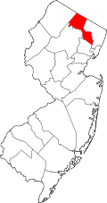 | |
| Boroughs | ||
| Townships | ||
| CDPs | ||
| Other unincorporated communities | ||