Wamboin, New South Wales
| Wamboin New South Wales | |
|---|---|
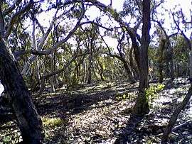 Wamboin bushland | |
|
Wamboin | |
| Coordinates | 35°15′30″S 149°18′25″E / 35.25833°S 149.30694°ECoordinates: 35°15′30″S 149°18′25″E / 35.25833°S 149.30694°E |
| Population | 1,672 (2011 census)[1] |
| Postcode(s) | 2620 |
| Elevation | 800 m (2,625 ft) |
| Time zone | AEST (UTC+10) |
| • Summer (DST) | AEDT (UTC+11) |
| Location |
|
| LGA(s) | Queanbeyan-Palerang Regional Council |
| County | Murray |
| Parish | Wamboin |
| State electorate(s) | Monaro |
| Federal Division(s) | Eden-Monaro |
Wamboin is a rural residential area in the Southern Tablelands of New South Wales, Australia in the County of Murray, Queanbeyan-Palerang Regional Council LGA. It is approximately 16 kilometres north-east of the Australian city of Canberra.
It should not be confused with the Parish of Wamboyne, near West Wyalong, NSW, the rural locality of Wamboin near The Marra in central northern NSW, nor the village of Wonboyn Lake on the far south coast of NSW.
The Parish of Wamboin is about 20 minutes drive from the Canberra CBD, 25 minutes from the Woden Town Centre, and about 10 minutes drive from the city of Queanbeyan. Services in the area include a local Church (Anglican), community centre, recycling area at the community centre, waste transfer station (at Macs Reef Road, Bywong) and rural fire brigade.
Community organisations include the Wamboin Community Association, a bookgroup, golf club, Greenways Renewal Working Group (GRoW), Landcare, Palerang Local Action Network for Sustainability (FuturePLANS), Playgroup, Pony Club, Wildcare and Wonderful Women of Wamboin (WWoW). Blocks of land range in size from 5 acres (20,000 m2) to 40 acres (160,000 m2).
The name Wamboin is possibly derived from Wiradjuri wambuuwayn, meaning "large grey kangaroo",[2] though Wamboin is some distance from Wiradjuri country, and the Ngunnawal people, whose country lies between Wamboin and Wiradjuri country had, and have, a different word for kangaroo (buru).[3]
In the 2011 census Wamboin had a population of 1,672 including those at home (1,566) and elsewhere in Australia (107) on census night. (The inconsistency between these figures is in the census data referenced below.) Thirteen males and seven females identified as being Aboriginal. Some 84% stated that they were born in Australia, and only 75 stated that they spoke a language other than English in the home. The modal age group was 45–54 years. Of those aged 15 years and above who gave details of their education level, 57% stated that their qualifications were at the bachelor's degree or higher level.[4]
The Wamboin Community Association provides a range of community services, and represents the community at policy forums, etc. It conducts a market at the community hall, located on Bingley Way, on the third Saturday of the month, except in winter. It has available online, and in printed form at the monthly markets, a comprehensive New Residents' Pack.[5]
References
- ↑ Australian Bureau of Statistics (31 October 2012). "Wamboin (State Suburb)". 2011 Census QuickStats. Retrieved 4 November 2012.
- ↑ McNicol, Sally; Hosking, Dianne (1994). "Wiradjuri". Macquarie Aboriginal Words. Sydney: Macquarie Library. p. 98.
- ↑ "Ngarigo and Ngunnawal word lists". /www.forkword.com.
- ↑ "2011 Census Community Profiles: Wamboin". Australian Bureau of Statistics.
- ↑ "Local Services ~ New Residents Guide". WCA Working Group.
External links
- www.wamboincommunity.asn.au Wamboin Community Association Website
- www.bywongcommunity.org.au Website of Neighbouring Community Bywong