Shoalhaven River
| Shoalhaven River | |
| Open mature wave dominated barrier estuary[1] | |
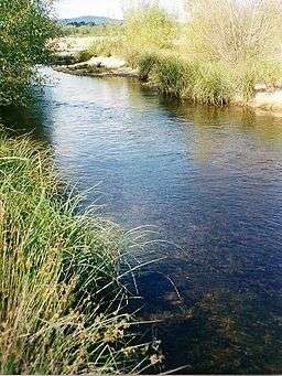 Shoalhaven River, near the Great Dividing Range, west of Batemans Bay. | |
| Name origin: "Shoals Haven" (Bass in 1797).[2] | |
| Country | Australia |
|---|---|
| State | New South Wales |
| Regions | Sydney Basin (IBRA), Southern Tablelands, South Coast |
| Local government areas | Palerang, Shoalhaven |
| Tributaries | |
| - left | Kangaroo River |
| - right | Mongarlowe River, Corang River, Endrick River |
| Cities | Nowra, Bomaderry |
| Source | Euranbene Mountain, Great Dividing Range |
| - location | west of Bendethera |
| - elevation | 864 m (2,835 ft) |
| - coordinates | 35°58′15″S 149°38′3″E / 35.97083°S 149.63417°E |
| Mouth | Tasman Sea, South Pacific Ocean |
| - location | Shoalhaven Heads |
| - elevation | 0 m (0 ft) |
| - coordinates | 34°51′S 150°44′E / 34.850°S 150.733°ECoordinates: 34°51′S 150°44′E / 34.850°S 150.733°E |
| Length | 327 km (203 mi) |
| Depth | 2.9 m (10 ft) |
| Volume | 86,509 m3 (3,055,037 cu ft) |
| Basin | 7,086 km2 (2,736 sq mi) |
| Area | 32 km2 (12 sq mi) |
| Islands | Pig (Burraga), Comerong |
| National park | Deua NP |
| Dam | Tallowa |
 | |
| Wikimedia Commons: Shoalhaven River | |
| Website: NSW Environment & Heritage webpage | |
| [3] | |
The Shoalhaven River is a perennial river that rises from the Southern Tablelands and flows into an open mature wave dominated barrier estuary[1] near Nowra on the South Coast of New South Wales, Australia.
Location and features
The Shoalhaven River rises on the eastern side of the Great Dividing Range, below Euranbene Mountain, about 350 kilometres (220 mi) southwest of Sydney. The upper reaches of the river flow northwards through an upland pastoral district near the town of Braidwood. The river works its way down into a remote canyon east of Goulburn and emerges into the coastal lowlands at Nowra in the Shoalhaven district, where it is spanned by the historic Nowra Bridge. The river is joined by thirty-four tributaries, including the Mongarlowe, Corang, Endrick, and Kangaroo rivers, and descends 864 metres (2,835 ft) over its 327-kilometre (203 mi) course.[3]
Berrys Canal
The estuary has two entrances, approximately 5 kilometres (3.1 mi) apart, that flow into the Shoalhaven Bight within the Tasman Sea of the South Pacific Ocean. The southern entrance is located at Crookhaven Heads and is permanently open. The Shoalhaven River flows south via Berrys Canal to Greenwell Point, where it is joined by the Crookhaven River and then flows east past Orient Point into the bight, north of Culburra.[4] The Berrys Canal between the Shoalhaven and the Crookhaven was constructed in June 1822 by convicts overseen by Hamilton Hume under the direction of Alexander Berry to facilitate ship transport to the original European settlement located in the region.[5] The construction of the canal formed Comerong Island. The canal was dug using own hand tools, and was the first land navigable canal in Australia. Berrys Canal remains one of two navigable canals in New South Wales, the other being the Alexandra Canal.
The northern entrance is located south of Shoalhaven Heads, and is open intermittently, at times of peak flow and during flood events.[4]
Use for water supply
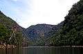
Tallowa Dam is the only major dam on the Shoalhaven, and is a part of the Shoalhaven Scheme. It impounds the river's lower reaches to form Lake Yarrunga and part of Sydney's water supply. Some water is pumped out of the lake and over the Southern Highlands into Lake Burragorang. Proposals for a much larger water storage at Welcome Reef on the upper Shoalhaven have been shelved.
Environment
The Shoalhaven River and its main tributary the Kangaroo River were once renowned as an Australian bass fishery. Unfortunately, Tallowa Dam has been a potent barrier to migratory native fish with estuarine/marine juvenile stages, blocking species including Australian bass from more than 80% of their former range in the Shoalhaven system. Recent stockings of hatchery-bred Bass in Lake Yarrunga are an attempt to remediate the situation. A fishway for Tallowa Dam was completed in August 2009.[6] This fishway is designed to allow for the movement of bass and other native fish over the dam.[7] Lake Yarrunga has also suffered the illegal introduction of highly damaging European carp, which are now present in high densities.
History
Indigenous history
The traditional custodians of the land surrounding the Shoalhaven River, in its lower reaches, are the Aboriginal peoples of the Yuin nation. In the land north of the river, the people from the Wodi Wodi clan are the traditional custodians; while south of the river, the Wandi Wandian clan are the traditional custodians.[8] Some of the culturally important Aboriginal places in the Shoalhaven include Coolangatta Mountain, Bundarwa (Beecroft Headland), Cambewarra Mountain, Didthul or Pigeon House Mountain, Kangaroo Valley, Burrill Lake, and Murramarang Aboriginal Area and its environs.[9][10]
European history
The explorer and navigator George Bass found the entrance to the Shoalhaven River during his whaleboat voyage down the south coast of New South Wales in 1797. He gave the name Shoals Haven to the river (now known as the Crookhaven River) because of the shoals of mud and sand he found at the river mouth.[2][11]
Approximately 20 kilometres (12 mi) west of Nowra are a series of properties along the banks of the Shoalhaven River that were a gift to the people of Australia from Arthur Boyd, his wife, Yvonne, and the Boyd Family. Entrusted to the Bundanon Trust, along with further gifts by Boyd, including copyright of all of his artwork, these properties provide an environment that promotes visual arts, writing, music and other performing arts, and the promotion of education and research in the arts.[12]
Crossings
The river crossings, from its headwaters to its river mouth, include:
- Bombay Crossing
- Warri Bridge carries the Kings Highway, near Braidwood. A bridge at this location was first opened on 23 September 1874,[13] and later replaced by the current structure.
- Stewart's Crossing is a ford on Stewart's Crossing Road.
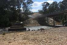
- Oallen Crossing is a flood-prone single-lane timber bridge with a low-level concrete floodway for the Oallen Ford Road at Oallen Ford, near Nerriga, constructed in 1936. The timber bridge and floodway is expected to be replaced by a longer higher concrete culvert crossing slightly downstream, around mid-2015. Preliminary site-works commenced in late January 2015.[14] The new crossing is designed to permit higher speed transit and only to be overtopped by much deeper 1:20 year flood events.[15]
- Nowra Bridge carries the Princes Highway between Bomaderry and Nowra.
- Comerong Island Ferry carries vehicles and pedestrians to Comerong Island near the river mouth.
Gallery


See also
| Wikimedia Commons has media related to Shoalhaven River. |
- List of rivers of New South Wales
- List of rivers in New South Wales (L-Z)
- Morton National Park
- Rivers of New South Wales
- Shoalhaven Scheme
References
- 1 2 Roy, P. S; Williams, R. J; Jones, A. R; Yassini, I; et al. (2001). "Structure and Function of South-east Australian Estuaries". Estuarine, Coastal and Shelf Science. 53: 351–384. doi:10.1006/ecss.2001.0796.
- 1 2 Reed, A. W (1984). Place names of Australia (paperback reprint ed.). Sydney: Reed Books Pty Limited. p. 196.
- 1 2 "Map of Shoalhaven River, NSW". Bonzle Digital Atlas of Australia. 2013. Retrieved 18 May 2013.
- 1 2 "Shoalhaven River Hydrographic Survey" (PDF). Estuary Management Program. NSW Department of Natural Resources. September 2005 – November 2006. Retrieved 19 May 2013.
- ↑ "Berry, Alexander (1781–1873)". Australian Dictionary of Biography. Retrieved 16 October 2009.
- ↑ "NSW's first fish lift to save the endangered Grayling" (Press release). Sydney Catchment Authority. 23 August 2009. Retrieved 20 October 2009.
- ↑ New South Wales Department of Primary Industry, Improving Fish Passage in the Shoalhaven (PDF)
- ↑ "(Draft) Aboriginal protocols" (PDF). NSW Department of Local Government. Retrieved 19 May 2013.
- ↑ "Aboriginal Heritage management". Human Settlement: Infrastructure services and resources. City of Shoalhaven. 2006. Retrieved 19 May 2013.
- ↑ "Shoalhaven Indigenous History". Shoalhaven Holidays. City of Shoalhaven. Retrieved 19 May 2013.
- ↑ "Bass in the Famous Whaleboat Voyage". The Brisbane Courier. National Library of Australia. 26 July 1924. p. 19.
- ↑ "Mission". About Bundanon. Bundanon Trust. 2013. Retrieved 19 May 2013.
- ↑ "THE OPENING OF THE WARRI BRIDGE.". The Sydney Morning Herald. 28 September 1874. p. 3.
- ↑ |url=http://www.goulburn.nsw.gov.au/site/files/ul/data_text12/4083494.pdf|
- ↑ |url=http://www.southcoastregister.com.au/story/2864017/one-new-crossing-gets-under-way/?cs=203|
Further reading
- Gehrke, P. C.; Gilligan, D. M.; Barwick, M. (2002). "Changes in fish communities of the Shoalhaven River 20 years after construction of Tallowa Dam, Australia". River Research and Applications. 18: 265–286. doi:10.1002/rra.669.
Rivers of the Southern Rivers catchment, New South Wales, Australia | |||||||
|---|---|---|---|---|---|---|---|
| |||||||
| |||||||
| |||||||
| |||||||
| |||||||
|
| Cities | |
|---|---|
| Townships |
|
| Local government areas | |
| National parks |
|
| Rivers and other waterbodies | |