Walloon Lake, Michigan
| Walloon Lake, Michigan | |
|---|---|
| Census-designated place | |
 Walloon Lake Location within the state of Michigan | |
| Coordinates: 45°15′58″N 84°56′0″W / 45.26611°N 84.93333°WCoordinates: 45°15′58″N 84°56′0″W / 45.26611°N 84.93333°W | |
| Country | United States |
| State | Michigan |
| Counties | Charlevoix |
| Township | Melrose |
| Area | |
| • Total | 1.36 sq mi (3.51 km2) |
| • Land | 1.36 sq mi (3.51 km2) |
| • Water | 0 sq mi (0 km2) |
| Elevation | 715 ft (218 m) |
| Population (2010) | |
| • Total | 290 |
| • Density | 214/sq mi (82.6/km2) |
| Time zone | Eastern (EST) (UTC-5) |
| • Summer (DST) | EDT (UTC-4) |
| ZIP code | 49796 |
| Area code(s) | 231 |
| FIPS code | 26-83140 |
| GNIS feature ID | 1615729[1] |
Walloon Lake is an unincorporated community and census-designated place in Charlevoix County in the U.S. state of Michigan. As of the 2010 census it had a population of 290.[2]
Geography
Walloon Lake is located at the southeastern end of the lake of the same name in eastern Charlevoix County in the northwest corner of Melrose Township. The community is located just north of the outlet of the lake into the Bear River.
U.S. Route 131 forms the eastern edge of the CDP and runs north 8 miles (13 km) to Petoskey on Little Traverse Bay and south 7 miles (11 km) to Boyne Falls. M-75 runs west from US 131 through the center of town, then leads 6 miles (10 km) southwest to Boyne City.
According to the U.S. Census Bureau, the Walloon Lake CDP has a total area of 1.36 square miles (3.51 km2), all of it land.[2]
History
In 1872, John Jones, Jr. and his sons, Clarence and Elliot, homesteaded in the area. They helped to cut the railroad ties used to build the Grand Rapids and Indiana Railway in 1874. The stop was named "Melrose". The community applied for a post office named "Bear Lake", but there already was a Bear Lake post office in Michigan. A post office named "Tolcott" was established in October 1897, and renamed "Talcott" in March 1899, and again renamed "Walloon Lake" in September 1900. The name was suggested by a local butcher, J. R. Haas, who had seen the name on an old railroad map. An investigation into how the name came to be on the map indicated that many years earlier a group of Walloons had settled at the north end of the lake, which was then known as Bear Lake. No trace of the settlement remains.[3]
References
- ↑ U.S. Geological Survey Geographic Names Information System: Walloon Lake, Michigan
- 1 2 "Geographic Identifiers: 2010 Demographic Profile Data (G001): Walloon Lake CDP, Michigan". U.S. Census Bureau, American Factfinder. Retrieved September 5, 2014.
- ↑ Romig, Walter (1986) [1973]. Michigan Place Names. Detroit, Michigan: Wayne State University Press. ISBN 0-8143-1838-X.
Municipalities and communities of Charlevoix County, Michigan, United States | ||
|---|---|---|
| Cities | 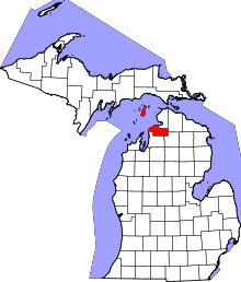 | |
| Village | ||
| Townships | ||
| CDPs | ||