St. James Township, Michigan
| St. James Township, Michigan | |
|---|---|
| Township | |
 St. James Township Location within the state of Michigan | |
| Coordinates: 45°45′19″N 85°32′56″W / 45.75528°N 85.54889°WCoordinates: 45°45′19″N 85°32′56″W / 45.75528°N 85.54889°W | |
| Country | United States |
| State | Michigan |
| County | Charlevoix |
| Area | |
| • Total | 315.9 sq mi (818.2 km2) |
| • Land | 20.3 sq mi (52.7 km2) |
| • Water | 295.6 sq mi (765.5 km2) |
| Elevation | 581 ft (177 m) |
| Population (2010) | |
| • Total | 365 |
| • Density | 18/sq mi (6.9/km2) |
| Time zone | Eastern (EST) (UTC-5) |
| • Summer (DST) | EDT (UTC-4) |
| FIPS code | 26-70920[1] |
| GNIS feature ID | 1627029[2] |
St. James Township is a civil township of Charlevoix County in the U.S. state of Michigan. As of the 2010 census, the township population was 365.[3]
Communities
- Beaver Island is an unincorporated community located on the Northern portion of Beaver Island.
History
The township was named for James Strang, who led a faction of Mormon settlers to Beaver Island in 1848. Producing mysterious brass plates from the ground, and receiving directives from God, Strang formed a colony on Beaver Island in 1848[4] called St. James, naming it after himself. Strang led those who accepted him to Nauvoo, Illinois, and then Voree, Wisconsin, before deciding that God wanted him to bring his flock to Beaver Island.[4] James J. Strang appointed by Joseph Smith Jr. presided over the Church of Jesus Christ of Latter Day Saints (Strangite) from 1844 to 1856.
Geography
St. James Township consists of the northern tip of Beaver Island. Most of the township's population lives in the unincorporated community of St. James, at the northeastern end of Beaver Island. According to the United States Census Bureau, the township has a total area of 315.9 square miles (818.2 km2), of which 20.3 square miles (52.7 km2) is land and 295.6 square miles (765.5 km2), or 93.56%, is water.[3]
Demographics
| Largest ancestries (2000) | Percent |
|---|---|
| Irish | 39.4% |
| English | 17.3% |
| Polish | 17.0% |
| German | 15.5% |
| French | 14.0% |
As of the census[1] of 2000, there were 307 people, 138 households, and 82 families residing in the township. The population density was 15.4 per square mile (5.9/km²). There were 331 housing units at an average density of 16.6 per square mile (6.4/km²). The racial makeup of the township was 98.70% White, and 1.30% Native American.
There were 138 households out of which 24.6% had children under the age of 18 living with them, 55.1% were married couples living together, 5.1% had a female householder with no husband present, and 39.9% were non-families. 34.8% of all households were made up of individuals and 13.8% had someone living alone who was 65 years of age or older. The average household size was 2.22 and the average family size was 2.93.
In the township the population was spread out with 24.4% under the age of 18, 2.9% from 18 to 24, 21.2% from 25 to 44, 29.0% from 45 to 64, and 22.5% who were 65 years of age or older. The median age was 46 years. For every 100 females there were 91.9 males. For every 100 females age 18 and over, there were 95.0 males.
The median income for a household in the township was $33,182, and the median income for a family was $46,250. Males had a median income of $33,000 versus $20,682 for females. The per capita income for the township was $20,109. About 5.6% of families and 6.6% of the population were below the poverty line, including 5.5% of those under the age of eighteen and none of those sixty five or over.
References
- 1 2 "American FactFinder". United States Census Bureau. Retrieved 2008-01-31.
- ↑ U.S. Geological Survey Geographic Names Information System: St. James Township, Michigan
- 1 2 "Geographic Identifiers: 2010 Demographic Profile Data (G001): St. James township, Charlevoix County, Michigan". U.S. Census Bureau, American Factfinder. Retrieved September 4, 2014.
- 1 2 "Strang". www.beaverislandhistory.org. Retrieved 2016-01-14.
External links
Municipalities and communities of Charlevoix County, Michigan, United States | ||
|---|---|---|
| Cities | 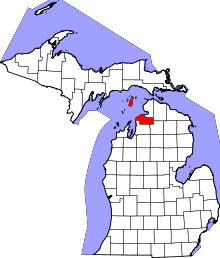 | |
| Village | ||
| Townships | ||
| CDPs | ||