Wakefield Regional Council
| Wakefield Regional Council South Australia | |||||||||||||
|---|---|---|---|---|---|---|---|---|---|---|---|---|---|
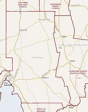
 Location of Wakefield Regional Council | |||||||||||||
| Population | 6,886 (2015 est)[1] | ||||||||||||
| • Density | 1.98478/km2 (5.1406/sq mi) | ||||||||||||
| Established | 1 July 1997 | ||||||||||||
| Area | 3,469.4 km2 (1,339.5 sq mi) | ||||||||||||
| Mayor | Rodney Reid [2] | ||||||||||||
| Council seat | Balaklava | ||||||||||||
| Region | Yorke and Mid North [3] | ||||||||||||
| State electorate(s) | Frome, Goyder | ||||||||||||
| Federal Division(s) | Wakefield, Grey | ||||||||||||
 | |||||||||||||
| Website | Wakefield Regional Council | ||||||||||||
| |||||||||||||

Wakefield Regional Council is a local government area in the Yorke and Mid North region of South Australia.[3] The council seat is at Balaklava.[4]
Geography
The Wakefield Regional Council includes the towns and localities of Avon, Balaklava, Barunga Gap, Beaufort, Blyth, Bowillia, Bowmans, Brinkworth, Bumbunga, Burnsfield, Condowie, Dalkey, Erith, Everard Central, Goyder, Hart, Hope Gap, Hoskin Corner, Inkerman, Kallora, Kybunga, Lake View, Lochiel, Marola, Mount Templeton, Nantawarra, Owen, Pinery, Port Wakefield, Proof Range, Rochester, Saints, Snowtown, Stockyard Creek, Stow, Watchman and Whitwarta, and parts of Alma, Barabba, Bute, Grace Plains, Halbury, Hamley Bridge, Hoyleton, Long Plains, Mundoora, Salter Springs, South Hummocks, Wild Horse Plains, and Wokurna.[5]
On the west side of the Wakefield Regional Council's area is the coastal fringe along the north east of Gulf St Vincent and the Hummocks and Barunga ranges. The area spans wide fertile plains to the north Mount Lofty Ranges on its eastern border. Immediately to the east of the Hummocks and Barunga ranges are a series are low-lying salt lakes, of which Lake Bumbunga is the largest.[6] The Wakefield River, from which the council name derives, flows from east to west across the council region approximately a third of the way from south to north border.
History
The Wakefield Regional Council came into being on 1 July 1997, as a result of the amalgamation of the former District Council of Blyth-Snowtown and the District Council of Wakefield Plains.[7]
The amalgamation occurred when much of the boundary reform of the local government was coming from the State Government as a result of various provisions contained in the "Local Government Act 1934". As a result, the number of local councils in South Australia was reduced from 118 to 68 by the deadline of 30 June 1999.
The area falling under Wakefield Regional Council has been much affected by local government boundary changes that have taken place since the early 1980s. Before 1983, five district councils served the area currently covered by the council.
Transport
The Wakefield Regional Council is well served by a developed transport and communication networks. The main roads, which include the Princes Highway, are all sealed and there are well maintained minor gravel roads. There is no rail service for passengers in the council area, but it is traversed by the Adelaide-Port Augusta railway line.
Demographics
The population of Wakefield Regional Council is 6,756 (2009 estimate).[8]
The council recorded a net decrease in its population of 4.2% between 1991-2001, about 27 people per annum. In 2001, the median age of the population was 39, an increase of 5 years since 1991, indicating a trend towards an aging population.
The council's geographical area covers 3,469.4 square kilometres (1,339.5 sq mi) in which 2,695 kilometres (1,675 mi) of road existed at 30 June 2002. As at 1 July 2005, the total assessed value within the council area was $1,354,733,680 (capital value).
Councillors
| Ward | Councillor | Notes | |
|---|---|---|---|
| Mayor [2] | Rodney Reid | ||
| South [2] | Peter Bowyer | ||
| Barry Smith | |||
| North [2] | Darryl Ottens | Deputy Mayor | |
| Greg Stevens | |||
| John Wood | |||
| Central [2] | David Lamond | ||
| Malcolm May | |||
| Richard Pain | |||
| Terry Williams | |||
The Wakefield Regional Council has a directly-elected mayor.[9]
References
- ↑ "3218.0 – Regional Population Growth, Australia, 2014–15". Australian Bureau of Statistics. Retrieved 29 September 2016.
- 1 2 3 4 5 "Mayor & Elected Members". Wakefield Regional Council. Retrieved 2 April 2016.
- 1 2 "Yorke and Mid North SA Government region" (PDF). The Government of South Australia. Retrieved 10 October 2014.
- ↑ "Wakefield Regional Council". Retrieved 2 April 2016.
- ↑ "Location SA Map Viewer". Government of South Australia. Retrieved 2 April 2016.
- ↑ 2008 EHO Information Kit (PDF), Wakefield Regional Council, p. 4, archived from the original (PDF) on September 27, 2011, retrieved 14 July 2011
- ↑ "Our Region". Wakefield Regional Council. Retrieved 2 April 2016.
- ↑ "National Regional Profile: Wakefield (DC) (Local Government Area)". National Regional Profiles. Australian Bureau of Statistics. 22 November 2010. Retrieved 26 September 2011.
- ↑ "Election Results 2014" (PDF). Local Government Association of South Australia. Retrieved 15 February 2016.
External links
Coordinates: 34°08′51″S 138°24′56″E / 34.1475°S 138.415555556°E