City of Port Augusta
| City of Port Augusta South Australia | |||||||||||||
|---|---|---|---|---|---|---|---|---|---|---|---|---|---|
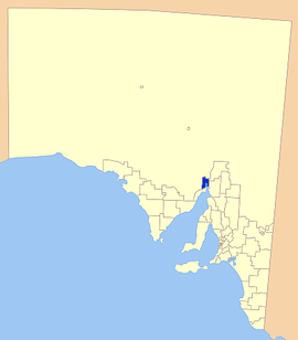 Location of the City of Port Augusta | |||||||||||||
| Population | 14,522 (2015 est)[1] | ||||||||||||
| • Density | 11.72/km2 (30.4/sq mi) | ||||||||||||
| Established | 1875 | ||||||||||||
| Area | 1,153.1 km2 (445.2 sq mi) | ||||||||||||
| Mayor | Sam Johnson [2] | ||||||||||||
| Council seat | Port Augusta | ||||||||||||
| Region | Far North[3] | ||||||||||||
| State electorate(s) | Stuart[4] | ||||||||||||
| Federal Division(s) | Grey[5] | ||||||||||||
|
| |||||||||||||
| Website | City of Port Augusta | ||||||||||||
| |||||||||||||
The City of Port Augusta is a local government area located at the northern end of Spencer Gulf in South Australia. It is centred on the town of Port Augusta. The city is the site of South Australia's main power supplier, the Port Augusta powerhouse, located on the coast in Spencer Gulf.
History
The Port Augusta region is a natural crossroads and aborigines have been trading in the area for 40 000 years. European settlement began in the 1840s and the town grew from a pastoral service centre to a railway town with the construction of the overland telegraph line, then the commencement of the railways towards Alice Springs and Kalgoorlie.
The municipality was created as the Corporate Town of Port Augusta on 3 November 1875.[6][7] A number of smaller separate municipalities were subsequently proclaimed in the Port Augusta area, including the Corporate Town of Davenport (25 August 1887), the Corporate Town of Port Augusta West (6 October 1887), and the District Council of Davenport (later Woolundunga) (5 January 1888). The municipalities in the area were amalgamated on 16 February 1933, with Port Augusta West, Davenport and part of Woolundunga being merged into a larger Port Augusta municipality.[8] It became the City of Port Augusta with the granting of city status in late 1964, and the current council was formed.
The Port Augusta Town Hall was built to house the municipality in 1886-87. It was severely damaged by fire in 1944, rebuilt in 1946, but was vacated by the City in 1983 after the completion of the new Port Augusta Civic Centre. The former town hall subsequently fell into disuse, and was advertised for sale by the state government in June 2015 awaiting redevelopment.
Another major industry now is the production of electric power, with three coal-fired power stations burning coal mined at Leigh Creek, the first of which was completed in 1954.
Localities
The district also includes two closely neighbouring areas, one of which is a significant town. This means there are two towns in the district:
- Blanche Harbor[9]
- Commissariat Point[10]
- Davenport [11]
- Miranda[12]
- Mundallio[13]
- Port Augusta
- Port Augusta West[14]
- Port Paterson [15]
- Saltia (part)[16]
- Stirling North[17]
- Wami Kata[18]
- Winninowie[19]
- Woolundunga (part)[20]
Council
| Ward | Councillor | Notes | |
|---|---|---|---|
| Mayor [2] | Sam Johnson | ||
| Unsubdivided [2] | Brett Benbow | Deputy Mayor | |
| Phillip Brown | |||
| Phil Greagan | |||
| Colleen Hutchison | |||
| Ann Johnston | |||
| Lisa Lumsden | |||
| Tony Mitchell | |||
| Mark Myers | |||
| Fran Paynter | |||
The City of Port Augusta has a directly-elected mayor.[21]
Mayors of Port Augusta
- T. M. Gibson (1875) [22]
- Thomas Young Jr. (1879-1881) [23]
- Thomas Burgoyne (1881-1882) [24]
- Samuel James Mitchell (1882-1883) [25][26]
- John Crouch Knipe (1884-1886) [27]
- Villeneuve Francis Smith (1886) [27]
- David Drysdale (1886-1887) [27]
- John George Bice (1887-1889) [27]
- Charles Edward Robertson (1889-1895) [27]
- Noel Augustin Webb (1895-1897) [27]
- Thomas Young Jr. (1897-1900) [27]
- Thomas Hewitson (1900-1908) [27][28]
- Anthony Edward Carrig (1908-1910) [29][27]
- Thomas Hewitson (1910-1912) [27]
- Joseph Roberts (1912-1917) [27]
- John Gilbert Partridge (1917-1918) [27]
- Joseph Roberts (1918-1919) [27]
- William Allen Burke Litchfield (1919-1921) [27]
- John Gilbert Partridge (1921-1922) [27]
- Joseph Roberts (1922-1924) [27]
- William Allen Burke Litchfield (1924-1925) [27]
- Keith Henderson Hunter (1925-1932) [27]
- James Beerworth (1932-1936) [30]
- Lindsay Riches (1936-1970) [30]
- William Irvin Charles Howard (1970-1981) [31]
- Joy Baluch (1981-1982) [32]
- Kenneth Charles Naisbitt (1982-1983) [31]
- Joy Baluch (1983-1993) [32]
- R. Robertson (1993-1995) [30]
- Joy Baluch (1995-2013) [32]
- Sam Johnson (2013-present) [33]
See also
- Port Augusta Airport
- Australian Arid Lands Botanic Garden
- List of parks and gardens in rural South Australia
References
- ↑ "3218.0 – Regional Population Growth, Australia, 2014–15". Australian Bureau of Statistics. Retrieved 29 September 2016.
- 1 2 3 "Mayor and Members". City of Port Augusta. Retrieved 12 November 2015.
- 1 2 3 4 "Far North SA Government Region" (PDF). Department of Planning, Transport and Infrastructure. Retrieved 10 October 2014.
- ↑ "District of Stuart Background Profile". ELECTORAL COMMISSION SA. Retrieved 20 August 2015.
- ↑ "Federal electoral division of Grey, boundary gazetted 16 December 2011" (PDF). Australian Electoral Commission. Retrieved 20 August 2015.
- ↑ "The 1870s". City of Port Augusta. Retrieved 12 November 2015.
- ↑ "THE GOVERNMENT GAZETTE.". The Express and Telegraph (Adelaide, SA : 1867 - 1922). Adelaide, SA: National Library of Australia. 5 November 1875. p. 3 Edition: SECOND EDITION. Retrieved 12 November 2015.
- ↑ Marsden, Susan (2012). "A History of South Australian Councils to 1936" (PDF). Local Government Association of South Australia. p. 11. Retrieved 30 October 2015.
- ↑ "Search result for "Blanche Harbor (LOCB)" (Record no SA0007245)". Department of Planning, Transport and Infrastructure , Government of South Australia. Retrieved 26 January 2016.
- ↑ "Search result for " Commissariat Point (LOCB)" (Record no SA0014966)". Department of Planning, Transport and Infrastructure , Government of South Australia. Retrieved 25 January 2016.
- ↑ "Search result for " Davenport (SUB)" (Record no SA0068092)". Department of Planning, Transport and Infrastructure , Government of South Australia. Retrieved 1 November 2015.
- ↑ "Search result for "Miranda (LOCB)" (Record no SA0045289)". Department of Planning, Transport and Infrastructure , Government of South Australia. Retrieved 1 November 2015.
- ↑ "Search result for " Mundallio (LOCB)" (Record no SA0047657)". Department of Planning, Transport and Infrastructure , Government of South Australia. Retrieved 1 November 2015.
- ↑ "Search result for " Port Augusta West (SUB)" (Record no SA0040491)". Department of Planning Transport and Infrastructure. Retrieved 31 October 2015.
- ↑ "Search result for " Port Paterson (Locality Bounded)" (Record no SA0040645)". Department of Planning, Transport and Infrastructure , Government of South Australia. Retrieved 1 November 2015.
- ↑ "Search result for "Port Augusta West (LOCB)" (Record no SA0044243)". Department of Planning, Transport and Infrastructure , Government of South Australia. Retrieved 1 November 2015.
- ↑ "Search result for " Stirling North (SUB)" (Record no SA0063254)". Department of Planning, Transport and Infrastructure , Government of South Australia. Retrieved 1 November 2015.
- ↑ "Search result for " Wami Kata (Suburb)" (SA0016929)". Department of Planning, Transport and Infrastructure , Government of South Australia. Retrieved 1 November 2015.
- ↑ "Search result for " Winninowie (Locality Bounded)" (Record no SA0044249)". Department of Planning, Transport and Infrastructure , Government of South Australia. Retrieved 1 November 2015.
- ↑ "Search result for " Woolundunga (Locality Bounded)" (SA0044247)". Department of Planning, Transport and Infrastructure , Government of South Australia. Retrieved 1 November 2015.
- ↑ "Election Results 2014" (PDF). Local Government Association of South Australia. Retrieved 15 February 2016.
- ↑ "PORT AUGUSTA: South Australia's Most Northerly Outport". The Register (Adelaide). XCI, (26,586). South Australia. 2 November 1926. p. 6. Retrieved 5 June 2016 – via National Library of Australia.
- ↑ "THE MAYOR OF PORT AUGUSTA.". Adelaide Observer. LV, (2,944). South Australia. 5 March 1898. p. 16. Retrieved 18 March 2016 – via National Library of Australia.
- ↑ "PORT AUGUSTA.". Adelaide Observer. XXXVIII, (2095). South Australia. 26 November 1881. p. 32. Retrieved 5 June 2016 – via National Library of Australia.
- ↑ "PORT AUGUSTA TOWN COUNCIL.". Port Augusta Dispatch and Flinders' Advertiser (SA : 1880 - 1884). SA: National Library of Australia. 6 December 1882. p. 3. Retrieved 24 November 2015.
- ↑ "PORT AUGUSTA, October 15.". South Australian Register (Adelaide, SA : 1839 - 1900). Adelaide, SA: National Library of Australia. 16 October 1883. p. 6. Retrieved 24 November 2015.
- 1 2 3 4 5 6 7 8 9 10 11 12 13 14 15 16 17 18 Hosking, P. (1936). The Official civic record of South Australia : centenary year, 1936. Adelaide: Universal Publicity Company. pp. 354–355.
- ↑ "PORT AUGUSTA.". Chronicle. 50, (2,572). South Australia. 7 December 1907. p. 44. Retrieved 23 March 2016 – via National Library of Australia.
- ↑ "PORT AUGUSTA'.". The Advertiser. LI, (15,638). South Australia. 30 November 1908. p. 8. Retrieved 23 March 2016 – via National Library of Australia.
- 1 2 3 "The 1930s". City of Port Augusta. Retrieved 24 November 2015.
- 1 2 Matthews, Penny (1986), South Australia, the civic record, 1836-1986, Wakefield Press, p. 466, ISBN 978-0-949268-82-2
- 1 2 3 "Joy Baluch". Monument Australia. Retrieved 24 November 2015.
- ↑ "New Port Augusta mayor Sam Johnson promises no-nonsense approach". Australian Broadcasting Corporation. 10 September 2013. Retrieved 24 November 2015.
External links
Coordinates: 32°29′30″S 137°45′44″E / 32.4916666667°S 137.762222222°E