Maralinga Tjarutja
| Maralinga Tjarutja South Australia | |||||||||||||
|---|---|---|---|---|---|---|---|---|---|---|---|---|---|
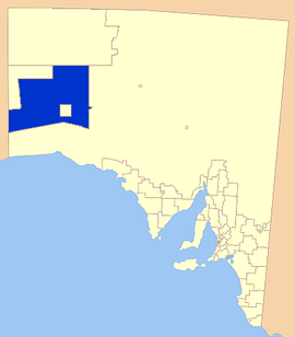 Location of the Maralinga Tjarutja Council | |||||||||||||
| Population | 105 (2006)[1] | ||||||||||||
| • Density | 0.001/km2 (0.0026/sq mi) | ||||||||||||
| Established | 2006 | ||||||||||||
| Area | 102,863.6 km2 (39,715.9 sq mi) | ||||||||||||
| Council seat | Ceduna (outside Council area) | ||||||||||||
| Region | Eyre and Western[2] | ||||||||||||
| State electorate(s) | Flinders | ||||||||||||
| Federal Division(s) | Grey | ||||||||||||
| Website | Maralinga Tjarutja | ||||||||||||
| |||||||||||||
The Maralinga Tjarutja is the corporation representing the traditional Anangu owners of the remote western areas of South Australia known as the Maralinga Tjarutja lands. It is one of the four regions local government areas of South Australia classified an Aboriginal Council (AC) and not incorporated within a local government area. This indigenous Australian people whose historic rights over the area have been officially recognized belong to the southern branch of the Pitjantjatjara people. They have a community centre at Oak Valley, 520 miles NW of Ceduna, and close historicasl and kinship links with the Yalata 350km south, and the Pila Nguru centre of Tjuntjuntjara 370km to their west.[3]
Languages and peoples
The Maralinga Tjarutja people belong to a general Western Desert ecological zone sharing cultural affinities with the Pitjantjatjara, Yankunytjatjara and Ngaanyatjarra to their north and the Pila Nguru of the spinifex plains to their west, They speak dialects of Pitjantjatjara and Yankunytjatjara.[4]
Ecology and cultural beliefs
The term maralinga is not of local origin. It is a term chosen from a Northern Territory indigenous language, signifying 'field of thunder/thunder', and was selected to designate the area where atomic bomb testing was to be undertaken by the then Chief Scientist of the Department of Supply, W. A. S. Butement.[5] The land was covered in spinifex grasses[6] and good red soil (parna wiru) furnishing fine camping.[7]
Waterholes (gabi) have a prominent function in their mythology: they are inhabited by spirit children and thought of as birth places, and control of them demarcate the various tribal groups.[8] According to Ronald Berndt, one particular water snake, Wonambi, tutelage spirit over native doctors, whose fertility function appears to parallel in some respects that of the Rainbow serpent of Arnhem Land myth, was regarded as the creator of these gabi, and figured prominently in male initiation ceremonies.[9]
Contact
Ooldea or Yuldi/Yutulynga/Yooldool (the place of abundant water) sits on a permanent underground aquifer.[4] The area is thought to have been originally part of Wirangu land, lying on its northern border,[10] though it fell within the boundaries of a Kokatha emu totem group. It served several indigenous tribes, furnishing aborigines with a ceremonial site, trade node and meeting place for tribes from the northeast who would travel several hundred miles to visit kin. Among the tribes that congregated there were tribes from the Kokatha and Ngalea language speaking north groups and Wirangu of south east and Mirning south west.[11] By the time Daisy Bates (1919–1935) took up residence there it was thought that earlier groups had disappeared, replaced by an influx of spinifex people from the north. By her time, the Trans-Australian Railway route had just been completed, coinciding with a drought that drew the Western desert peoples to the depot at Ooldea.[11][12]
Beginning in the 1890s, there was a gradual encroachment by pastoralists up to the southern periphery of the Nullarbor Plain, but the lack of adequate water to sustain stock maintained the region relatively intact from intense exploitation.[12] In 1933 the United Aborigines Missions established itself there, drawing substantial numbers of desert folk to the site for food and clothing, and four years later, the government established a 2,000 sq.mile reserve.[12] In 1941, the anthropologist Berndt and his wife Catherine Berndt spent several months in the aboriginal camp at the water soak and mission in 1941, and in the following three year period (1942–1945) wrote one of the first scientific ethnographies of an Australian tribal group, based on his interviews in a community of some 700 desert people.[13] Traditional life still continued since Ooldea lay on the fringe of the desert, and incoming aborigines could return to their old hunting style.
Nuclear testing, dispossession and return
When the Australian government decided in the early 1950s to set aside the Emu Field and Maralinga in the area for British nuclear testing, the community at Ooldea was forcibly removed from the land and resettled further south at Yalata, in 1952. Road blocks, and soldiers barred any return.[6] Yalata, bordering on the Nullarbor Plain offered a totally different ecological environment, in place of the spinifex plains to the north, the Maralinga Tjaruta people found an arid stone plain, with poor thin soil and a powdery limestone that kicked up a grey dust when disturbed. Their word for 'grey', namely tjilpi also signified the greying elders of a tribe, and the native denizens of Yalata called the new area parna tjilpi, the 'grey earth/ground', suggesting that their forced relocation to Yalata went concomitantly with ageing towards death.[14]
Between 1956 and 1957, 7 atomic bombs were exploded on Maralinga land. In further minor trials from 1957 to 1962, plutonium was dispersed widely over much of the area.[15] Compensation in 1993 of $13.5 million was determined after 3 elders flew to London and presented samples of the contaminated soil in London in October 1991.[16]
In 1962, the long-serving Premier of South Australia, Sir Thomas Playford made a promise that their traditional lands would be restored to the people displaced at Yalata sometime in the future.[17] Under the administration of his successor Frank Walsh, short two-week long bush trips were permitted, enabling them to re-connect with their traditional lifestyles.[18] As negotiations got underway in the 1980s, the native peoples started setting up outstations near their original lands. With the passage of the Maralinga Tjarutja Land Rights Act in 1984 under Premier John Bannon's government, the Maralinga Tjarutja secured freehold title in 1984, and the right to developmental funds from the State and Federal governments. They completed a move back into Oak Valley in March 1985.[19]
In 2003 South Australian Premier Mike Rann opened a new school, costing $2,000,000 at Oak Valley. The new school replaced 2 caravans, devoid of running water and air-conditioning in the middle of the desert, a Third World type teaching facility that had been described as the "worst school in Australia".[20] In May 2004, following the passage of special legislation, Rann fulfilled a pledge he had made as Aboriginal Affairs Minister in 1991,[21] by handing back title to 21,000 square kilometres of land to the Maralinga Tjarutja and Pila Nguru people. The land, 1000 km Northwest of Adelaide and abutting the Western Australia border is now known as Mamungari Conservation Park. It includes the Serpentine Lakes and was the largest land return since Premier John Bannon's hand over of Maralinga lands in 1984.
Maralinga Tjarutja Council
The Maralinga Tjarutja Council is an incorporated body constituted by the traditional Yaslata and Maralinga owners to administer the lands granted to them under the Maralinga Tjarutja Land Rights Act 1984 (SA).[22] The head office is at: 43 McKenzie Street, Ceduna.
The Maralinga Tjarutja and the Pila Nguru (or Spinifex people) also jointly own and administer the 21,357.85 km² Mamungari Conservation Park, which area is contained in the area total for the council area. Emu Field is now part of the council area, too, while the 3,300 km² Maralinga area is still a roughly square shaped enclave within the council area.
The land surveyed and known as Section 400, 120 square kilometres within the Taranaki Plumes,[23] was returned to Traditional Ownership in 2007. This land includes the area of land occupied by the Maralinga Township and the areas in which atomic tests were carried out by the British and Australian governments.
The final part of the 1782 square kilometre former nuclear test site was returned in 2014.[24]
See also
Notes and references
Notes
- ↑ census.abs.gov.au, National Regional Profile: Maralinga Tjarutja (AC) (Local Government Area). 2010.
- ↑ "Eyre Western SA Government region" (PDF). The Government of South Australia. Retrieved 10 October 2014.
- ↑ School Context Statement 2015, p. 11.
- 1 2 Mazel 2006, p. 161.
- ↑ Mazel 2006, p. 169.
- 1 2 Palmer 1990, p. 172.
- ↑ Palmer 1990, p. 173.
- ↑ Thurnwald 1951, pp. 385–386.
- ↑ Berndt 1974, p. 6.
- ↑ Hercus 1991, p. 3.
- 1 2 Reece 2007, pp. 79–80.
- 1 2 3 Mazel 2006, p. 162.
- ↑ Palmer 1990, p. 181.
- ↑ Palmer 1990, pp. 172–173.
- ↑ Cross 2005, p. 83.
- ↑ Cross 2005, p. 87.
- ↑ Mazel 2006, pp. 167–168.
- ↑ Palmer & 1990 pp172-173.
- ↑ Palmer & 1990 pp172-175-176.
- ↑ ABC News 2003.
- ↑ The Age 2004.
- ↑ Maralinga Tjarutja 1984.
- ↑ Mazel 2006, p. 175.
- ↑ Sydney Morning Herald 2014.
References
- "Maralinga Tjarutja Land Rights Act 1984". Australasian Legal Information Institute. 1984.
- Berndt, Ronald Murray (1974). Australian Aboriginal Religion. Brill Archive.
- Cross, Roger (2005) [First published 2003]. "British Nuclear Tests and the Indigenous People of Australia". In Barnaby, Frank; Holdstock, Douglas. The British Nuclear Weapons Programme, 1952-2002. Routledge. pp. 75–88. ISBN 978-1-135-76197-4.
- Hercus, Luise Anna (1999). A Grammar of the Wirangu Language from the West Coast of South Australia. Pacific linguistics. ISBN 978-0-858-83505-4.
- Mazel, Odette (2006). "Returning Parna Wiru: Restitution of the Maralinga Lands to the Traditional owners". In Langton, Marcia; Mazel, Odette; Palmer, Lisa; Shain, Kathryn; Tehan, Maureen. Settling with Indigenous People: Modern Treaty and Agreement-making in South Australia. Federation Press. pp. 159–180. ISBN 978-1-862-87618-7.
- Palmer, Kingsley (1990). "Government policy and Aboriginal aspirations: self-managem, ent at Yalata". In Tonkinson, Robert; Howard, Michael. Going it Alone?: Prospects for Aboriginal Autonomy;Essays in Honourt of Ronald and Catherine Berndt. Aboriginal Studies Press. pp. 165–183. ISBN 978-0-855-75566-9.
- Berndt, Ronald Murray (1941). "Tribal Migrations and Myths Centering on Ooldea, South Australia". Oceania. Sydney University Press. 12 (1): 1–20.
- Reece, Bob (2007). Daisy Bates: Grand Dame of the Desert. National Library of Australia. ISBN 978-0-642-27654-4.
- "School Context Statement" (PDF). Department for Education and Child Development, Government of South Australia. August 2015. pp. 1–11.
- "Maralinga students welcome new school". ABC News (Australia). 4 May 2003.
- "Homeland ceded to traditional owners". The Sydney Morning Herald. 5 November 2014.
- "Maralinga hand-over prompts celebration". The Age. 25 August 2004.
- Thurnwald, Richard (1951). Des Menschengeistes Erwachen, Wachsen und Irren: Versuch einer Paläopsychologie von Naturvölkern mit Einschluss der archaischen Stufe und der allgemein menschlichen Züge. Duncker & Humblot.
- Yu, Sarah (1999). Ngapa Kunangkul: Living Water (pdf). University of Western Australia.
Further reading
- Emma Pedler (22 August 2002). "Returning the Maralinga Tjarutja Lands". Statewide Afternoons, ABC South Australia.
External links
- Maralinga Tjarutja
- Agreements, Treaties and Negotiated Settlements (ATNS) project:
- Hansard extract from South Australian House of Assembly, 15 October 2003, of Second Reading Speech on co-management of the unnamed conservation park
Coordinates: 26°29′25″S 132°00′28″E / 26.4902777778°S 132.007777778°E