District Council of the Copper Coast
| District Council of the Copper Coast South Australia | |||||||||||||
|---|---|---|---|---|---|---|---|---|---|---|---|---|---|
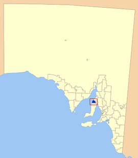 Location of the District Council of the Copper Coast | |||||||||||||
| Population | 14,114 (2015 est)[1] | ||||||||||||
| • Density | 18.259/km2 (47.29/sq mi) | ||||||||||||
| Established | 1997[2] | ||||||||||||
| Area | 773 km2 (298.5 sq mi) | ||||||||||||
| Mayor | Paul Thomas [3] | ||||||||||||
| Council seat | Kadina | ||||||||||||
| Region | Yorke and Mid North [4] | ||||||||||||
| State electorate(s) | Goyder | ||||||||||||
| Federal Division(s) | Grey | ||||||||||||
|
| |||||||||||||
| Website | District Council of the Copper Coast | ||||||||||||
| |||||||||||||
The District Council of the Copper Coast is a local government area in the Australian state of South Australia located at the northern end of the Yorke Peninsula. It was established in 1997 and its seat is in Kadina.
Description
The District Council of the Copper Coast is located at the northern end of Yorke Peninsula adjoining the coastline with Spencer Gulf between the settlement in Tickera in the north and the northern boundary of Nalyappa in the south.[5]
The local government area covers an area of about 773 square kilometres (298 sq mi) of which 97.5% is used for agricultural purposes and with the remaining 2.5% (i.e. 19 square kilometres (7.3 sq mi)) being associated with three urban areas centred on the former government towns of Kadina, Moonta and Wallaroo. A fourth settlement, Paskeville, is located on the Copper Coast Highway in the east of the local government area.[2][5]
The local government area’s population counted at the 2011 Census was 12,949.[6]
The council seat is located at Kadina where its head office is located, while it maintains sub-offices at Moonta and Wallaroo.[7]
History
The council was formed in May 1997 through the amalgamation of the former District Council of Northern Yorke Peninsula and the Corporation of the Town of Wallaroo.[2]
Geography
The council includes the towns and localities of Boors Plain, Cross Roads, Cunliffe, East Moonta, Hamley, Jericho, Jerusalem, Kadina, Kooroona, Matta Flat, Moonta, Moonta Bay, Moonta Mines, New Town, North Beach, North Moonta, North Yelta, Paramatta, Port Hughes, Thrington, Wallaroo, Wallaroo Mines, Wallaroo Plain, Warburto, Willamulka and Yelta, and parts of Paskeville and Tickera.[8]
Councillors
The District Council of the Copper Coast has a directly-elected mayor.[9][2]
| Ward | Councillor | Notes | |
|---|---|---|---|
| Mayor [3] | Paul Thomas | ||
| Unsubdivided [3] | Su Bell | ||
| Sheridan Brand | |||
| Bill Clarke | |||
| Matthew East | |||
| Margaret Pope | |||
| Bruce Schmidt | |||
| Roslyn Talbot | Deputy Mayor | ||
| Cathy Vluggen | |||
| Brent Walker | |||
| David Woodforde | |||
Mayors of the District Council of the Copper Coast
See also
- Kernewek Lowender- the biennial Copper Coast festival celebrating the local Cornish heritage
- Yorke Peninsula Field Days
- List of parks and gardens in rural South Australia
References
- ↑ "3218.0 – Regional Population Growth, Australia, 2014–15". Australian Bureau of Statistics. Retrieved 29 September 2016.
- 1 2 3 4 "Your Council". District Council of the Copper Coast. Retrieved 10 July 2016.
- 1 2 3 "Current Members". District Council of the Copper Coast. Retrieved 2 April 2016.
- ↑ "Yorke and Mid North SA Government region" (PDF). The Government of South Australia. Retrieved 10 October 2014.
- 1 2 "Search result for "Kadina (Locality bounded)" (Record no. SA0033380) with the following layers selected - "Suburbs and Localities" and "Local Government Areas"". Property Location Browser. Government of South Australia. Retrieved 10 July 2016.
- ↑ Australian Bureau of Statistics (31 October 2012). "Copper Coast (DC)". 2011 Census QuickStats. Retrieved 10 July 2016.
- ↑ "Contact us". District Council of the Copper Coast. Retrieved 2 April 2016.
- ↑ "Location SA Map Viewer". Government of South Australia. Retrieved 2 April 2016.
- ↑ "Election Results 2014" (PDF). Local Government Association of South Australia. Retrieved 2 April 2016.
- ↑ "Thursday, 3 April 1997" (PDF). The Government Gazette of South Australia. Government of South Australia. Retrieved 20 November 2016.
- 1 2 "House of Assembly - Tuesday 23 May 2000". Hansard. Parliament of South Australia. Retrieved 20 November 2016.
- ↑ "Local Government Election Results". The Advertiser. 20 May 2000.
External links
- District Council of the Copper Coast official site
- District Council of the Copper Coast tourism website
Coordinates: 33°58′00″S 137°43′00″E / 33.9666666667°S 137.716666667°E