Wahkon, Minnesota
| Wahkon, Minnesota | |
|---|---|
| City | |
 Location of Wahkon within Mille Lacs County, Minnesota | |
| Coordinates: 46°7′22″N 93°31′12″W / 46.12278°N 93.52000°W | |
| Country | United States |
| State | Minnesota |
| County | Mille Lacs |
| Area[1] | |
| • Total | 0.96 sq mi (2.49 km2) |
| • Land | 0.96 sq mi (2.49 km2) |
| • Water | 0 sq mi (0 km2) |
| Elevation | 1,273 ft (388 m) |
| Population (2010)[2] | |
| • Total | 206 |
| • Estimate (2012[3]) | 206 |
| • Density | 214.6/sq mi (82.9/km2) |
| Time zone | Central (CST) (UTC-6) |
| • Summer (DST) | CDT (UTC-5) |
| ZIP code | 56386 |
| Area code(s) | 320 |
| FIPS code | 27-67558[4] |
| GNIS feature ID | 0653719[5] |
Wahkon is a city in Mille Lacs County, Minnesota, United States. The population was 206 at the 2010 census.[6]
History
Wahkon was established in 1885 as Potts Town, then its name changed to Lawrence in 1891 when the post office was established. A second Pottstown was platted next to Lawrence in 1901 by T.E. Potts. In 1907, Wahkon was platted by Soo Line Railroad. By 1910, Pottstown and Lawrence amalgamated into Wahkon. Wahkon was incorporated on November 6, 1912.[7] Before the establishment Wahkon, the site was an Ojibwe village named Sagawamick[8] (from the Ojibwe language Zaagawaamik, meaning "Sandbar"). Prior to being an Ojibwe village, it was also a Mdewakanton Dakota village.
Geography
According to the United States Census Bureau, the city has a total area of 0.96 square miles (2.49 km2), all of it land.[1]
Minnesota Highway 27 serves as a main route in the community.
Demographics
| Historical population | |||
|---|---|---|---|
| Census | Pop. | %± | |
| 1920 | 292 | — | |
| 1930 | 228 | −21.9% | |
| 1940 | 273 | 19.7% | |
| 1950 | 202 | −26.0% | |
| 1960 | 172 | −14.9% | |
| 1970 | 208 | 20.9% | |
| 1980 | 271 | 30.3% | |
| 1990 | 197 | −27.3% | |
| 2000 | 314 | 59.4% | |
| 2010 | 206 | −34.4% | |
| Est. 2015 | 209 | [9] | 1.5% |
2010 census
As of the census[2] of 2010, there were 206 people, 100 households, and 52 families residing in the city. The population density was 214.6 inhabitants per square mile (82.9/km2). There were 206 housing units at an average density of 214.6 per square mile (82.9/km2). The racial makeup of the city was 95.1% White, 2.4% Native American, 0.5% Asian, and 1.9% from two or more races. Hispanic or Latino of any race were 1.0% of the population.
There were 100 households of which 20.0% had children under the age of 18 living with them, 36.0% were married couples living together, 10.0% had a female householder with no husband present, 6.0% had a male householder with no wife present, and 48.0% were non-families. 36.0% of all households were made up of individuals and 13% had someone living alone who was 65 years of age or older. The average household size was 2.06 and the average family size was 2.58.
The median age in the city was 49.7 years. 15.5% of residents were under the age of 18; 7.4% were between the ages of 18 and 24; 17.5% were from 25 to 44; 35.9% were from 45 to 64; and 23.8% were 65 years of age or older. The gender makeup of the city was 51.9% male and 48.1% female.
2000 census
As of the census[4] of 2000, there were 314 people, 150 households, and 79 families residing in the city. The population density was 320.7 people per square mile (123.7/km²). There were 256 housing units at an average density of 261.5 per square mile (100.9/km²). The racial makeup of the city was 92.99% White, 5.41% Native American, 0.64% from other races, and 0.96% from two or more races. Hispanic or Latino of any race were 0.96% of the population.
There were 150 households out of which 18.7% had children under the age of 18 living with them, 42.7% were married couples living together, 7.3% had a female householder with no husband present, and 47.3% were non-families. 39.3% of all households were made up of individuals and 15.3% had someone living alone who was 65 years of age or older. The average household size was 2.09 and the average family size was 2.78.
In the city the population was spread out with 20.1% under the age of 18, 7.6% from 18 to 24, 19.1% from 25 to 44, 31.8% from 45 to 64, and 21.3% who were 65 years of age or older. The median age was 48 years. For every 100 females there were 113.6 males. For every 100 females age 18 and over, there were 118.3 males.
The median income for a household in the city was $22,321, and the median income for a family was $35,000. Males had a median income of $35,417 versus $13,958 for females. The per capita income for the city was $16,088. About 16.2% of families and 22.6% of the population were below the poverty line, including 40.0% of those under age 18 and 18.2% of those age 65 or over.
References
- 1 2 "US Gazetteer files 2010". United States Census Bureau. Retrieved 2012-11-13.
- 1 2 "American FactFinder". United States Census Bureau. Retrieved 2012-11-13.
- ↑ "Population Estimates". United States Census Bureau. Retrieved 2013-05-28.
- 1 2 "American FactFinder". United States Census Bureau. Retrieved 2008-01-31.
- ↑ "US Board on Geographic Names". United States Geological Survey. 2007-10-25. Retrieved 2008-01-31.
- ↑ "2010 Census Redistricting Data (Public Law 94-171) Summary File". American FactFinder. U.S. Census Bureau, 2010 Census. Retrieved 23 April 2011.
- ↑ "Wahkon" in Upham, Warren (1920 as "Minnesota Geographic Names"; 3rd and expanded edition, 2001). Minnesota Place Names: A Geographical Encyclopedia (St. Paul: Minnesota Historical Society Press) ISBN 0873513967
- ↑ "Sagawamick" in Hodge, Frederick Webb (1910). Handbook of American Indians, Volume 2 (Washington: Government Printing Office).
- ↑ "Annual Estimates of the Resident Population for Incorporated Places: April 1, 2010 to July 1, 2015". Retrieved July 2, 2016.
- ↑ "Census of Population and Housing". Census.gov. Retrieved June 4, 2015.
External links
Municipalities and communities of Mille Lacs County, Minnesota, United States | ||
|---|---|---|
| Cities | 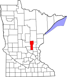 | |
| Townships | ||
| CDP | ||
| Unincorporated communities | ||
| Indian reservation | ||
| Footnotes | ‡This populated place also has portions in an adjacent county or counties | |
Coordinates: 46°07′06″N 93°31′16″W / 46.11833°N 93.52111°W