Vaux-lès-Palameix
| Vaux-lès-Palameix | |
|---|---|
 Vaux-lès-Palameix | |
|
Location within Grand Est region  Vaux-lès-Palameix | |
| Coordinates: 49°01′09″N 5°32′23″E / 49.0192°N 5.5397°ECoordinates: 49°01′09″N 5°32′23″E / 49.0192°N 5.5397°E | |
| Country | France |
| Region | Grand Est |
| Department | Meuse |
| Arrondissement | Arrondissement of Commercy |
| Canton | Canton of Vigneulles-lès-Hattonchâtel |
| Intercommunality | Communauté de communes du Sammiellois |
| Government | |
| • Mayor (2008–2014) | François Vich |
| Area1 | 10.52 km2 (4.06 sq mi) |
| Population (1999)2 | 26 |
| • Density | 2.5/km2 (6.4/sq mi) |
| Time zone | CET (UTC+1) |
| • Summer (DST) | CEST (UTC+2) |
| INSEE/Postal code | 55540 / 55300 |
| Elevation |
237–377 m (778–1,237 ft) (avg. 261 m or 856 ft) |
|
1 French Land Register data, which excludes lakes, ponds, glaciers > 1 km² (0.386 sq mi or 247 acres) and river estuaries. 2 Population without double counting: residents of multiple communes (e.g., students and military personnel) only counted once. | |
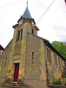
The church of the Saint Saintin
Vaux-lès-Palameix is a commune in the Meuse department in Grand Est in north-eastern France.
See also
| Wikimedia Commons has media related to Vaux-lès-Palameix. |
This article is issued from Wikipedia - version of the 11/6/2016. The text is available under the Creative Commons Attribution/Share Alike but additional terms may apply for the media files.