Avioth
| Avioth | |
|---|---|
|
Main road and Our Lady's basilica | |
 Avioth | |
|
Location within Grand Est region  Avioth | |
| Coordinates: 49°34′02″N 5°23′30″E / 49.5672°N 5.3917°ECoordinates: 49°34′02″N 5°23′30″E / 49.5672°N 5.3917°E | |
| Country | France |
| Region | Grand Est |
| Department | Meuse |
| Arrondissement | Verdun |
| Canton | Montmédy |
| Intercommunality | Pays de Montmédy |
| Government | |
| • Mayor (2008–2014) | Edithe Lhuire |
| Area1 | 6.5 km2 (2.5 sq mi) |
| Population (2009)2 | 128 |
| • Density | 20/km2 (51/sq mi) |
| Time zone | CET (UTC+1) |
| • Summer (DST) | CEST (UTC+2) |
| INSEE/Postal code | 55022 / 55600 |
| Elevation |
196–315 m (643–1,033 ft) (avg. 215 m or 705 ft) |
|
1 French Land Register data, which excludes lakes, ponds, glaciers > 1 km² (0.386 sq mi or 247 acres) and river estuaries. 2 Population without double counting: residents of multiple communes (e.g., students and military personnel) only counted once. | |

Avioth is a commune in the Meuse department in the Grand Est region in northeastern France.
Population
| Historical population | ||
|---|---|---|
| Year | Pop. | ±% |
| 1962 | 148 | — |
| 1968 | 152 | +2.7% |
| 1975 | 108 | −28.9% |
| 1982 | 103 | −4.6% |
| 1990 | 122 | +18.4% |
| 1999 | 113 | −7.4% |
| 2007 | 120 | +6.2% |
| 2009 | 128 | +6.7% |
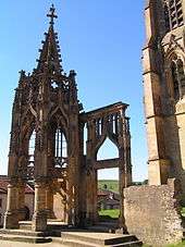
The Recevresse
See also
References
| Wikimedia Commons has media related to Avioth. |
This article is issued from Wikipedia - version of the 11/6/2016. The text is available under the Creative Commons Attribution/Share Alike but additional terms may apply for the media files.