Vanderkloof
| Vanderkloof | |
|---|---|
 Vanderkloof  Vanderkloof  Vanderkloof
| |
| Coordinates: 30°0′S 24°44′E / 30.000°S 24.733°ECoordinates: 30°0′S 24°44′E / 30.000°S 24.733°E | |
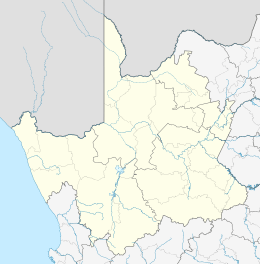
| Country | South Africa |
| Province | Northern Cape |
| District | Pixley ka Seme |
| Municipality | Renosterberg |
| Area[1] | |
| • Total | 4.91 km2 (1.90 sq mi) |
| Population (2011)[1] | |
| • Total | 1,228 |
| • Density | 250/km2 (650/sq mi) |
| Racial makeup (2011)[1] | |
| • Black African | 17.8% |
| • Coloured | 45.3% |
| • Indian/Asian | 0.4% |
| • White | 35.2% |
| • Other | 1.3% |
| First languages (2011)[1] | |
| • Afrikaans | 90.1% |
| • English | 3.1% |
| • Xhosa | 3.1% |
| • Tswana | 1.7% |
| • Other | 2.0% |
| Postal code (street) | 8771 |
| PO box | 8771 |
| Area code | 053 |
Vanderkloof is a town in the Northern Cape province of South Africa. It is located on the Orange River and near the Rolfontein Nature Reserve.
Village on the site of the Vanderkloof Dam, (formerly the P.K. le Roux Dam), 9 km north-east of Petrusville. It was established to house the labour force constructing the dam. The name is derived from the surname of Petrus J van der Walt, and a ravine (Afrikaans kloof) in the vicinity.[2]
References
- 1 2 3 4 "Main Place Vanderkloof". Census 2011.
- ↑ "Dictionary of Southern African Place Names (Public Domain)". Human Science Research Council. p. 453.
Municipalities and communities of Pixley ka Seme District Municipality, Northern Cape | ||
|---|---|---|
District seat: De Aar | ||
| Emthanjeni | .svg.png) | |
| Kareeberg | ||
| Renosterberg | ||
| Siyancuma | ||
| Siyathemba | ||
| Thembelihle | ||
| Ubuntu | ||
| Umsobomvu | ||
This article is issued from Wikipedia - version of the 8/19/2016. The text is available under the Creative Commons Attribution/Share Alike but additional terms may apply for the media files.