Vail, Iowa
| Vail, Iowa | |
|---|---|
| City | |
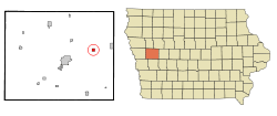 Location of Vail, Iowa | |
| Coordinates: 42°3′40″N 95°12′9″W / 42.06111°N 95.20250°WCoordinates: 42°3′40″N 95°12′9″W / 42.06111°N 95.20250°W | |
| Country |
|
| State |
|
| County | Crawford |
| Area[1] | |
| • Total | 0.57 sq mi (1.48 km2) |
| • Land | 0.57 sq mi (1.48 km2) |
| • Water | 0 sq mi (0 km2) |
| Elevation | 1,260 ft (384 m) |
| Population (2010)[2] | |
| • Total | 436 |
| • Estimate (2012[3]) | 437 |
| • Density | 764.9/sq mi (295.3/km2) |
| Time zone | Central (CST) (UTC-6) |
| • Summer (DST) | CDT (UTC-5) |
| ZIP code | 51465 |
| Area code(s) | 712 |
| FIPS code | 19-80130 |
| GNIS feature ID | 0462511 |
Vail is a city in Crawford County, Iowa, United States. The population was 436 at the 2010 census.
History
Vail was laid out in 1871, and incorporated in 1875.[4] The city was named for C. E. Vail, a relative of railroad magnate John Insley Blair.[5]
Geography
Vail is located at 42°3′40″N 95°12′9″W / 42.06111°N 95.20250°W (42.061061, -95.202423).[6]
According to the United States Census Bureau, the city has a total area of 0.57 square miles (1.48 km2), all of it land.[1]
Demographics
| Historical populations | ||
|---|---|---|
| Year | Pop. | ±% |
| 1880 | 511 | — |
| 1890 | 538 | +5.3% |
| 1900 | 578 | +7.4% |
| 1910 | 631 | +9.2% |
| 1920 | 635 | +0.6% |
| 1930 | 622 | −2.0% |
| 1940 | 576 | −7.4% |
| 1950 | 532 | −7.6% |
| 1960 | 473 | −11.1% |
| 1970 | 486 | +2.7% |
| 1980 | 490 | +0.8% |
| 1990 | 388 | −20.8% |
| 2000 | 452 | +16.5% |
| 2010 | 436 | −3.5% |
| 2014 | 430 | −1.4% |
| 2015 | 424 | −1.4% |
| Source:"American FactFinder". United States Census Bureau. and Iowa Data Center Source: | ||
2010 census
As of the census[2] of 2010, there were 436 people, 174 households, and 120 families residing in the city. The population density was 764.9 inhabitants per square mile (295.3/km2). There were 189 housing units at an average density of 331.6 per square mile (128.0/km2). The racial makeup of the city was 89.2% White, 0.7% African American, 0.9% Native American, 8.9% from other races, and 0.2% from two or more races. Hispanic or Latino of any race were 12.4% of the population.
There were 174 households of which 35.1% had children under the age of 18 living with them, 55.2% were married couples living together, 8.6% had a female householder with no husband present, 5.2% had a male householder with no wife present, and 31.0% were non-families. 27.6% of all households were made up of individuals and 15% had someone living alone who was 65 years of age or older. The average household size was 2.51 and the average family size was 3.00.
The median age in the city was 42.3 years. 27.3% of residents were under the age of 18; 6.1% were between the ages of 18 and 24; 20.3% were from 25 to 44; 31.2% were from 45 to 64; and 15.1% were 65 years of age or older. The gender makeup of the city was 47.0% male and 53.0% female.
2000 census
As of the census[8] of 2000, there were 452 people, 185 households, and 128 families residing in the city. The population density was 808.0 people per square mile (311.6/km²). There were 196 housing units at an average density of 350.4 per square mile (135.1/km²). The racial makeup of the city was 97.57% White, 0.88% African American, 0.22% Asian, 1.33% from other races. Hispanic or Latino of any race were 1.77% of the population.
There were 185 households out of which 35.7% had children under the age of 18 living with them, 53.0% were married couples living together, 9.2% had a female householder with no husband present, and 30.8% were non-families. 28.1% of all households were made up of individuals and 15.7% had someone living alone who was 65 years of age or older. The average household size was 2.44 and the average family size was 2.95.
28.1% are under the age of 18, 7.1% from 18 to 24, 25.4% from 25 to 44, 21.5% from 45 to 64, and 17.9% who were 65 years of age or older. The median age was 37 years. For every 100 females there were 100.0 males. For every 100 females age 18 and over, there were 100.6 males.
The median income for a household in the city was $33,750, and the median income for a family was $39,107. Males had a median income of $24,500 versus $19,063 for females. The per capita income for the city was $15,071. About 6.2% of families and 7.0% of the population were below the poverty line, including 7.8% of those under age 18 and 12.5% of those age 65 or over.
References
- 1 2 "US Gazetteer files 2010". United States Census Bureau. Retrieved 2012-05-11.
- 1 2 "American FactFinder". United States Census Bureau. Retrieved 2012-05-11.
- ↑ "Population Estimates". United States Census Bureau. Retrieved 2013-05-23.
- ↑ History of Western Iowa, Its Settlement and Growth. Western Publishing Company. 1882. p. 476.
- ↑ Chicago and North Western Railway Company (1908). A History of the Origin of the Place Names Connected with the Chicago & North Western and Chicago, St. Paul, Minneapolis & Omaha Railways. p. 132.
- ↑ "US Gazetteer files: 2010, 2000, and 1990". United States Census Bureau. 2011-02-12. Retrieved 2011-04-23.
- ↑ "Census of Population and Housing". Census.gov. Retrieved June 4, 2015.
- ↑ "American FactFinder". United States Census Bureau. Retrieved 2008-01-31.
Municipalities and communities of Crawford County, Iowa, United States | ||
|---|---|---|
| Cities | ||
| Townships | ||
| Unincorporated communities | ||
| Footnotes | ‡This populated place also has portions in an adjacent county or counties | |