Denison Township, Crawford County, Iowa
| Denison Township | |
|---|---|
| Township | |
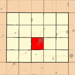 Location in Crawford County | |
| Coordinates: 41°59′26″N 095°22′53″W / 41.99056°N 95.38139°WCoordinates: 41°59′26″N 095°22′53″W / 41.99056°N 95.38139°W | |
| Country |
|
| State |
|
| County | Crawford |
| Area | |
| • Total | 35.39 sq mi (91.66 km2) |
| • Land | 35.35 sq mi (91.56 km2) |
| • Water | 0.04 sq mi (0.1 km2) 0.11% |
| Elevation | 1,263 ft (385 m) |
| Population (2000) | |
| • Total | 7,757 |
| • Density | 219.4/sq mi (84.7/km2) |
| GNIS feature ID | 0467702 |
Denison Township is a township in Crawford County, Iowa, USA. As of the 2000 census, its population was 7,757.
Geography
Denison Township covers an area of 35.39 square miles (91.7 km2) and contains one incorporated settlement, Denison (the county seat). According to the USGS, it contains five cemeteries: Crawford County Home, Crawford Heights Memorial, Oakland, Saint Rose of Lima and Zion.
The streams of Coon Creek, East Boyer River and Willow Creek run through this township.
Transportation
Denison Township contains one airport, Denison Municipal Airport.
References
External links
Municipalities and communities of Crawford County, Iowa, United States | ||
|---|---|---|
| Cities | ||
| Townships | ||
| Unincorporated communities | ||
| Footnotes | ‡This populated place also has portions in an adjacent county or counties | |
This article is issued from Wikipedia - version of the 11/20/2015. The text is available under the Creative Commons Attribution/Share Alike but additional terms may apply for the media files.