Vạn Ninh District
| Vạn Ninh District Huyện Vạn Ninh | |
|---|---|
| Rural district | |
| Country |
|
| Region | South Central Coast |
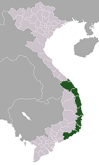
| Province | Khánh Hòa |
| Capital | Vạn Giã |
| Area | |
| • Total | 210 sq mi (550 km2) |
| Population (2003) | |
| • Total | 126,805 |
| Time zone | UTC + 7 (UTC+7) |
Vạn Ninh is a rural district of Khánh Hòa Province in the South Central Coast region of Vietnam.
Geography
Vạn Ninh is the northernmost district of Khánh Hòa. Vạn Ninh has communes from north to south: Đại Lãnh, Vạn Thọ, Vạn Thạnh, Vạn Phước, Vạn Long, Vạn Bình, Vạn Khánh, Vạn Phú, Vạn Lương, Xuân Sơn, Vạn Hưng, Vạn Thắng. It is bordered to the north by Phú Yên Province, and to the south by Ninh Hòa. It contains the easternmost point in mainland Vietnam. East of Vạn Ninh is the Vân Phong bay, East Vietnam Sea, and Pacific Ocean.
As of 2003 the district had a population of 126,805.[1] The district covers an area of 550 km². The district capital lies at Vạn Giã.[1]
Notable people from Vạn Ninh
References
- 1 2 "Districts of Vietnam". Statoids. Retrieved March 20, 2009.
External links
Coordinates: 12°45′00″N 109°10′01″E / 12.750°N 109.167°E
This article is issued from Wikipedia - version of the 8/21/2013. The text is available under the Creative Commons Attribution/Share Alike but additional terms may apply for the media files.